4K
Posts
10K
Followers
Good food. Good people. Good living. Localish is all about bringing out the good in America’s cities.
NYC's oldest maps blaze paths to the past and future
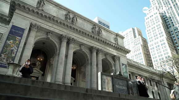
The skyline of Manhattan, along with the actual width of the island, has grown a lot over the decades.
Some of the oldest maps of New York City -- maps still used by experts today -- tell this story vividly.
The New York Public Library has a vast collection of more than 400,000 maps.
"For maps of New York City, we are second to none," said Ian Fowler, who serves as the curator of maps, history and government information for the NYPL.
The maps show where the city has been and where it's going.
"What was there before and what can that tell us about where we could go in the future," said Fowler. "A lot of these maps can unlock those questions."
The collection includes one of the oldest maps, the Castello Plan, of Dutch-controlled New Amsterdam in the 1600s, to British-made maps from the 1760s.
The maps also show how, in a short period of time, British named streets were replaced by American street names. For example, "King" Street became "Pine" Street.
Other historic maps show what the island used to look like before development, full of hills and streams.
The maps are still used by scientists and developers today.
They also show how thin the island used to be before the coastlines were built out.
"While we were building out the island, especially after the Revolution, we took a lot of that rubble and a lot of oyster shells and put that in the East River and Hudson River and then the tip of Manhattan, and then we built it out," said Fowler.
And what's on the maps from so long ago is just as important as what is not on them.
"What's interesting is the depiction of the lands and the depiction of the native people," said Fowler. "The French portray them more prevalently while still from a colonial lens, while the British were more aggressive in their mapping, they delete more native peoples and more native places."
"I think 250 years from now, I think it'll be such a different city that these will look even more antiquated than they do now," said Fowler.
Some of the maps will be part of a special three-part exhibit opening at the New York Public Library on June 15 called Declaring America: 1776 and Beyond.
The exhibits will be on display at the Stephen A. Schwarzman Building on 42nd Street.
Comments
YOU MAY ALSO LIKE
Thomas Smith
National Weather Force Innovations
Tropical Storm Rachel Expected to Impact Southern California and Surrounding States | Complex Setup
Once again, the setup remains to be very complex, so it is no surprise that the track remains difficult to pin down with now almost two areas of shift possible. A cutoff low, an upper level trough, and what remains of Rachel all have to interact, with their timing and positioning playing a major role in how this unfolds. Even small changes could shift where the deepest moisture moves, where the lifting mechanism is, where thunderstorms develop, and which areas receive the heaviest rainfall. That is why individual model runs can show noticeably different outcomes. Confidence should improve as these features evolve, but the exact track and rainfall totals still have room to change still.
CJ Coombs
Missing for nearly a decade: Donna Kay Cloud mysteriously disappeared at age 19 from Spring, Texas
Donna Kay Cloud has been missing from Spring, Texas (Montgomery County), since October 25, 2016, according to the National Center for Missing and Exploited Children (NCMEC). She would now be 29.