undefined
Posts
undefined
Followers
First Warning Forecast: Tracking coastal storm impacts, rain, wind & flooding
By Derrah Getter,
2026-09-23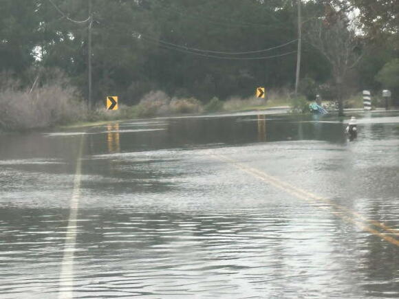
Derrah Getter's First Warning Forecast
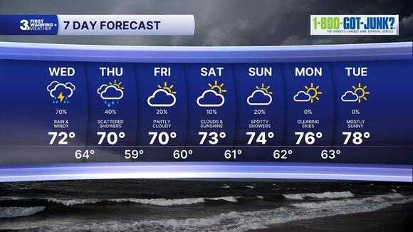
Off-and-on scattered showers and storms continue Wednesday. High temperatures will struggle to make it out of the low 70s. Strong winds are expected with gusts up to 50 mph. Coastal flooding concerns continue into the weekend.
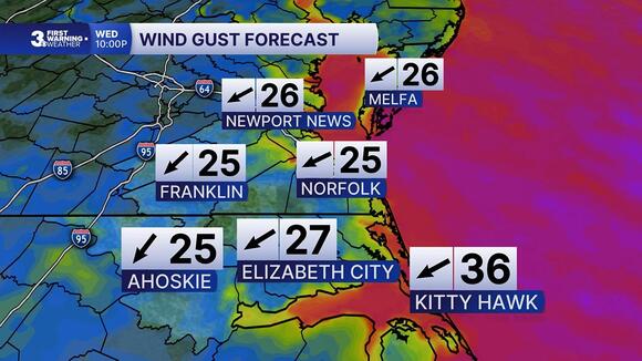
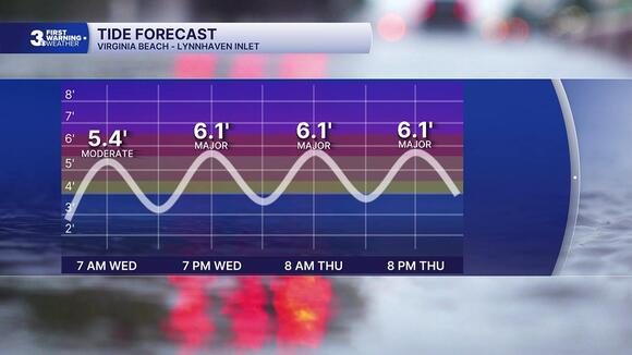
Showers linger on Thursday. Highs remain in the upper 60s and low 70s. Another round of tidal flooding is expected.
Drier conditions return as we head into the weekend. Highs will be in the low to mid 70s.
Temperatures rebound to the mid and upper 70s next week with a bit more sunshine.
Let's connect on social media!
Meteorologist Derrah Getter:
For weather updates on Facebook:HERE
For weather updates on X:HERE
Follow me on Instagram:HERE
Check out the Interactive Radar on WTKR.com: Interactive Radar
 Add to Preferred Sources