undefined
Posts
undefined
Followers
High Surf Could Flood Beach Roads as Two Storms Move In
By Current Staff,
1 days ago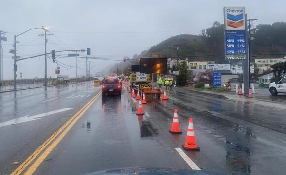
LOS ANGELES - Two Pacific systems are expected to deliver a quarter-inch to 1 inch of rain across most areas through Saturday morning. Along the Malibu coast and Los Angeles County beaches, waves are expected to reach 7 to 12 feet Saturday, with the largest surf hitting west- to northwest-facing shores.
Forecasters warned of significant beach erosion and shallow flooding near high tide, particularly Saturday morning. Dangerous surf is expected to persist into next week, even after the first two rounds of rain pass.A beach hazards statement remains in effect for the Malibu coast and Los Angeles County beaches through Friday afternoon. A high surf advisory takes effect at 2 p.m. Friday and continues until 3 p.m. Tuesday.Breaking waves are expected to reach 4 to 7 feet Friday before peaking Saturday, then decline to 6 to 9 feet Sunday through Tuesday.The weather service warned of dangerous rip currents and strong currents along the shore, as well as sneaker waves and powerful waves breaking close to the beach. Beachgoers were urged to remain out of the water or stay near occupied lifeguard towers and to avoid rock jetties.Rain is expected to begin moving into the Southland late Thursday evening, ending the region's dry stretch."Our next weather system is rapidly approaching," according to the National Weather Service.Rain chances will increase after midnight in Los Angeles County, with precipitation spreading across the region overnight. Scattered showers are expected Friday, primarily in the morning.A second, more widespread round of rain associated with a passing front is expected late Friday afternoon or evening and will continue into Saturday morning.There is a slight chance of thunderstorms late Thursday and Friday, with the best chances in Orange County and areas farther south. Mountain slopes and locations hit by thunderstorms could receive more than the quarter-inch to 1 inch forecast for most areas.Rainfall rates are expected to remain at or below a quarter-inch per hour in most locations. Forecasters said there is a 20% to 30% chance of localized rates reaching a half-inch per hour.Thursday's high temperatures are expected to be 5 to 10 degrees cooler than Wednesday's. Highs Friday and Saturday are expected to reach the 60s to low 70s, with gusty southwest to northwest winds possible.More storms are forecast after the weekend."Pattern-wise, the `storm train' is expected to continue with one storm impacting the area Sunday night through Tuesday then another system during the day on Wednesday/Wednesday night," the NWS said.Editor's Note: This story includes reporting from City News Service, a content partner of Westside Current.
 Add to Preferred Sources