undefined
Posts
undefined
Followers
Southeast Wisconsin Weather: Fall 60s
By Lindsey Slater,
2026-09-20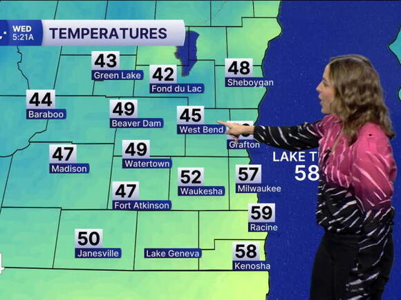
Wednesday features the first FULL day of FALL, after the equinox occurred Tuesday at 7:05PM CDT. Today we top out in the low and mid 60s as we continue our stretch of 60 degree temperatures. Normal highs for this time of the year fall in the low 70s, so we are running about 5-10 degrees below average. Be on the lookout for a rogue spotty shower in the morning. After that, skies are slow to clear to bring the return of sunshine back to SE Wisconsin.
Thursday has a mix of sun and clouds with highs in the mid 60s. Friday is much of the same with shifting winds SE 5 to 10 mph.
The weekend is hit and miss. Saturday (as of right now) is partly cloudy with a system on the way that could bring a few showers late in the day. Sunday, that system exits, and could clear early morning. Stay tuned to the latest forecast on when and where these showers pop up.
STORM TEAM 4CAST 4PM 9/22/2026
HERE'S YOUR LATEST STORM TEAM WEATHER FORECAST FOR MILWAUKEE
AND SOUTHEASTERN WISCONSIN BY METEOROLOGIST LINDSEY SLATER.
TODAY: Spotty am shower, then clearing skies.
High: 63
Wind: NE 10-15 mph
TONIGHT: Clearing skies, cooler
Low: 56
Wind: E 10-15 mph
THURSDAY: On and off clouds. Cool for Sept.
High: 64
Wind: E 5-10 mph
FRIDAY: A tad warmer, more sun
High: 64
Wind: ESE 5-10 mph
SATURDAY: Sl Chance showers late
High: 65
Wind: SE 5-10 mph
SUNDAY: Mostly Cloudy
High: 66
Wind: SSE 5-10 mph
MONDAY: Warmer, Partly Cloudy
High: 70
Wind: SW/SE 5-10 mph
It’s about time to watch on your time. Stream local news and weather 24/7 by searching for “TMJ4” on your device.
Available for download on Roku, Apple TV, Amazon Fire TV, and more.
 Add to Preferred Sources
