Weather
Over ten avalanches make for a busy day across Central Wasatch
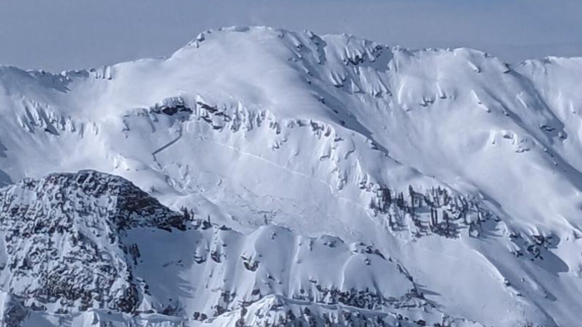
Image after an avalanche at Mill B South in Big Cottonwood Canyon. Photo: Courtesy of the Utah Avalanche Center.
UTAH — With new snow on the way and occasional above-freezing temperatures in Park City, conditions around the state are changing. Add in the strong winds and snowstorm after snowstorm passing through, and you have the recipe for avalanches to occur at a high rate.
According to the Utah Avalanche Center, many of the avalanches on Tuesday were soft slabs that consisted of new snow and wind-drifted snow at mid or upper elevations. On Monday, a massive avalanche occurred in Big Cottonwood Canyon at Mill B South at around 9,500 feet of elevation. The avalanche reached a width of 1,500 feet and a depth of 5 feet.
Much of the state is forecasted to have considerable danger ratings, with the exception of the Skyline area and Moab. Heavy winds are predicted to accompany the new snowfall that has the potential to reach between two and three feet in spots at the end of the week.
Find the avalanche forecast for your area on the Utah Avalance Center website. Each forecast goes into great detail on what to expect and guidelines to follow.
Both wind-drifted and new snow avalanches will likely fail 1-2’ deep, but have the potential to fail deeper at the new/old snow interface that is now down 2-5’ in places. For that reason, cautious route-finding, and conservative decision-making will be essential today. pic.twitter.com/DqfKyHJWSq
— UtahAvalancheCenter (@UACwasatch) March 29, 2023
Kevin Cody

7948 Red Tail Court
Park City, UT 840601366 Montabon Way
Midway, UT 840492145 S Belaire Drive
Salt Lake City, UT 841093088 Fawn Drive
Park City, UT 840983137 East George White Road
Moab, UT 845323557 S Cypress Point Road
Hurricane, UT 847378840 N The Knoll Unit 29
Sundance, UT 84604Talk of the Town


Park City Jobs

Cooks and Servers, Woodland Biscuit Company
1 day ago Part time $16.00 - $30.00 hourly
Food & Beverage Fine Dining Manager - Hearth, Promontory Club
6 days ago Full time
Promontory Club Senior Catering Sales Manager, Promontory Club
6 days ago Full time
Sous Chef and Sushi Chef - The Peak - Full Time., Promontory Club
6 days ago Full time
You May Also Like