Morning Showers Exit Quickly
Parts of Green Country are waking up to some early-morning showers.Tuesday, March 21st 2023, 5:32 am
If you’re into podcasts or in a rush, check out my daily weather update. Search for NewsOn6 and ‘Weather Out The Door’ on most podcast providers, including Spotify, Stitcher and Tune-In, or Click Here to listen on Apple Podcasts.
TULSA, Okla. - Parts of Green Country are waking up to some early-morning showers.
Here are the details from News On 6 Meteorologist Alan Crone:

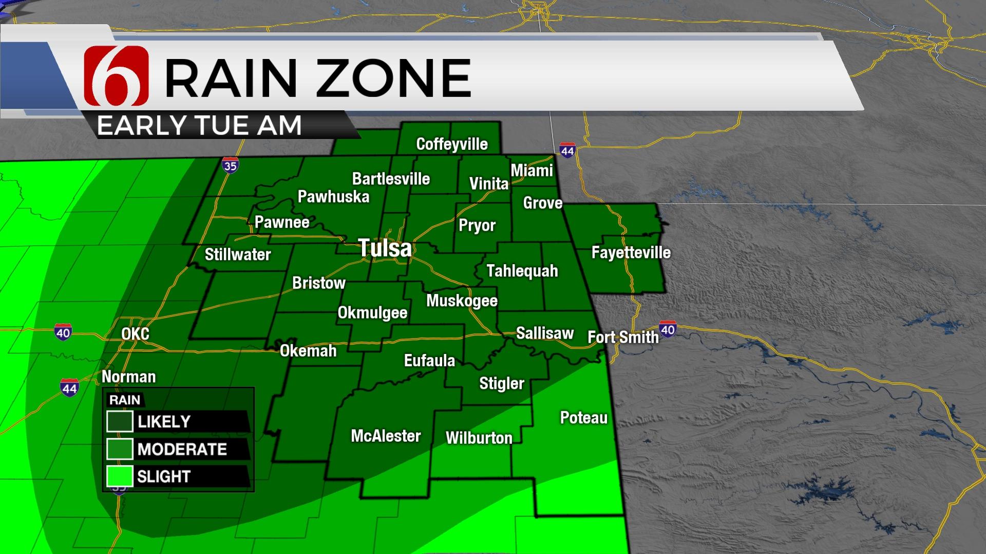
A fast system is producing showers on Tuesday morning across part of northeastern Oklahoma. Severe weather is not expected but some rumbles of thunder will remain possible in a few spots. This wave exits quickly and brings strong south winds later in the day from 20 to 40 mph with decreasing clouds from the west to east late in the afternoon. Highs this afternoon will range from the upper 50s across far eastern Oklahoma to the lower 70s near I-35. The Tulsa metro will reach highs in the lower 60s. Warmer weather is likely Wednesday with another very windy day. Highs will reach the mid to upper 70s with south winds from 20 to 35 mph. A strong storm system nears the area Thursday bringing additional chances for thunderstorms, including the possibility of strong and severe storms near and south of the Tulsa metro. The system will be initially slow to progress out of the area but should exit southeastern Oklahoma early Friday morning. There remain some differences regarding the exact outcome of a possible wave behind the system late Friday night, but the probabilities for showers and storms will remain out of the forecast until Sunday when another fast-moving system will near the state.

As the strong upper-level trough nears the state Thursday, low-level moisture in the form of 60-degree dew points should be advecting northward near the metro with higher values into the upper 60s along the Red River Valley southward into northcentral Texas. There may be a few showers or storms developing early Thursday morning in a few spots across northeastern OK. Temps during the midday to afternoon Thursday should bring highs in the lower to mid-70s near and south of the metro with some upper 60s north of I-44 where a surface boundary (cold front) will move across during the midday to afternoon period. Data is suggesting slightly drier air will filter southward behind the front and will be positioned along and northwest of I-44 Thursday afternoon and evening. Most of the stronger to severe storms will be south of this front where surface instabilities are expected to increase by afternoon, especially along the Arbuckles eastward into southeastern OK and north central Texas. A dryline feature is likely to sharpen up west of I-35. Strong winds aloft will move along the base of the upper trough by afternoon and evening bringing significant lift over the area. The potential for discrete supercell storms will be possible across south central OK into north central Texas during the early afternoon before a few line segments will become more likely by evening as the upper air flow becomes more parallel with the surface cold. This boundary and the continued influx of moisture also supports the potential for pockets of locally heavy rainfall across part of southeastern and far eastern OK overnight Thursday before easing early Friday morning. Gusty north winds should arrive Friday with highs staying in the 60s through the afternoon. Another fast-developing system is possible Sunday for part but not all of the area.

Thanks for reading the Tuesday morning weather discussion and blog.
Have a super great day!
Alan Crone
KOTV

Get The Daily Update!
Be among the first to get breaking news, weather, and general news updates from News 9 delivered right to your inbox!
More Like This
March 21st, 2023

April 24th, 2024

April 24th, 2024

Top Headlines

April 25th, 2024


April 24th, 2024

April 24th, 2024
