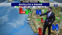


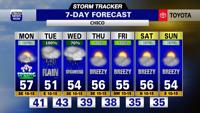

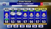

One storm is exiting the region tonight into tomorrow before another round of rain arrives Tuesday.
Rain passed through this morning with many places receiving between a half an inch to an inch of rain in the valley with higher amounts to in the north. Showers remain in parts of our area. Snow levels are sitting around 5000’ to 6000’. We have seen winds around 15-20mph today. Clouds will remain with some shower chances sticking around into the evening.
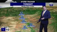
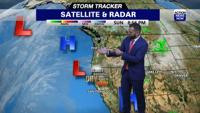
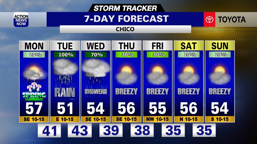
Monday, shower chances decrease throughout the day with some sun peeking through by the afternoon. Temperatures will top off in the upper 50s for the valley. This is a brief break before another chance for rain returns Tuesday. Rain slides in from the south, heavy at times. This is an atmospheric river for SoCal. NorCal will be on the northern side, therefore a cooler side of the system along with less moisture. The heaviest rain will be on Tuesday with a chance for showers on Wednesday. Highs top off in the low to mid 50s. Snow levels begin to drop Monday morning and stay between 3500 to 5000ft during this time. Thursday through Saturday still has a significant amount of model disagreement. For now I have shower chances each day. Highs will warm up a little, into the mid-50s. This may change as models hone in exactly when or if the shower chances arrive. Sunday may be a transition day as some models bring rain the following week.

Chico 7-Day

Redding 7-Day