SALT LAKE CITY (ABC4) – Happy Friday, Utah we made it to the end of the workweek! We close out the work week in the Beehive State with a few more clouds as our dominant area of high pressure slightly shifting east and pulling away.
Temperatures will climb into the 30s up north and 30s and 40s down south with a few spots like St. George getting into the mid 50s. Our increasing cloud cover is linked to a quick little disturbance that will graze the state. At this point, the chance of any wet weather looks low with only a slight chance for some light snow in the high country and maybe a few flurries in our valleys. This system could bring some minimal haze relief in our valleys, but we’re not expecting any significant changes.
Now to the not-so-fun part of the forecast. Since the system moving through today won’t be strong, we won’t see much if any relief from the ongoing haze in our northern Utah valleys. In Cache County, Salt Lake County, Davis, and Duchesne County, the air quality currently is or is expected to be unhealthy. If you can, limit time outside in these areas. Meanwhile, for the rest of the Wasatch Front, the air quality is projected to fall into the unhealthy for sensitive groups category today.
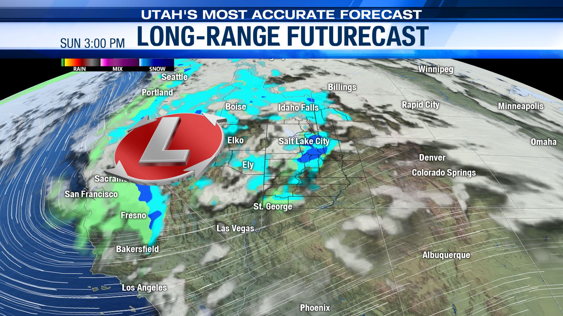
High pressure will build back briefly for Saturday resulting in a bit more sunshine as temperatures level out a bit, but the haze will remain and might actually get worse in some spots. The high pressure won’t stick around though as another storm is expected to arrive late Sunday into Monday of next week with more significant chances of moisture. Temperatures will warm up over the weekend with the strong southwest flow in place, highs could be in the mid-40’s on Sunday ahead of the storm along the Wasatch Front while St. George could hit 60! With milder air in place, moisture could initially fall as rain/wintry mix in our valleys before changing over to snow Sunday afternoon into Sunday night.
Through Monday, this storm looks to deliver another healthy dose of snow to our mountains, especially in our central and northern mountains where half a foot, plus looks possible. Valleys will also have a chance of seeing some accumulations. It’s still more than a couple of days away, but early returns on most models suggest we could see 1-4″ along the Wasatch Front. We’ll continue to fine-tune the forecast as we get closer so be sure to stay tuned. With the chance of snow from Sunday into Monday though, we could see some slippery conditions for the Monday morning commute so heads up there.
Bottom line? Battling bad air to close the work week with moisture arriving over the weekend.