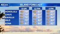
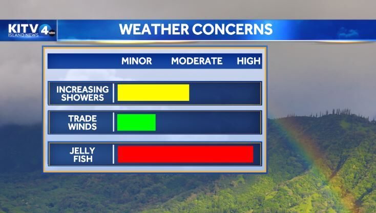
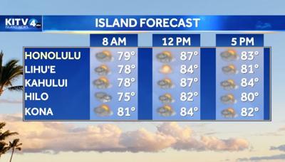
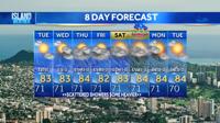
HONOLULU (KITV4) - Increasing trades will bring increasing trade wind showers Expect partly to mostly cloudy skies Friday with heavy rain at times and a few thunderstorms. Highs 78 to 83. Trade winds 10 to 20 mph.
Tonight, cloudy with scattered showers and isolated thunderstorms from Kaua'i to Moloka'i. Lows 64 to 69. Trade winds 15 to 20 mph.
TruVuAdmin
Maxuser
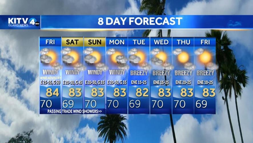
The remnants of an old cold front are drifting into the islands from the north this morning with a cut off low moving in from the west. These two low pressure systems will produce increasing shower activity over the islands of Kauai, Niihau and Oahu today and the eastern islands later tonight. A high pressure center passing north of the islands today will also bring a return to moderate to breezy trade winds lasting through the weekend. The upper level low will slowly move from west to east across the state this weekend spreading unstable wet weather to all islands, with heavy rain at times, and a few thunderstorms. More typical trade winds will return from Monday onward with passing showers as more stable conditions are forecast over the region.
Maxuser
Maxuser
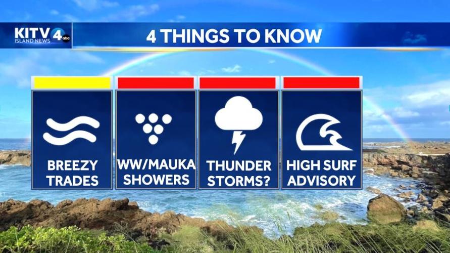
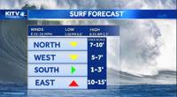
Surf along north facing shores will slowly decline into the weekend. A medium-period north-northwest swell will arrive by the end of the day Saturday, then hold into Sunday before fading. On Monday, an upward trend is expected out of the northwest. This long-period northwest swell will slowly fill in through the day Monday, then peak sometime between Tuesday and Wednesday before lowering into the latter half of next week. If this materializes, surf could near advisory levels for exposed north and west facing shores of the smaller islands as it peaks. Surf along south facing shores will ease into the weekend as a long-period south swell moves through. Surf along east facing shores will trend up this weekend through next week as high pressure sets up to the north and a belt of fresh to strong easterly trades develops over and far upstream of the islands.
Do you have a story idea? Email news tips to news@kitv.com