
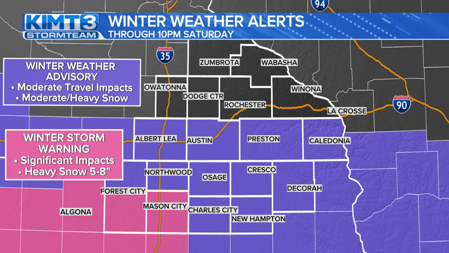


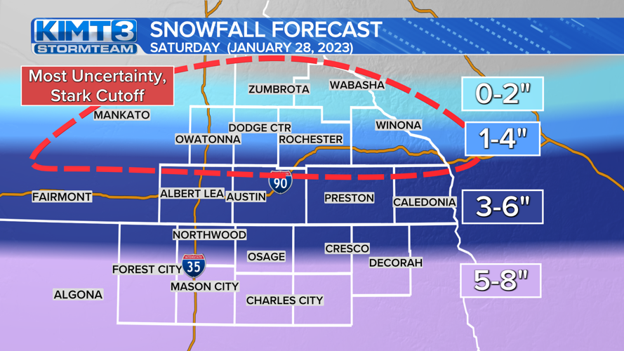
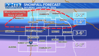


A WINTER WEATHER ADVISORY through 10pm Saturday has been expanded further north to include the very southernmost counties of Minnesota including Freeborn, Mower, Fillmore, and Houston. 3-6" is expected here during the day Saturday. This expansion has also also included the Iowa counties of Winnebago, Worth, Mitchell, Howard, and Winneshiek. At least 3-6" of snow is expected here, with potential for a bit more in some places.
Floyd and Chickasaw counties remain under a winter weather advisory for now, but stand a better chance of seeing closer to 5-8" of snow, so an upgrade to a winter storm warning is possible.
A WINTER STORM WARNING through 9pm Saturday has been issued for Hancock, and Cerro Gordo counties. 5-8" of snow is expected here.
More updates to these headlines are possible as the storm draws closer.

---
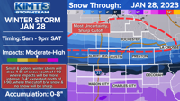
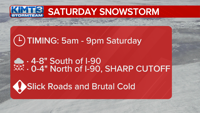
WHAT: 4-8" of snow south of I-90, 0-4" north of I-90 where a SHARP cutoff will be in place. This is where there is the greatest uncertainty.
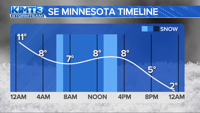
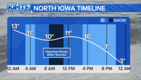
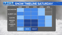
WHEN: Beginning in North Iowa between 3-7am, in Southern Minnesota between 5-9am. Heaviest snow between 8am-2pm. Snow will gradually wind down into the evening hours.
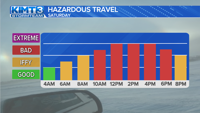
IMPACTS: Slick roads will make for difficult travel, while cold temps around 10 or less degrees will hamper efforts to help treat roads. Wind gusts to 25mph in the afternoon will blow some of this snow around and make for drifting and blowing snow with covered roads and lower visibility.
OTHER NOTES: This storm is small and potent. The snow will be incredibly fluffy, nearly twice as fluffy as average snow. This will make it very easy to blow around when winds gust to 15-25mph Saturday afternoon.
There will be a SHARP CUTOFF through most of the day along the US-14 corridor. It is no exaggeration to say that it might be possible for the north side of Rochester to get nothing and the south side to get nearly 6" of snow. Should the storm trend a bit more north, expect the winter weather advisory to be extended north, along with winter storm warnings in Iowa.
There is a potential for a light snow or freezing drizzle Saturday evening following the storm, especially in Southern Minnesota. This will either add some more snow on top (trace to an inch) or ice up the roads.


