


Today: Clouds to afternoon snow showers, evening snow, night rain. Highs in the 30s. Thursday: Windy, partly cloudy. Highs in the low 40s.
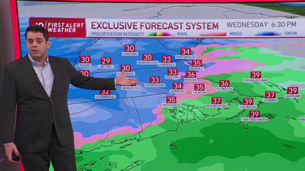
It’s shaping up to be another nasty evening drive (!) as a strong, compact, water-laden storm charges across New England Wednesday afternoon and night. Cold will be marginal at the onset of the storm, but with such tremendous lift in the atmosphere, we’re seeing a window of 3-4 hours of intense snow squarely landing in mid/late afternoon.

How Long Will the Snow Last?
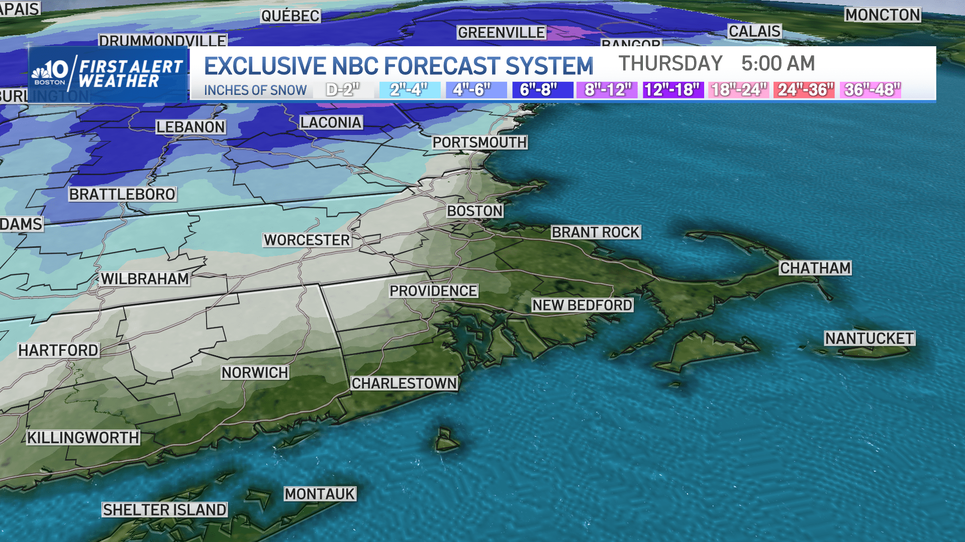
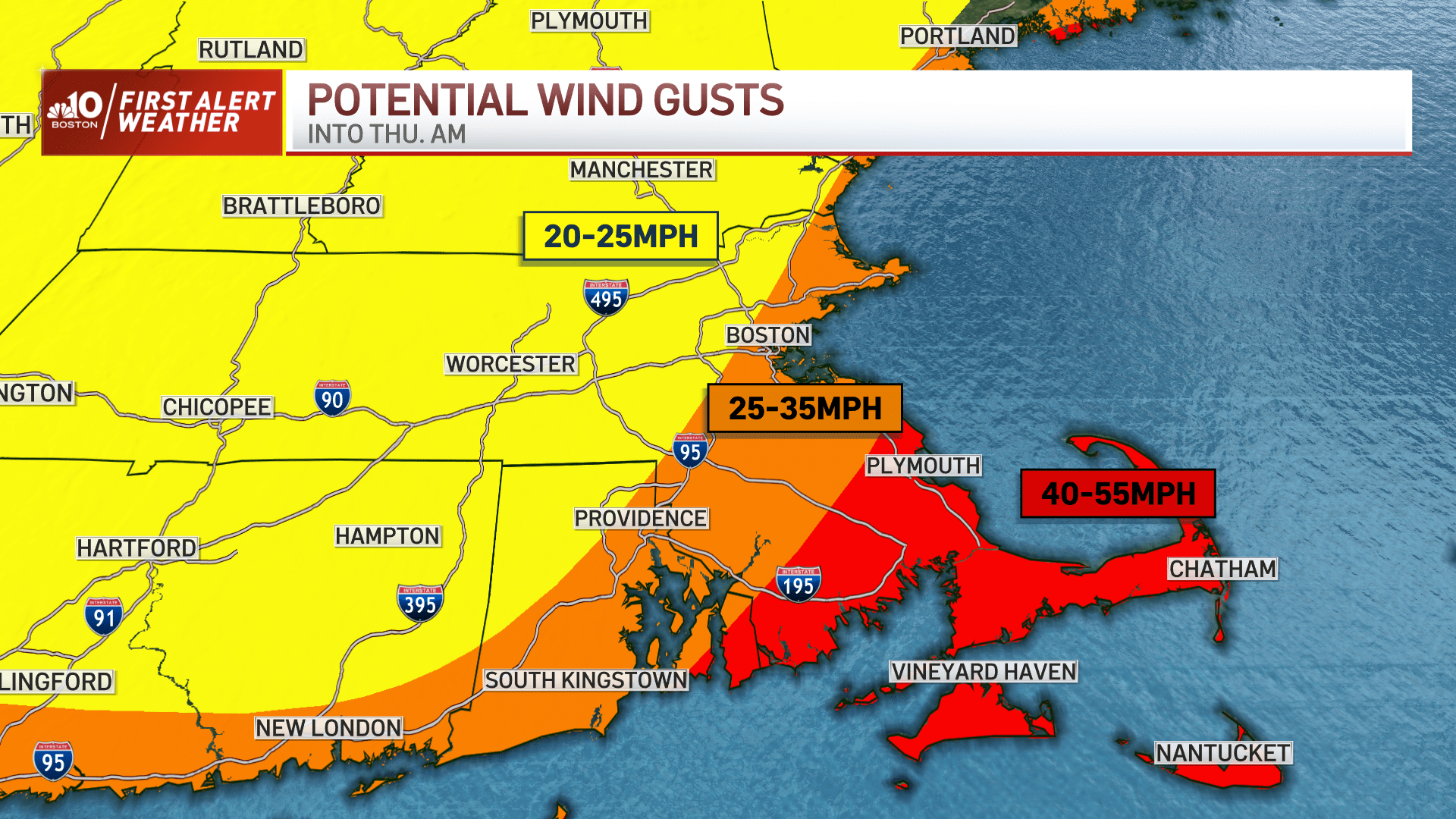
It's then that we’ll see ALL of the accumulation on the map we’re showing. Switchover to rain will be abrupt, and appears to start in southern Rhode Island/Cape Cod/Islands and move north starting at 7 p.m. That puts it in Greater Boston and Worcester close to 8 p.m. at the latest. Driving rain and increasing wind will take over from there, lasting into the early morning hours of Thursday, before also ending quickly.
Get New England news, weather forecasts and entertainment stories to your inbox. Sign up for NECN newsletters.

Will the Rain Melt the Snow?
Lots have asked whether or not to clean things up or not. This time around, there’s no backside snow and freeze, so much of the snow will vanish by Thursday afternoon. Some will still be around (esp. in the areas that see 3-5 inches), but it doesn’t appear to be an issue for travel or walking. Thursday’s highs will help with the meltdown as we reach well into the 40s, if not 50 in spots.
Colder air shuffles in for Friday, but just for a quick stay. We’re back to the 40s for the weekend as sun and clouds – not storms – pass through.
Weather Stories


School Impacts
Some school districts in New England have planned for an early dismissal on Wednesday because of the expected impacts from the winter storm.


