DENVER — A winter storm will blast parts of Colorado with snow and strong winds tonight and tomorrow.
Here's what we know and what we don't about this upcoming storm.
What we know
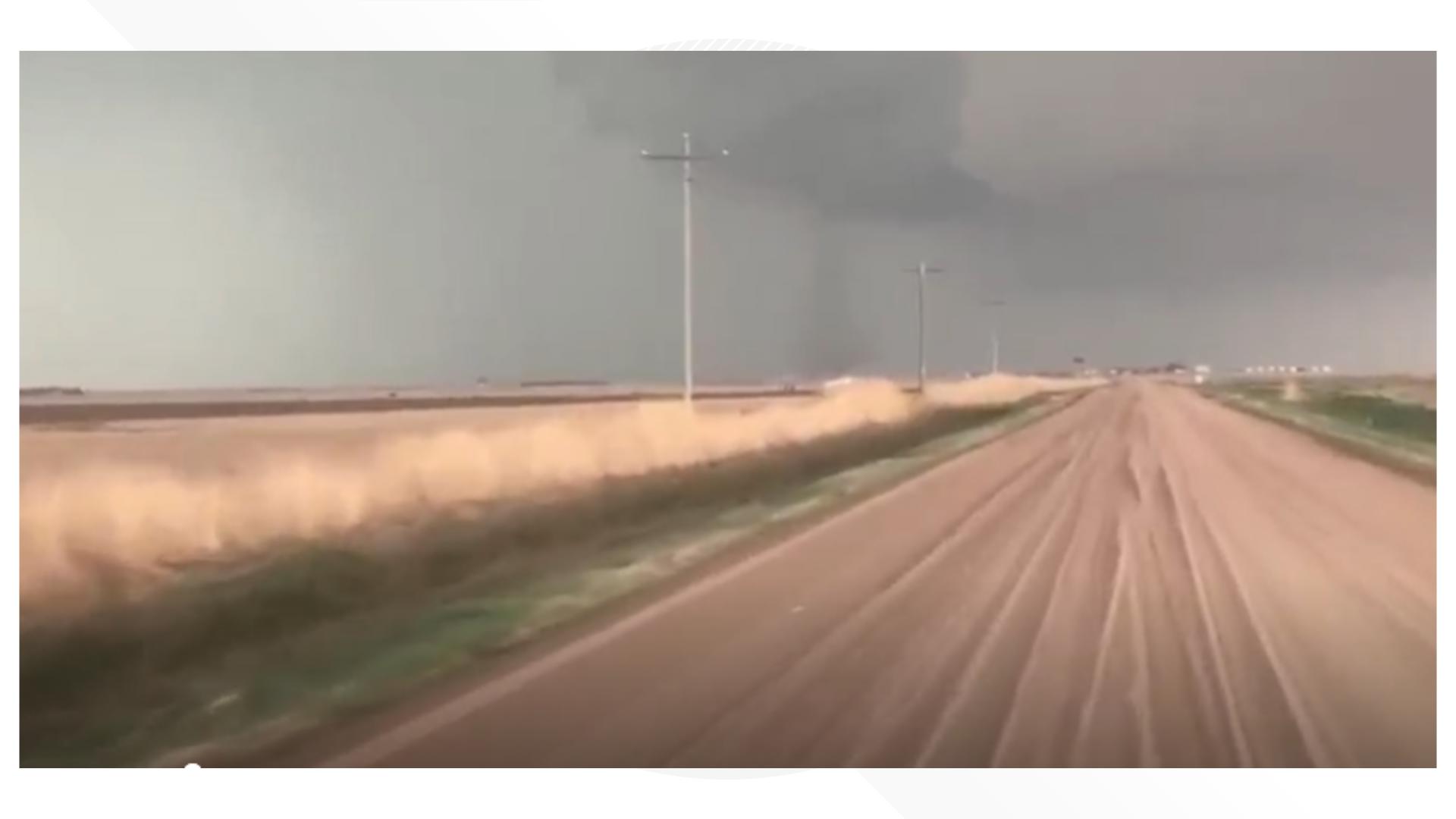
A big area of low pressure is moving in from the west. This is a big storm, and it'll produce heavy snow and strong winds for the Eastern Plains, starting late tonight.
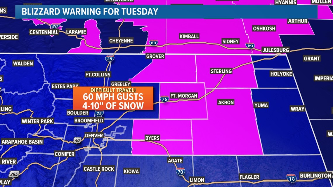
A Blizzard Warning - the first in Colorado since the March 2021 storm - is up for most of northeastern Colorado for Tuesday. A blizzard means that travel on I-70 and I-76 east of Denver will be next to impossible on Tuesday.
Heavy snow and strong winds will make visibility low, and it'll also likely lead to big issues at Denver International Airport on Tuesday. The highest impacts to the airport will probably be on Tuesday morning.
A blizzard means that travel will be really difficult because of a combination of snow and wind. In order to officially have a blizzard, you need three or more hours of sustained winds at or above 35 mph, falling or blowing snow, and visibility at or under a quarter-mile.
Areas from Fort Morgan and Limon on east look the most likely to experience blizzard conditions, mainly on Tuesday. That'll probably disrupt travel on I-70 and I-76.

It'll turn much colder next week across Colorado, including Denver, during and behind this storm. Highs will struggle to get into the 30s for most of next week, with lows in the teens in Denver.
At least some snow looks likely for the Denver area. However, snowfall totals will depend on the storm's exact track.
What we don't know
A heavy band of snow on the northwest corner of the storm will develop. Where exactly it sets up will determine who gets six or more inches of snow, versus maybe 1-3".
If this band nudges a bit further west, areas from downtown Denver on east could get heavy snowfall. There will be a sharp gradient in snowfall totals, with the west side of the city unlikely to get more than two or three inches of snow, while six or more inches remain possible from I-225 on east.
Most of the snow will take place on Monday night and before dawn on Tuesday, though snow will stick around east of Denver through most of Tuesday.

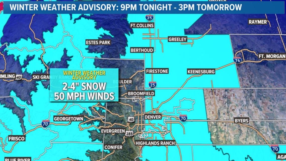
Our current hunch is a middling event that leads to a few inches (1-4") of windy snow for the Denver area, mostly on Monday night and Tuesday morning. But that could change. Stay tuned!
Stay with 9NEWS as the storm approaches for the latest on this storm.
SUGGESTED VIDEOS: Colorado Climate