The system is on track for Sunday, Dec. 11, according to the National Weather Service.
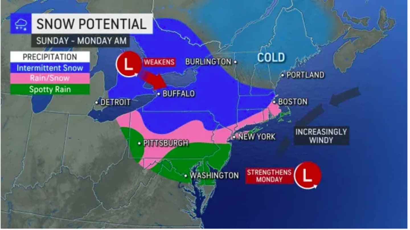
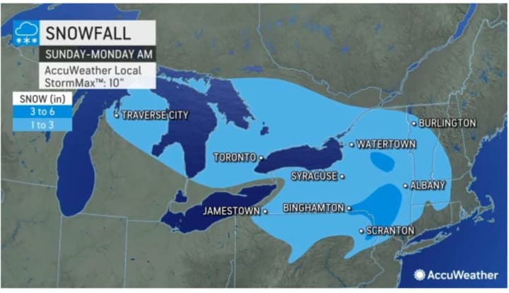
"A general 1-3 inches of snow is in store over part of the interior Northeast from the storm," AccuWeather Senior Meteorologist Brett Anderson said. Those areas include northwestern New Jersey, most of New York, western portions of Massachusetts and Connecticut and northern and central Pennsylvania.
Some areas expected to see several inches and others spotty rain, AccuWeather maps show.
The days leading up to the system's arrival will be dry with a mix of sun and clouds Friday, Dec. 9, and Saturday, Dec. 10 with a high temperature in the low to mid 40s each day, the National Weather Service says.
A wintry mix and snow are possible in areas where the temperature drops at or below the freezing mark both early Sunday morning as well as after nightfall Sunday.
Precipitation is expected to gradually end by the early overnight hours prior to daybreak on Monday, Dec. 12.
There is still uncertainty surrounding the precise timing, track, and strength of the storm.
Click here to follow Daily Voice Somerset and receive free news updates.