First of two storm systems set to arrive in Bay Area, impacting evening commute
SAN FRANCISCO -- The first of two storm systems aiming for the Bay Area is set to arrive Thursday afternoon, dumping rain on the region and impacting the evening commute.
Driven by a low pressure system moving south from the Gulf of Alaska, the two storm systems will bring heavy rain and blizzard conditions in the Sierra.
Thursday's storm is by far the weaker of the two systems, but the heaviest rain and strongest winds will arrive in San Francisco just in time for the evening rush hour. Rain will begin in the North Bay early Thursday afternoon, reaching the Golden Gate at around 4 p.m. or so, dropping into the South Bay by 6 p.m.
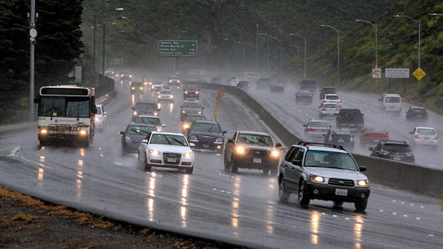
While the initial system won't be as wet or windy as the storm that made a mess of rush hour last Thursday morning, the roads are still likely to be a mess.
The National Weather Service said the weekend storm front will be packing a weak atmospheric river when it rolls into the region.
"A cold low pressure system dropping out of the Gulf of Alaska will phase (merge) with subtropical moisture and strong southwest flow as it intersects over the Sierra this weekend, bringing strong winds and heavy snow to the mountains," weather service forecasters in Reno predicted.
"There is a high probability (90+%) of seeing 2+ feet of snow along Sierra crest and 1+ foot of snow in Sierra mountain communities."
In the Bay Area, the storm front will bring a wet holiday weekend.
"A stronger and more potent storm takes aim at NorCal and the Central Coast over the weekend," weather service forecasters in the Bay Area predicted. "Models have been trending wetter since yesterday and tonight is no different. (The) system will bring light rain to the North Bay early Friday night before more intense rainfall arrives Saturday morning. The latest Atmospheric River guidance now puts this system in the weak Atmospheric River category."
How much rain can Bay Area residents expect?
As much as 4 inches in the North Bay hills and coastal mountains with 1-2 inches elsewhere.
Waves of heavier rain are likely from midday Saturday through the evening. Localized flooding will be possible, and road conditions will be challenging
The National Weather Service additionally issued a gale warning for Saturday, with gusts in the 35-45 mph range expected. The gale warning goes into effect at midnight in the North Bay and expires at 6 p.m. in the Monterey Bay.
The front will also usher in frigid temperatures which could bring snow flurries to the higher elevations of the San Francisco Bay Area.
"As of now, the best chance for accumulating snow will be over the higher peaks of the Santa Lucia range," weather service forecasters said. "Initial forecast will have up to half a foot possible above 4,500 feet."
In the Sierra, Thursday's storm has prompted a Winter Weather Advisory. Travel on Thursday night and early Friday will be slow, but not impossible. The weekend storm will bring several feet of snow and make travel much more difficult.