Insider Blog: First widespread frost of the season on Saturday
UPDATES
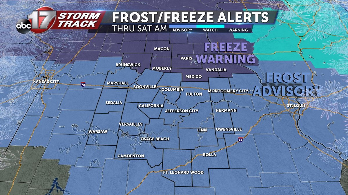
Friday morning, October 7th: An update was made to this blog to show the latest frost/freeze alerts.
BLOG
The first frost of the season is likely on Saturday as a cold front passes through the area Thursday night into Friday and upper high pressure originating from Canada settles over the Midwest.
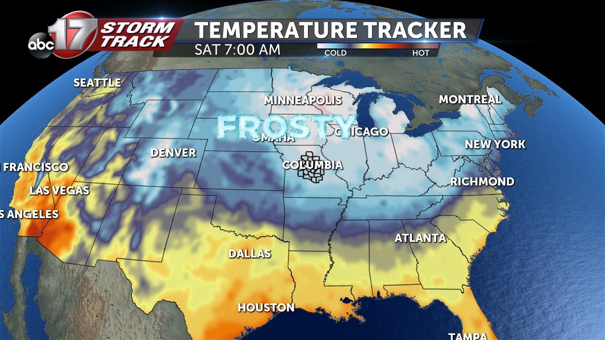
Temperatures on Friday night will dip into the upper 20s to the mid-upper 30s, depending where you are. Areas south of I-70 will be a bit warmer with morning temperatures on Saturday in the mid-upper 30s.
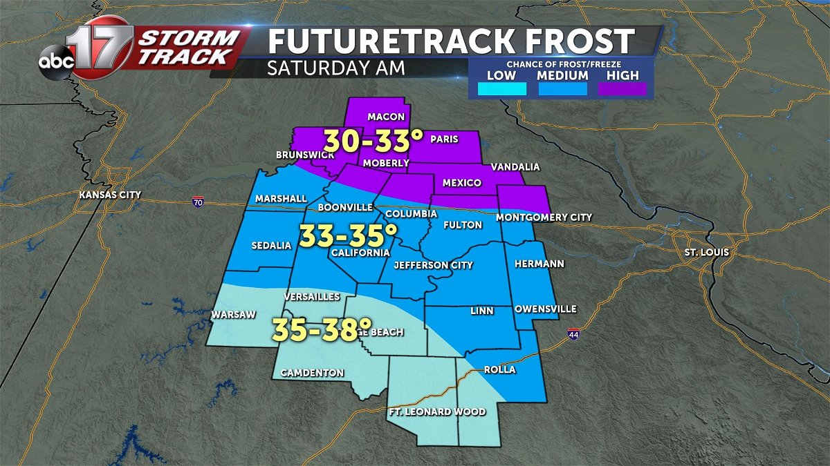
However, the farther north you go, temperatures will continue dropping and could fall below freezing north of Highway 24 where a Freeze Watch will go into effect late Friday night.
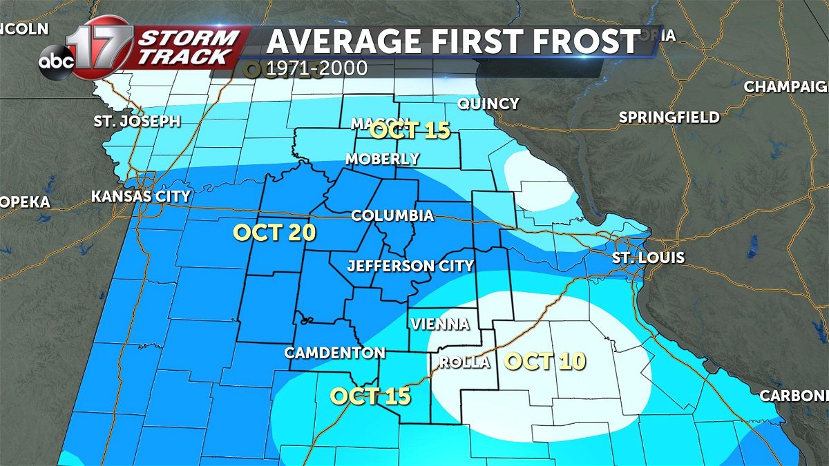
Typically we see our first frost for much of Mid-Missouri between October 15-20, so while this is a bit early we will only see one night with frost potential until late next week.
Frost develops when temperatures drop at night time, allowing heat to rise from the ground. As that's happening, the ground cools, allowing moisture to settle down onto the grass. As temperatures hover in the low to mid-30s, that moisture freezes on contact to the grass or any plants close to the ground.
Make sure to bring any sensitive plants inside, and cover vegetables with a tarp or plastic bag before heading to bed on Friday night.
