Warmer temps, sunny skies move in just in time for the weekend
Storm Watch Team Meteorologist Addison Green says expect rain and winds to fade going into tomorrow and this weekend.
News 12 Staff
•
Oct 5, 2022, 10:06 AM
•
Updated 571 days ago
Share:
More Stories
1:03

LIVE BLOG: News 12 weather updates
12h ago
Ready to explore the great outdoors? These 14 tips can help you stay safe while hiking
4ds ago1:20
Sunny and mild Monday for Long Island
7ds ago1:20
STORM WATCH: Periods of heavy rain, thunderstorms possible to close out the workweek
18ds ago
Guide: Tips to prevent fires during red flag warning
20ds ago1:52

Long Islanders take part in solar eclipse viewing parties at Jones Beach, Cradle of Aviation
20ds ago1:03
LIVE BLOG: News 12 weather updates
12h agoReady to explore the great outdoors? These 14 tips can help you stay safe while hiking
4ds ago1:20
Sunny and mild Monday for Long Island
7ds ago1:20
STORM WATCH: Periods of heavy rain, thunderstorms possible to close out the workweek
18ds agoGuide: Tips to prevent fires during red flag warning
20ds ago1:52
Long Islanders take part in solar eclipse viewing parties at Jones Beach, Cradle of Aviation
20ds agoWHAT'S NEW: Say goodbye to that soggy pattern and hello to warmth, sun & light winds for both Thursday and Friday!
WHAT'S NEXT: A cold front approaches Long Island Friday afternoon and evening, bringing a drop in temperatures (but no wet weather) as we go from Friday into Saturday.

Storm Watch Team Meteorologist Addison Green says to get ready for some very different weather the next few days than the soggy conditions we've been seeing recently.
TROPICS: There are two disturbances being monitored by the National Hurricane Center. TWELVE – the tropical depression formed Tuesday afternoon from a wave near the African continent. It is no longer forecast to become our next named storm, JULIA, and will now instead, fade away by the end of the week, staying out in the Eastern Atlantic Ocean. In the Central Atlantic, at the southern end of the Windward Islands, is a disturbance that has a 80% chance of development over the next five days. It will continue moving into the Caribbean Sea as it travels westward.

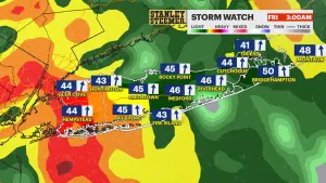
OVERNIGHT: Mostly cloudy to clearer skies with the rain and wind fading. Lows in the mid-50s.

THURSDAY: *Pick of the week* Mainly sunny skies along with a milder feeling and with just a light breeze! Highs in the low-70s. Lows in the mid- to upper-50s.

FRIDAY: Mostly sunny to partly cloudy with mild temps and a light breeze for most of the day, then the winds pick up later on as a cold front arrives in the afternoon and evening hours. Highs in the low-70s. Lows in the mid-to upper-40s.
THIS WEEKEND: After a 15-degree temperature drop, Saturday will be breezy and feeling colder with conditions improving for Sunday. We will be dry, though, with low to no shower chances. Highs in the upper-50s to low-60s. Lows in the mid- to upper-40s.