As Florida begins recovering from the devastation of Hurricane Ian, forecasters are keeping an eye on a tropical front near the Caribbean Sea that is on track to possibly follow the early path of Ian.
The National Hurricane Center (NHC) on Monday listed two disturbances it's monitoring in the Atlantic Ocean, including westward-moving stormy weather that could develop into a tropical cyclone. While the center hasn't sounded the alarm on another tropical storm, the forecast comes as Florida begins reckoning with the damage from Ian.
The NHC said it has recorded rain and thunderstorms from a tropical wave several hundred miles east of the Windward Islands, which are southeast of Puerto Rico. The rough weather from the tropical wave has "changed little in organization during the last several hours," according to the NHC.
"Slow (tropical storm) development is possible during the next several days while the wave moves generally westward at 15 to 20 mph, reaching the Windward Islands and the eastern Caribbean Sea by midweek," the NHC said.
Oct 2, 8 pm EDT: NHC is watching 2 systems tonight -- A tropical wave, the westernmost system in the outlook, could become a tropical depression in a few days, while the easternmost system is likely to become a depression by midweek. More: https://t.co/tW4KeFW0gB pic.twitter.com/W7AiuOymsq
— National Hurricane Center (@NHC_Atlantic) October 3, 2022
A map of the tropical wave's expected trajectory shows it'll pass to the south of Puerto Rico, the Dominican Republic, Haiti and Cuba over the next five days.
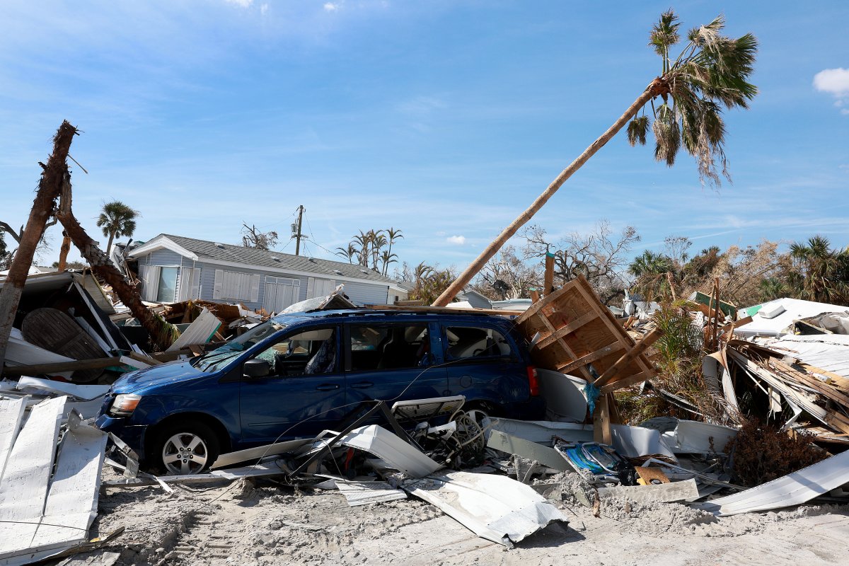
Ian followed a similar path before gathering strength last week as it headed northward, striking western Cuba and the Florida peninsula.
While Ian weakened after again making landfall in South Carolina and moving into Virginia, it left Florida severely battered. The death toll in the state has reportedly risen to more than 100, over half a million customers remain without power and videos have emerged showing entire neighborhoods destroyed.
The NHC puts the chance of the tropical wave headed toward the Caribbean Sea forming into a tropical cyclone in the next 48 hours at 30 percent and 40 percent over the next five days.
"This is not something that is an imminent threat to the Gulf Coast or the United States as a whole," Scot Pilié, meteorologist with The Weather Channel, said in a video posted to social media Monday. "But it's something that is worth watching."
Pilié added that the latest forecast model shows there will be some upper-level winds and dry air that would prevent the development of a cyclone. While conducive conditions could develop later, he said, there is a big question mark over whether the tropical wave will last long enough to pick up strength.
Regardless, he said, "I do think that it's worth watching this system as it moves into the eastern Caribbean late in the week and into the weekend."
Newsweek has reached out to the Florida Division of Emergency Management for comment.
Uncommon Knowledge
Newsweek is committed to challenging conventional wisdom and finding connections in the search for common ground.
Newsweek is committed to challenging conventional wisdom and finding connections in the search for common ground.
About the writer
Jake Thomas is a Newsweek night reporter based in Portland, Oregon. His focus is U.S. national politics, crime and public ... Read more
To read how Newsweek uses AI as a newsroom tool, Click here.