

NEW YORK (1010 WINS/WCBS 880) -- Lingering rain from Hurricane Ian, which has since been downgraded to a post-tropical storm, is drenching the New York City area with up to several inches of rain expected to accrue in total this weekend as temps feel more like fall.
HEAR THE LATEST FORECAST ON 1010 WINS
The local impacts won’t be anywhere near as severe as in Florida, where Ian cut a deadly path of destruction across the state as a Category 4 hurricane on Wednesday.
The storm then regained strength as a Category 1 hurricane on Thursday and hit South Carolina on Friday afternoon, with moisture from the storm pushing northward up the Eastern Seaboard.
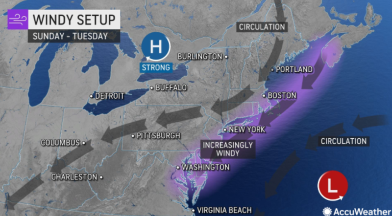
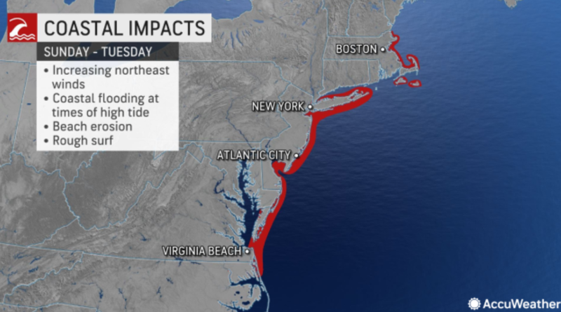
Rain and strong winds which can lead to coastal flooding and beach erosion will be felt in the New York City area throughout the day.
A coastal flood advisory is in effect for all but the Connecticut coastlines of New Haven, Middlesex, and New London counties for this afternoon into the evening high tide cycle, for widespread minor and localized moderate flooding.
Showers should let up during the day on Saturday but come back with a vengeance around 10 p.m. and carry on through the night into Sunday.
Temperatures should stay in the 50s throughout the rest of the day.
The rain should let up on Monday with the potential for localize showers, at which point temperatures will dip with a low of 48 degrees at night.
The weather should clear up with temperatures potentially rising back into the low 70s later in the week.
Related

Related

Related
