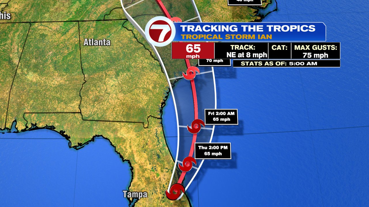
After a devastating blow to Southwest Florida yesterday, Ian is now a Tropical Storm with winds of 65 mph. As day breaks across Southwest Florida, the scope of the damaging inundation from the storm surge, as well as viscous wind, will become clearer. Many locations saw wind gusts over 100mph.

Ian is producing flooding rains this morning near Orlando to Daytona Beach. It’ll produce a storm surge along the east coast of Florida to South Carolina over the next couple of days as well of 3-6 feet.
![[Image of cumulative wind history]](https://www.nhc.noaa.gov/storm_graphics/AT09/refresh/AL092022_peak_surge+png/093959_peak_surge.png)
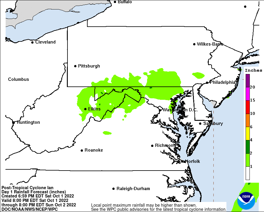
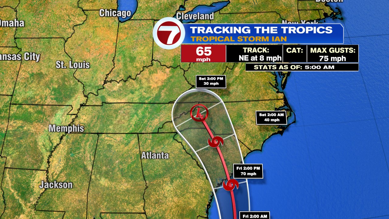
For us locally, some of Ian’s moisture moves into part of Southern New England Saturday afternoon and Saturday night. That’ll likely produce some steady rain along the south coast and perhaps showers as far north as around the Mass Pike. The best chance to stay dry will be across northern Mass and NH. There will be a fairly sharp gradient with the rain totals, as high pressure to our north with dry air, really chews away at the northern shield of rain. Additionally, as the area of high pressure increases to our north Sunday, and lower pressure is south of us, a gusty breeze develops thanks to the pressure difference. While Sunday looks mainly dry, we’ll pick up gusts 30-40mph at the coast, strongest across the Cape and Islands. Inland, gusts run 20-30mph.
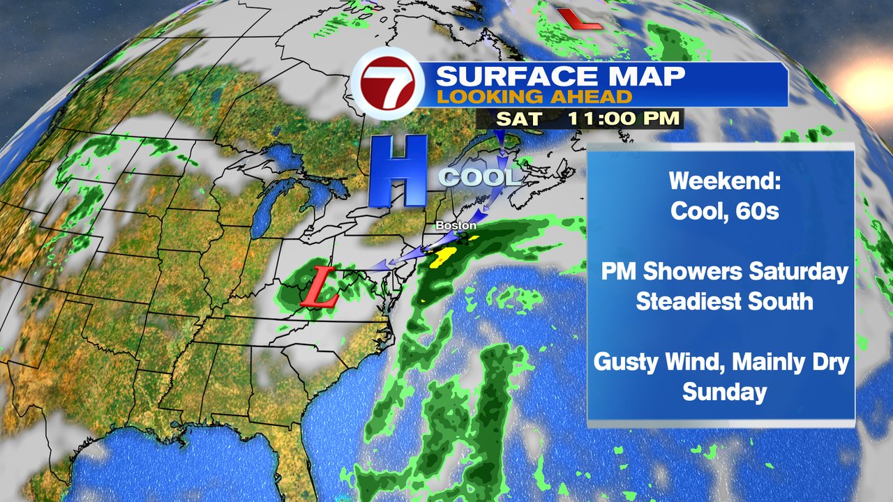

In the mean time, enjoy the next couple of days with highs in the mid 60s and dry weather prevailing.