


Ian is a hurricane again, reaching Category 1 status Thursday afternoon as it hovers over the warm waters off the east coast of Florida and makes it way toward South Carolina.
The storm is expected to make landfall about 2 p.m. Friday, according to Channel 2 Action News meteorologist Brad Nitz. The latest report from the National Hurricane Center showed that Ian consisted of 75-mph winds with gusts as high as 90 mph.
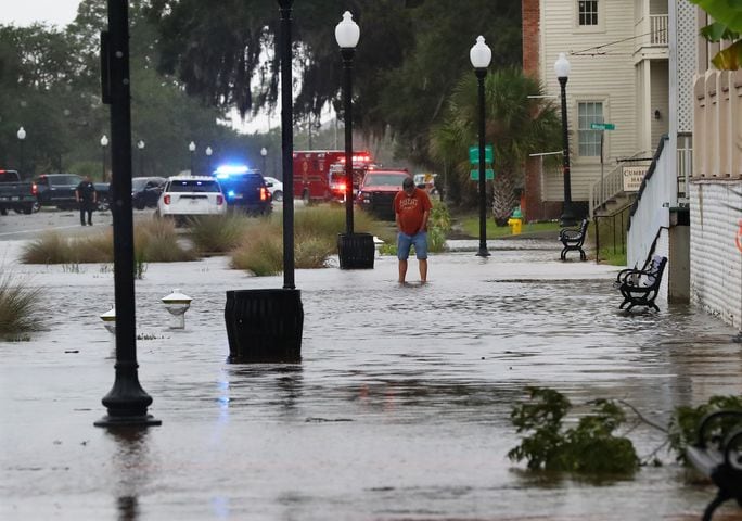
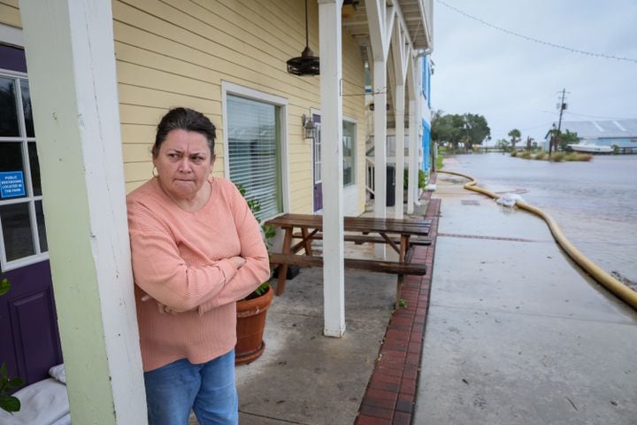
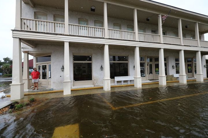
Ian, which had been downgraded to a tropical storm earlier Thursday, has the potential to create life-threatening storm surge in coastal Georgia. It battered southwest Florida as a Category 4 storm Wednesday with sustained winds of 150 mph at landfall, then continued a path across Orlando and into the Atlantic Ocean.
The storm’s current track is taking it farther east than originally forecast, which will likely lessen the impacts to metro Atlanta on Friday night and over the weekend.
Here are the 11 AM EDT 9/29 Key Messages for Tropical Storm #Ian.
— National Hurricane Center (@NHC_Atlantic) September 29, 2022
A Hurricane Warning has been issued for the entire coastline of South Carolina now that Ian is expected to regain hurricane intensity.
Latest Advisory: https://t.co/tnOTyg5UEw pic.twitter.com/yTeI5RVfzT
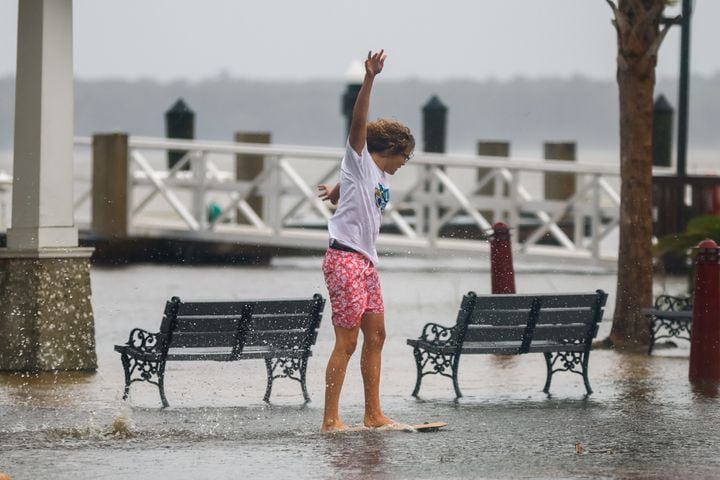
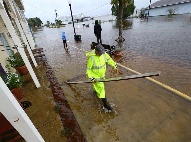
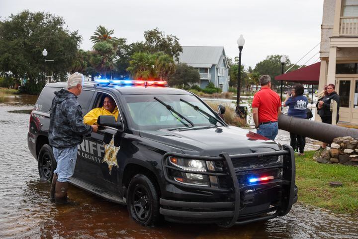
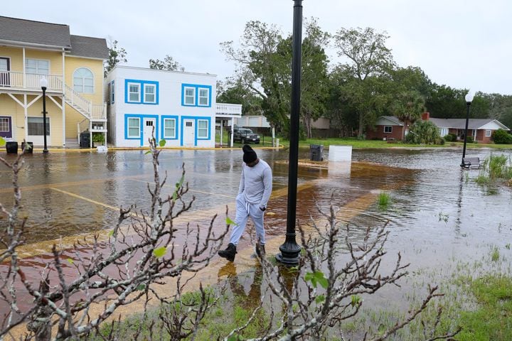
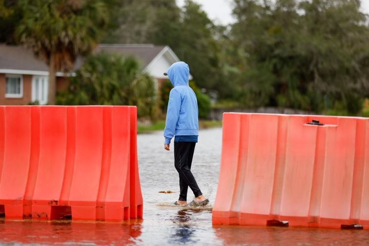
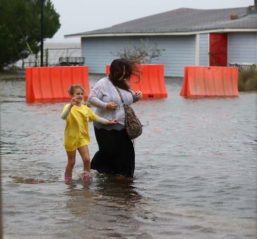
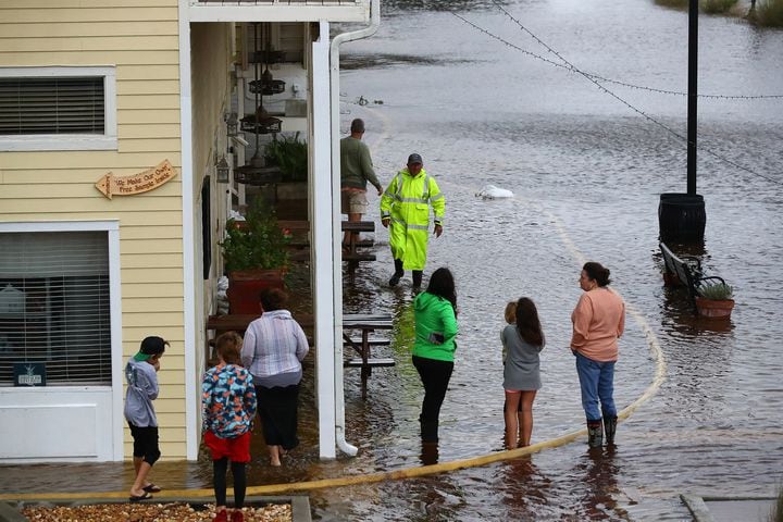
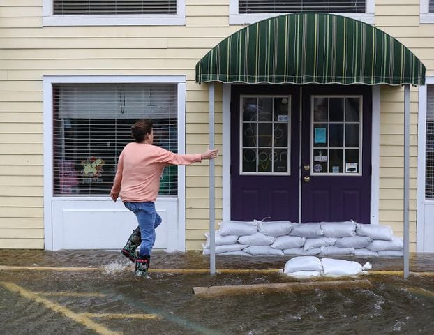
A hurricane warning has been issued for the South Carolina coast, and a hurricane watch is in effect for the Georgia coast. Sea levels could rise an additional 4 to 7 feet with storm surge in the Savannah area, and widespread rainfall totals of 4 inches or more are likely, according to forecaster Michael Brennan with the NHC.
“We are expecting tropical storm conditions (on the Georgia coast),” he said. “We could have winds near hurricane force. Hurricane conditions are possible there. It could be a very rough 24 hours in those areas.”
— National Hurricane Center (@NHC_Atlantic) September 29, 2022
In metro Atlanta, the only noticeable changes from Ian were a few more high clouds Thursday and a strong breeze, according to Channel 2 Action News meteorologist Brian Monahan.
“We’re going to see this cloud cover move in as we go through today and tonight,” Monahan said. “We’re going to see some wind pick up (Friday) evening and Saturday morning, but nothing we can’t handle. In fact in many spots, especially west of Atlanta, there’s just not going to be a whole lot with Ian.”
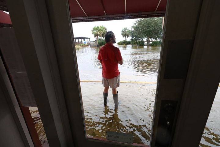
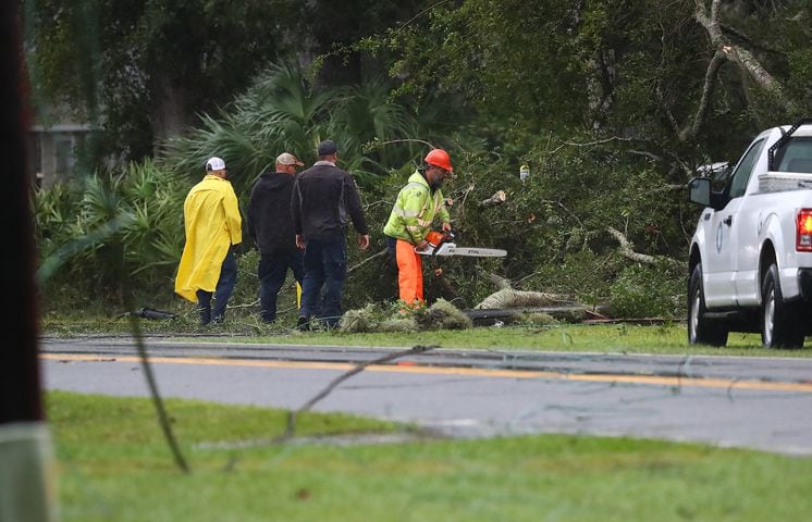
Hurricane Ian left a path of destruction in Florida, pushing a wall of storm surge, trapping people in flooded homes and knocking out power to 2.5 million people before aiming for the Atlantic Coast. Ian’s strength at landfall tied it for the fifth-strongest hurricane, when measured by wind speed, to ever strike the U.S.
Just awful in SWFL yesterday.
— Brian Monahan, WSB (@BMonahanWSB) September 29, 2022
I'm afraid what the first daylight this morning is going to show from Naples to Port Charlotte. https://t.co/ZzGV5gABwM
Tremendous tropical rain with #Ian leading to fresh water flooding like this in the Orlando area.
— Brian Monahan, WSB (@BMonahanWSB) September 29, 2022
Surge was the story along the coast.
Flooding from torrential rainfall in central Florida. https://t.co/Jc9zuauUtK
Its tropical-storm-force winds extended outward up to 415 miles, and nearly the entire state of Florida was getting drenched. Monahan said the size of the wind field could cause problems for large swaths of coastal and South Georgia when Ian makes landfall Friday.
The storm is expected to move inland over South Carolina late Friday and then gradually dissipate over the southern Appalachian Mountains by Saturday night.
9/29 11am EDT: There is the danger of life-threatening storm surge from #Ian along the coasts of northeast FL, GA, SC, & the Neuse River, NC, where a storm surge warning is in effect. Residents should follow advice from local officials & check https://t.co/0BMJEA5Wz0 for updates. pic.twitter.com/h7h6ZevGhx
— NHC Storm Surge (@NHC_Surge) September 29, 2022
Metro Atlanta will not see anything like tropical-storm-force winds as Ian passes to the east, Monahan said. A wind advisory is in effect for parts of North Georgia along and south of I-85 until 8 p.m. Thursday.
“Friday morning the breeze is going to be noticeable (in Atlanta),” he said. “We’ll have some 15- to 20-mph wind, a little breezy, a little gusty to start the day, but again nothing we can’t handle as the bulk of the wind stays to our east.”
Some gusty wind possible today with #Ian in north Georgia -- gusts to 35 mph in a few spots mainly and along south of I-85.
— Brian Monahan, WSB (@BMonahanWSB) September 29, 2022
Live on Channel 2 now. @wsbtv pic.twitter.com/85gjdaofBA
Monahan expects only spotty power outages in the metro area, as wind gusts should stay in the 25- to 40- mph range.
Heavy rain will arrive in east Georgia by Friday night, with some downpours extending into metro Atlanta, he said. The rain should begin to taper off at daybreak Saturday, according to Monahan, but it will be gusty through the morning before quieting down for the afternoon.
Areas from Atlanta to the west are expected to get a half-inch of rainfall or less, with four or more inches of accumulation expected for areas east of Athens toward the South Carolina border. By Sunday, all that’s left of Ian will be some breezy and cooler weather in Atlanta, with a projected high of just 70 degrees to end the weekend.
Ahead of the tropical system, the city should be mostly sunny and cool Thursday with a projected high of 73 degrees. Clouds and showers Friday will mean even lower temperatures, with a morning low of 57 degrees and an afternoon high of 71, according to the latest forecast.

Credit: Channel 2 Action News
Credit: Channel 2 Action News
— The Associated Press contributed to this article.
» For a detailed forecast, visit The Atlanta Journal-Constitution weather page.
» For updated traffic information, listen to News 95.5 and AM 750 WSB and follow @ajcwsbtraffic on Twitter.
» Download The Atlanta Journal-Constitution app for weather alerts on-the-go.