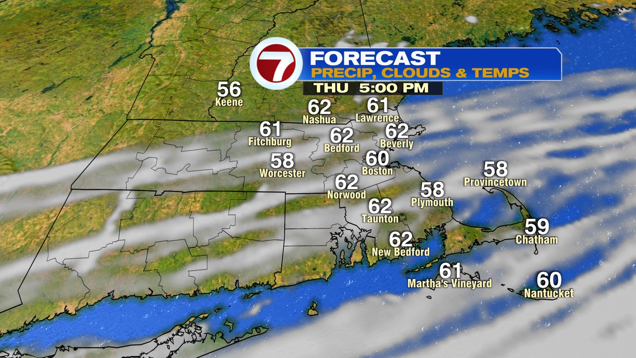
Temps run near 50 early this morning as seasonable cool air settles in. Overall, it’s a nice day with a mix of sun and clouds. While I can’t rule out a brief sprinkle/spot shower inland, much of the day turns out to be rain free. Highs run in the mid 60s to near 70.
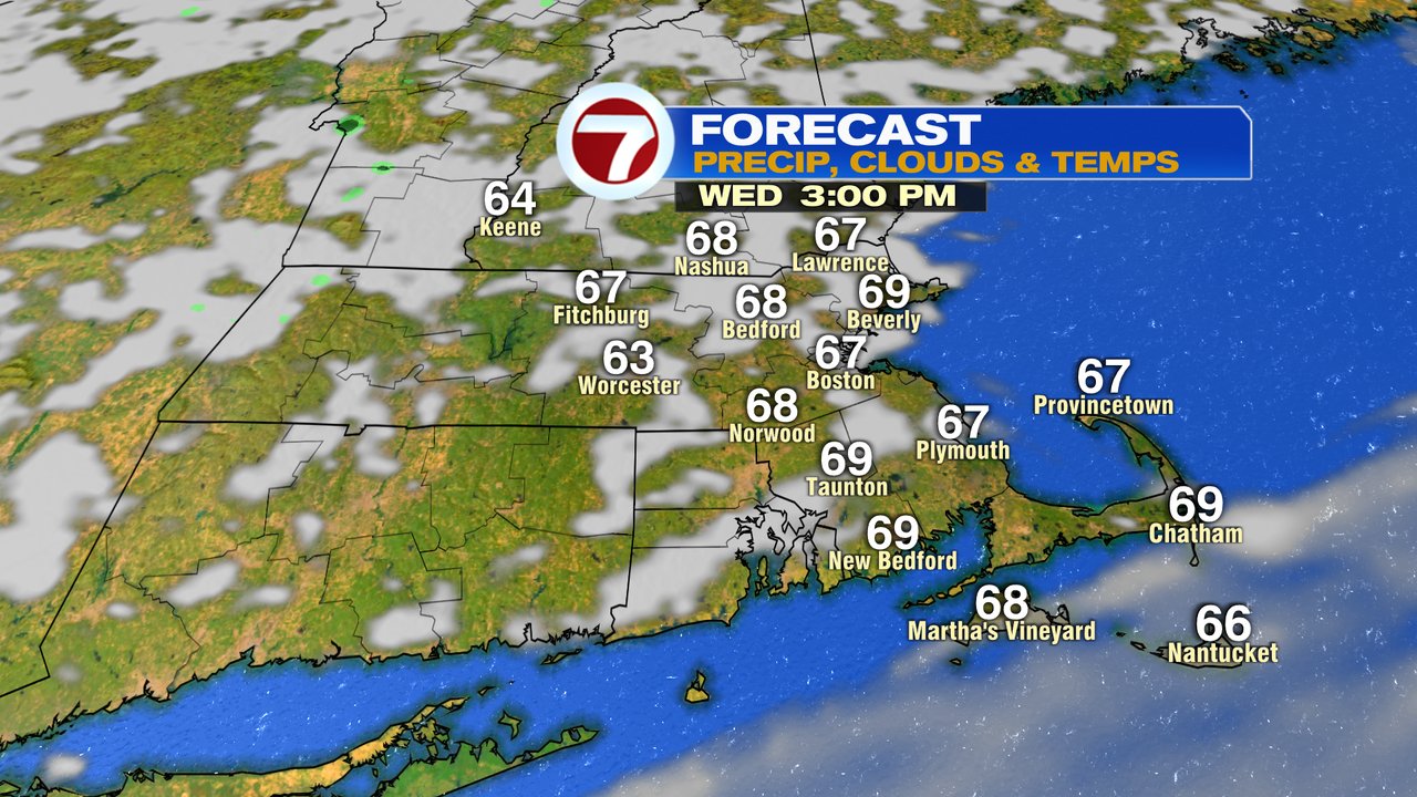
It’ll be a bit cooler tomorrow, low to mid 60s as dry weather prevails through the end of the week. Temps take a run at 70 Saturday, then fade back into the lower 60s Sunday.
While the weekend looks dry for many, some rain from Ian will likely get close to the south coast Saturday night/Sunday, so we’ll keep an eye out for the chance of some drops there. Not expecting much rain/wind issues here though.
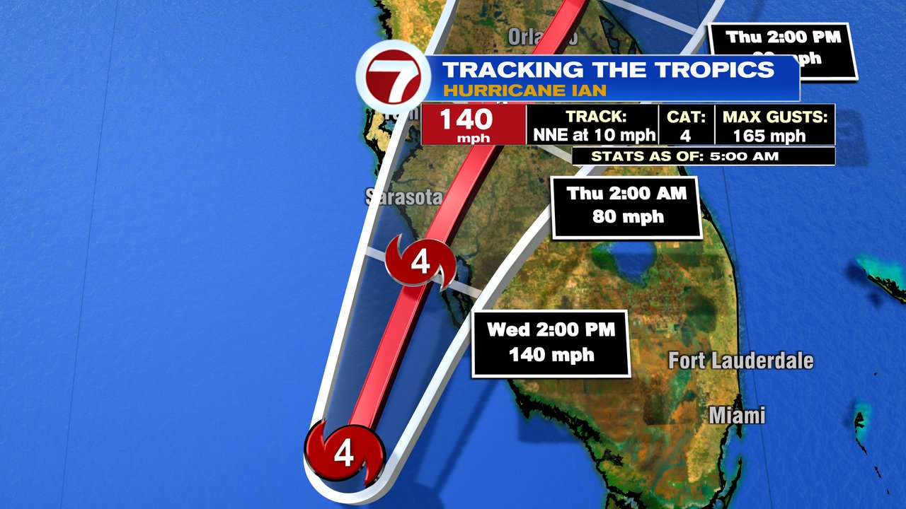
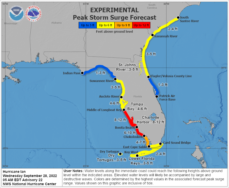
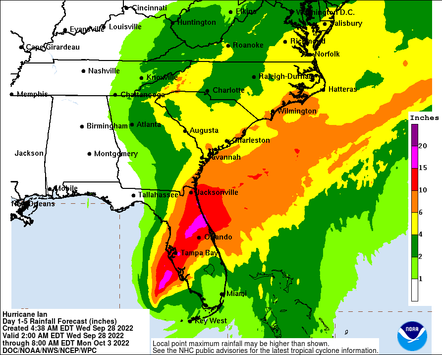
Hurricane Ian this morning is a category 4 hurricane with max sustained winds at 140mph. As it approaches the west coast of Florida, it’s expected to make landfall as a category 4 early to mid afternoon, most likely in either Charlotte County or southern Sarasota County. The track will be close to what Hurricane Charley’s track was back in 2004, however, Ian is a larger storm in terms of it’s wind field, so the chances for a higher storm surge is there. Charley’s surge maxed out at 7 feet, the forecast for Ian’s max surge is 8-12 feet. The highest numbers will be where the eye moves onshore and just to it’s south. Significant coastal flooding is likely from Sarasota to Marco Island, with some of the worst flooding likely from Lee to Charlotte to Sarasota County, especially around Charlotte Harbor if landfall is near/just north of there. Flooding rains will be a concern too, as 10-20″ is expected from Tampa to Orlando to Jacksonville.