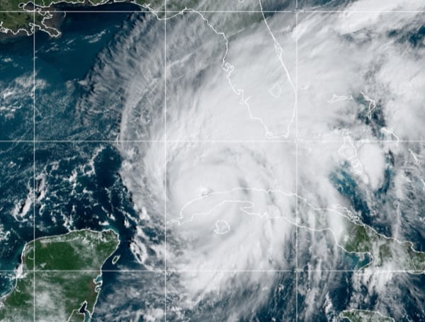
The latest forecasts for Hurricane Ian show the massive storm will make landfall in Sarasota County, farther south than previous predictions but still threatening devastation for much of the state, authorities said Tuesday.
“In some areas there will be catastrophic flooding and life-threatening storm surge,” DeSantis said Tuesday. “Because of the size of the storm, it’s kicking up a lot of surge. The Gulf is going to be very angry as this comes in.”
Ian’s shift east has put the city of Venice in the storm’s crosshairs sometime Wednesday, although high winds and storm surge are still expected farther north into the previously targeted Tampa Bay region, state Emergency Management Director Kevin Guthrie said.
DeSantis warned that flooding was likely across much of west Florida.
“Many people in the Southwest Florida area, your best bet is going to be evacuate across the state,” Guthrie said. “Just go straight across the state to Broward, Miami-Dade, Palm Beach.”
According to the National Hurricane Center (NHC), life-threatening storm surges, hurricane-force winds, flash floods, and possible mudslides are expected to continue in portions of western Cuba today. Devastating wind damage is expected near the core of Ian.
Life-threatening storm surge looks increasingly likely along much of the Florida west coast where a storm surge warning is in effect, with the highest risk from Fort Myers to the Tampa Bay region.
Hurricane-force winds are expected in the hurricane warning area in southwest and west-central Florida beginning Wednesday morning with tropical storm conditions expected by this evening. Residents should rush all preparations to completion today, according to the NHC.
Heavy rainfall will increase across the Florida Keys and south Florida today, spreading into central and northern Florida tonight and Wednesday, into the Southeast U.S. by Thursday and Friday, likely causing flash, urban, and small stream flooding.
Considerable flooding is expected across central Florida into southern Georgia and coastal South Carolina, with widespread, prolonged moderate to major river flooding expected across central Florida.


