
PORTLAND, Maine — A relatively slow Atlantic tropical season has quickly taken a turn with two major systems within a week: Fiona and now Ian.
Ian is already a hurricane, with relatively healthy looking symmetry and development. Symmetry tells us a lot about the environment a hurricane is in at the moment. A storm pulled to one side indicates strong shear aloft, which is hostile to the rapid intensification of a "warm core" system like a hurricane.
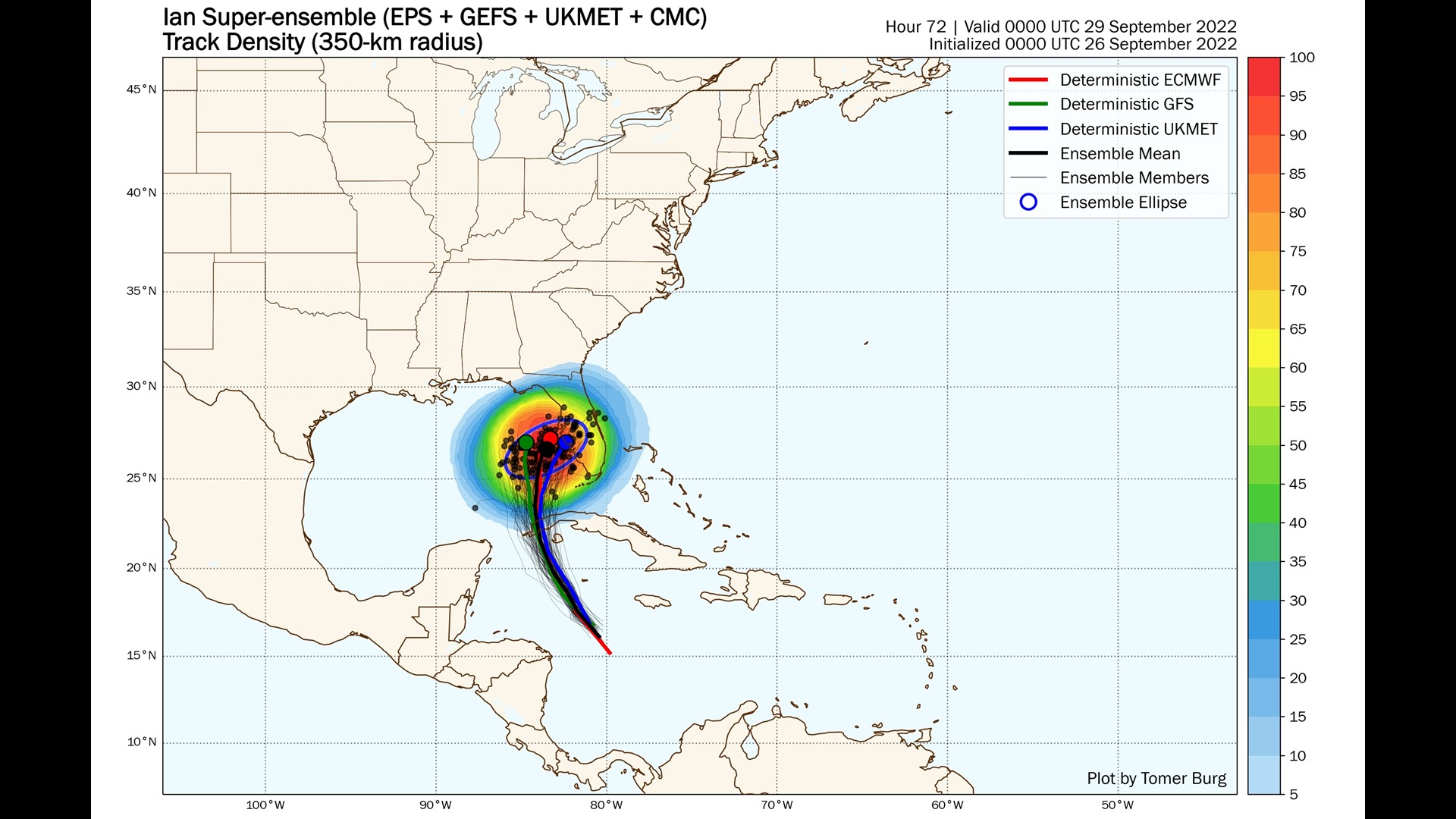
At this point there is little doubt that Ian will make a run toward Florida. The latest model consensus is pretty strong.
That's a pretty tight clustering for a few days out, but the devil will be in the details.
Strength is one of those details.


What will be the intensity of Ian as it makes it closest pass to Florida? That could be more important that strength on landfall, which may happen after the worst of the impacts.

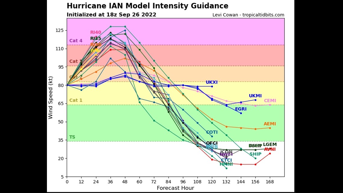
Most reliable guidance has Ian reaching high-end Category 3 or low-end Category 4 strength, which would make it a very powerful storm upon arrival.
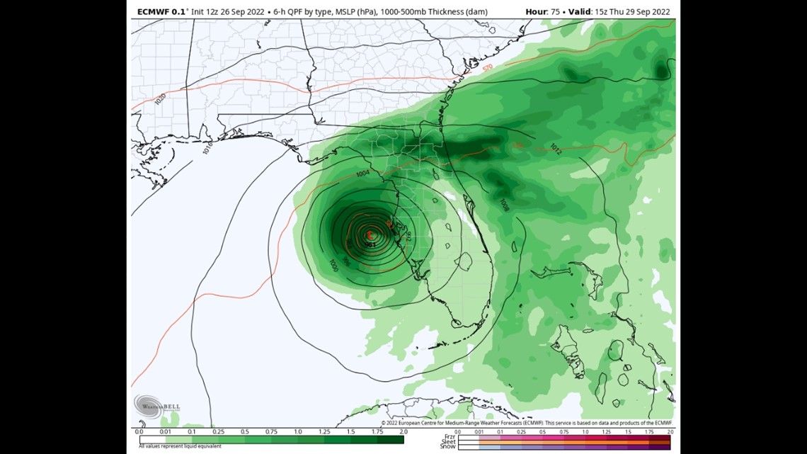
The exact track of Ian will be the key, as a slight wobble to the west could save the Tampa area from the worst of the impacts. The "worst case" scenario is if Ian holds just offshore of Tampa. That would put the city in the strongest wind and storm surge while allowing the hurricane to maintain some level of strength being over the water.
Such a track is depicted above in the EURO model forecast from today.

So how could Florida avoid disaster? Either a wobble west as discussed or a rapid weakening of Ian because of shallower water near Florida's west coast. That lack of water depth could allow for Ian to upwell colder water from below and basically kill its own dynamics.
Florida can rely on neither, however, and they are bracing for a major hurricane impact on Wednesday night.