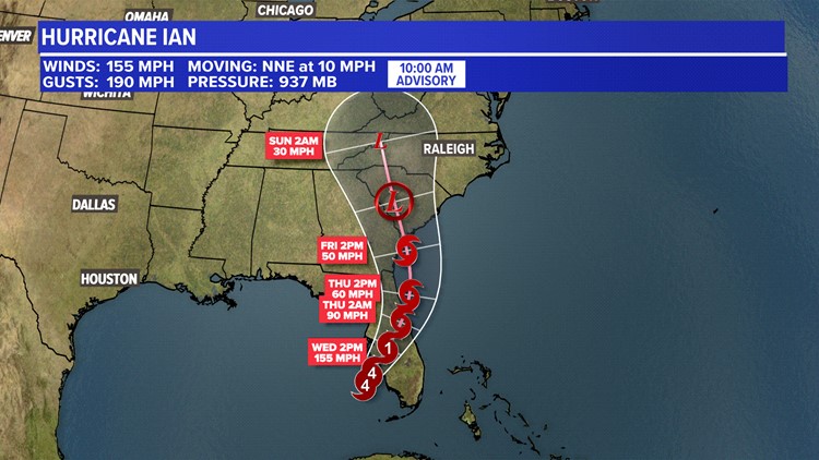
TAMPA, Fla. — Hurricane Ian continues to strengthen as it makes its way toward the Florida coast. Hurricane Ian was named a Category 4 storm Tuesday morning.
As of 12PM, Hurricane Ian is producing winds around 115 mph and wind gusts at 140 mph. Ian is moving north at 10 mph.
Ian is expected to make landfall in Florida on Tuesday. Those in the Keys and Western Florida could see heavy rain, storm surge and hurricane-force winds. Rain totals are possible from 6 inches to 15 inches, causing flooding to be a major concern.
West-Central Florida will start to see tropical storm conditions Tuesday night and hurricane conditions on Wednesday.
Those in East Tennessee could see the remnants of Ian later this week and weekend. Rainfall totals could vary depending on Ian's track once it makes landfall.
Stay with WBIR Weather for the latest tropics updates.