Showers and t’storms will wind down overnight with partial clearing toward dawn. Those storms brought some strong wind gusts, very heavy rain and quite a bit of lightning. There may have been a little bit of hail, too.
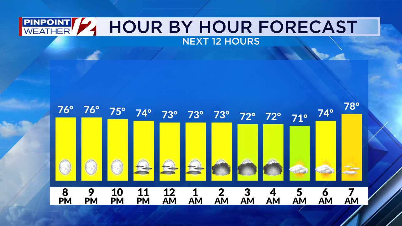
Hour by Hour // A close look at the upcoming conditions »
Monday will be quieter with clearing skies. Temperatures at the bus stops in the morning will be in the 60s. Afternoon highs will be in the low 70s.

We’re expecting lots of sunshine through the afternoon. Looks like a nice day!

TRACKING THE TROPICS
Tropical Storm Ian is expected to rapidly intensify during the next 24 hours as it turns north toward the western tip of Cuba.

From there, it could strengthen into an extremely dangerous Category 4 storm with winds to 130mph as it approaches Florida. Landfall in Florida is possible near Tampa through the panhandle. This would create a large storm surge near landfall along with destructive winds and heavy rainfall.
We’ll continue to monitor Ian closely because if it pops back out into the Atlantic, it could impact our weather. For now, it looks like it will stay in the Southeastern United States bringing flooding rains.

-Meteorologist T.J. Del Santo
Pinpoint Weather 12 Links
Detailed 7-Day Forecast | Weather Now | Radar | Hour-by-Hour | Ski Report | Ocean & Bay | Solar Report | Pinpoint Traffic | Flight Tracker | Active Weather Alerts | Closings & Delays | Power Outages | Get the Weather App