First Alert Weather: Red Alert for rain moving in Monday night, sticking around Tuesday
By Matt DeLucia, CBS2 Meteorologist/Weather Producer
If you have this Labor Day holiday off, it won't be a total washout during the day. That does change tonight, however...
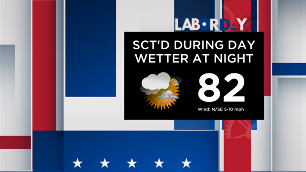
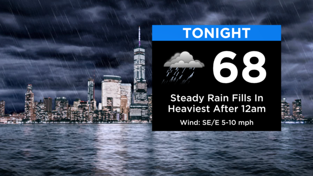
Today will be mostly cloudy with some scattered showers or a t-storm around, mainly to the N&W. Around the city and for the coasts, much more of the day will be dry rather than wet. It's still humid, but not as hot as yesterday with highs in the low to mid 80s. Things change this evening as the front drifts closer, allowing steadier rain to shift southward. Expect rain with some embedded heavier bouts tonight, especially after midnight. Lows will be in the upper 60s.
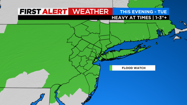
As for tomorrow, the morning commute will be a soggy one with ongoing steady rain. It'll be a Red Alert day as some flooding is possible where the heaviest rainfall rates occur, mainly in urban and poor drainage areas. A Flood Watch is in effect for the entire area.
Rain continues through the morning hours Tuesday, gradually becoming lighter and shifting south and east through the afternoon. It's much cooler with highs in the low/mid 70s. Total rainfall through Tuesday night will be 1-3" with locally higher amounts. Other than the localized flooding potential in spots, this will be much needed rain after our very dry summer!

There's still a lingering risk of showers on Wednesday, but it'll be much more scattered. Mostly cloudy skies and northeast winds will again hold temps in the 70s. More sunshine returns by Thursday with a nice and comfortable finish to the work week.