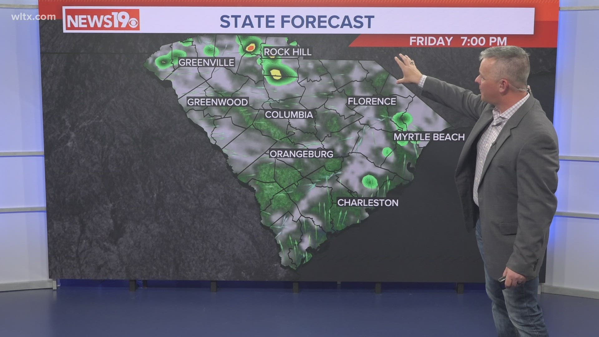
COLUMBIA, S.C. — A front will continue to lift north today. Showers will be likely through the early afternoon hours. Some drier air may work into the area later this afternoon and this evening. There will still be a chance for a few showers and storms this evening and tonight. More sunshine is forecast for Saturday, but the chance for rain will increase Sunday.
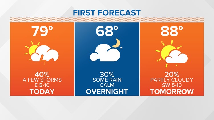
Today has started off wet. Showers, heavy downpours have impacted parts of the Midlands. Temperatures dropped into the upper 60s and lower 70s. Highs later today will be in the middle to upper 70s, with some areas reaching the 80° mark.

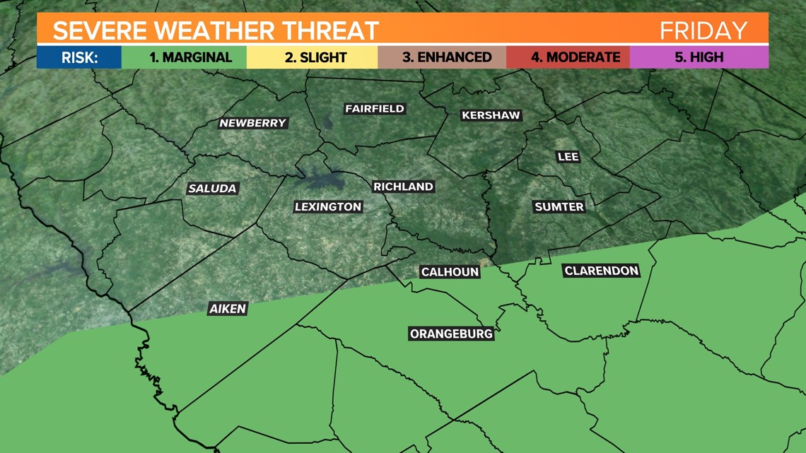
Severe weather is possible in the southern half of the Midlands this afternoon and this evening. The greatest threat would be damaging wind gusts.
heavy rainfall could lead to some flash flooding. The Weather Prediction Center has most of the Midlands under a slight risk for excessive rainfall.
Saturday will be partly cloudy. A stray shower or storm will be possible during the afternoon and evening hours. High temperatures will top out in the middle to upper 80s. Our average high for Saturday is 91 degrees.

The chance for rain will increase Sunday. A weak cold front will approach the area. The severe weather threat appears to be low, but heavy rainfall will be the greatest threat. High temperatures Sunday will be in the middle 80s.
The unsettled weather pattern will continue for the workweek. Each day there will be at least a chance for some rain. High temperatures will remain a little below normal, topping out in the middle 80s every day.
Tracking the Tropics:
A low pressure system is emerging over the southwestern Gulf of Mexico and it continues to produce disorganized shower activity.
Conditions appear favorable for slow development, and a tropical depression could form while the system moves northwest across the southwestern Gulf of Mexico late today or Saturday.
Saturday night, the system is forecast to move inland over northeastern Mexico, this will end its chances of development.