Hazy, hot, and humid for the rest of the week
Temperatures continued to climb on the Fourth of July, with middle-90s for highs across the FOX 23 coverage area. We continue the warming trend over the next couple of days.
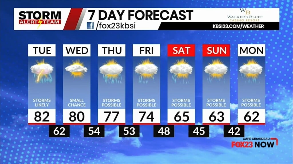
We had mostly clear skies on Monday, and we keep the mostly clear skies into Tuesday. Given the heat and humidity, there’s a small chance for your typical summertime pop-up thunderstorm. They’ll be hit-or-miss, and likely more miss than hit.
High temperatures will be in the upper-90s and in triple-digit territory for a few locations on Tuesday. We’re forecasting a high of 99° in Cape Girardeau.

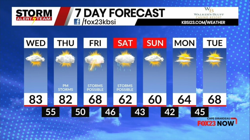
The sultry conditions remain through the end of the workweek, so the Skeeter Meter remains high.

The intense heat sticks around through Friday. However, rain chances start to increase by then. There’s a slightly better chance for thunderstorms on Friday and Saturday. While it will still be humid for the weekend, we do anticipate a cooldown. By Sunday, the latest data suggest that we trend in a drier direction.

Meteorologist Malcolm Byron
FOX 23 Storm Alert Team