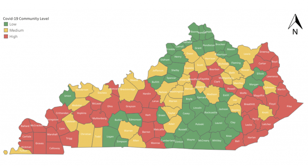
On the latest COVID map released by the Kentucky Department for Public Health, Russell County remains green, but neighboring Adair County turned yellow, indicating a medium level of community spread.
The remainder of Russell County’s neighboring counties remain green, indicating a low community level.
However, nearby Metcalfe, Barren, and Monroe counties are now red on the map.
This map model uses the number of new COVID-19 cases in each county, percent of hospital capacity devoted to COVID-19 patients and the number of new patients with COVID-19 admitted to the hospital in the past week.
Below is the most recent map released on Friday.