Colorado Weather: Monsoon/Cold Front Combo Set For Thursday
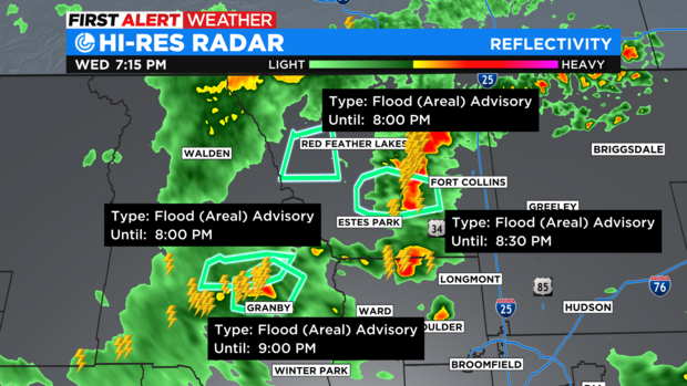
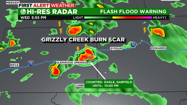
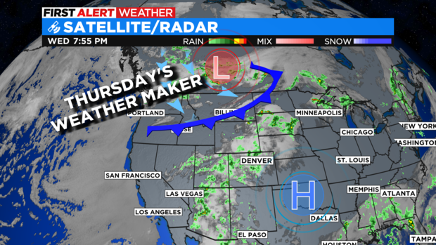
DENVER(CBS)- Wednesday thunderstorms prompted a few flood problems over the Cameron Peak, East Troublesome and Grizzly Creek burn areas heading into the evening. With Flood Advisories and Flash Flood Warnings posted for dangerous conditions.
Heading into Thursday there could be more heavy thunderstorms bringing the threat of flash flooding to mountain burn scars. We have the combination of the steady monsoon moisture flow and an afternoon cold front coming together to change our weather pattern.
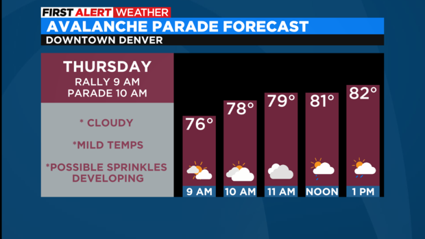
Lots of people will be in Downtown Denver for the Avalanche Victory Parade. There will be a big southwest push of monsoon moisture rolling in with lots of cloud cover expected on Thursday morning. At this time there is a small chance for a few sprinkles during the parade. But, for the most part conditions are looking mostly cloudy with comfortable temperatures in the 70s to start things off.
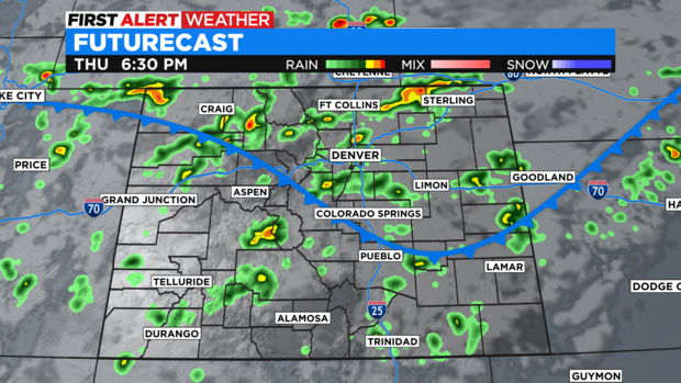
I am not expecting the heavier rainfall until after the noon hour for most areas of the Front Range and Eastern Plains. The first showers and storms to develop will be because of the heat of the day along with added monsoon moisture. By late afternoon the cold front arrives and may energize the afternoon and evening storms late into Thursday night.
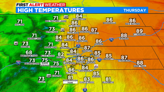
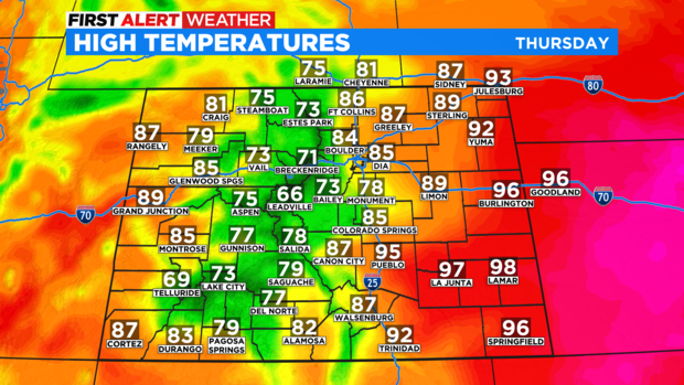
With the added cloud cover and approaching cold front temperatures across the Denver metro area and northeastern Colorado may be about 10 degrees cooler than the highs of Wednesday.
Friday will be similar to Thursday with cooler temps for most of the state and a good chance of afternoon and evening thunderstorms.