


Overnight Tuesday Night: Clear, crisp. Lows in the 50s.
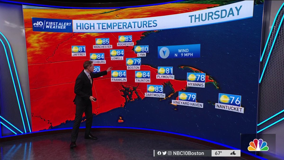
Wednesday & Thursday: Fair & pleasant. Highs in the 80s.
We finally had a good soaking rain across much of New England, which it's looking like we need ahead of a hot stretch coming up.
The NBC10 Boston weather team has added a First Alert Stamp to the forecast for the start of the holiday weekend. It will get really hot on Friday, with highs in the mid to upper 90s. Humidity will return, bringing the heat index to around 100.
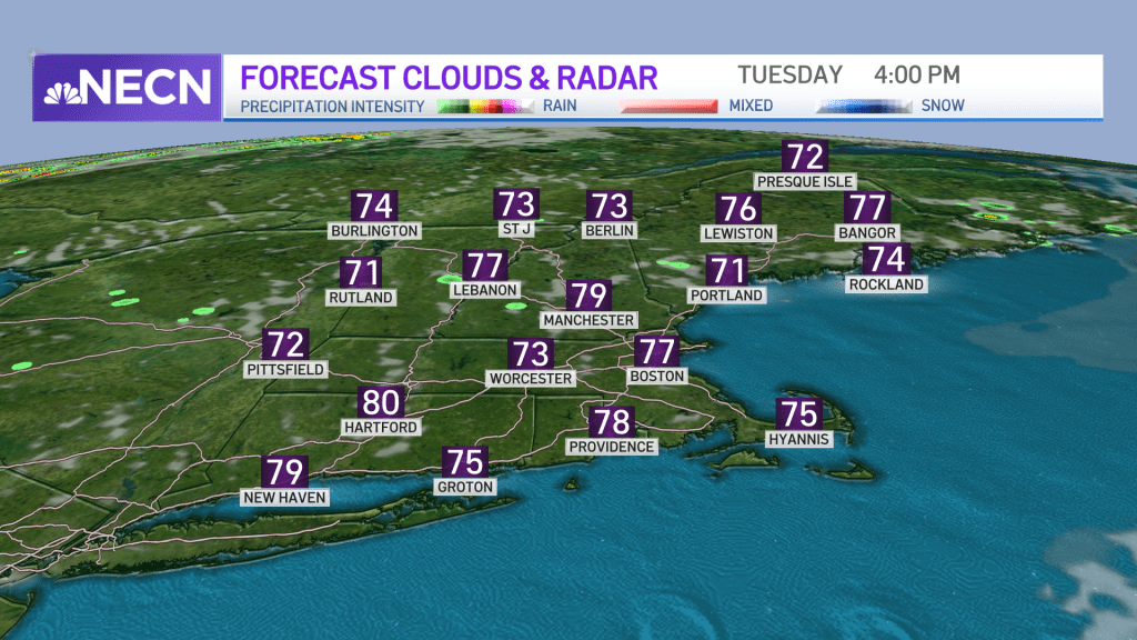
On Monday, Burlington, Vermont, had 1.2 inches in the observation site, with Boston reporting 0.65 inches. And we had everything in between! Even some spots pushing 2 inches in southern New England.
Now, high pressure takes over and our weather remains quiet for the rest of the week. Plus, the humidity is much lower. Tuesday, we also have sea breezes in the afternoon, but it’s a warm breeze with temperatures still in the low 70s at the coast and low 80s inland.
Get New England news, weather forecasts and entertainment stories to your inbox. Sign up for NECN newsletters.
Higher elevations could see a brief pop up shower late in the afternoon. There is an even a lower chance for a pop up shower in the mountains Wednesday. Most of New England stays dry and beautiful!

Highs gradually increase into the 90s again in time for the holiday weekend. Humidity creeps up by the end of this week, and for the weekend it’s muggy. Temperatures may very well reach the mid to upper 90s by Friday afternoon, and with the humidity it could feel like near 100 degrees.
U.S. & World


Saturday is the day we will see scattered thunderstorms along another cold front. Prior to the frontal boundary moving through, highs reach the low 90s with soupy air again.
The good news is that Sunday and Monday look to be dry and cooler but still around 80 degrees!
Stay tuned on the rain timing, as things could still change a bit.


