Pittsburgh Weather: Slight cooldown coming to close out June
PITTSBURGH (KDKA) - We will see some relief from the high heat over the next few days.
WEATHER LINKS:
Current Conditions | School Closings & Delays | Submit Your Weather Photos
Alert: None
Aware: Scattered to isolated showers and storms are possible tomorrow afternoon/evening as a cold front passes.
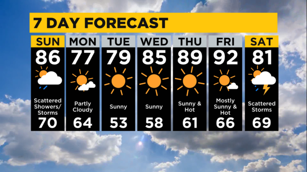
Another hot, muggy night is in store for us with lows only near 70 under partly cloudy skies. We'll still hit the mid to upper 80s Sunday before a cold front arrives to cool us down a bit and bring us some scattered showers and thunderstorms.
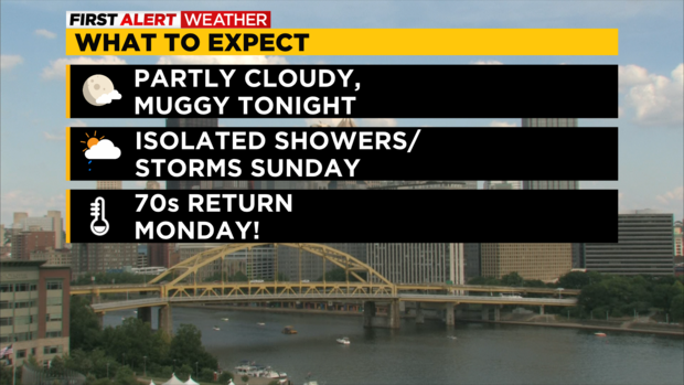
We're under a marginal (isolated) risk for severe storms across Western PA Sunday, but the activity will be scattered to isolated in nature with a few showers possible by noon and a few thunderstorms popping through the afternoon and into the mid-to-late evening as the front crosses. The threat for anything severe would be gusty wind but we're not calling for any First Alert days right now.
That's the only real chance of rain we'll have this week until next Saturday. Highs in the 70s return Monday and into Tuesday, which will feel refreshingly cool. Heat builds again toward the end of the week.
Stay up to date with the KDKA Mobile App – which you can download here!