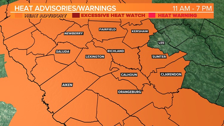
COLUMBIA, S.C. — More record-setting temperatures are forecast for this afternoon. A heat advisory is in effect from 11 A.M until 7 P.M. A few showers or storms will be possible over the next several days, this could bring us some relieve in the heat. Temperatures will be a little cooler over the weekend, and it will not be as humid.
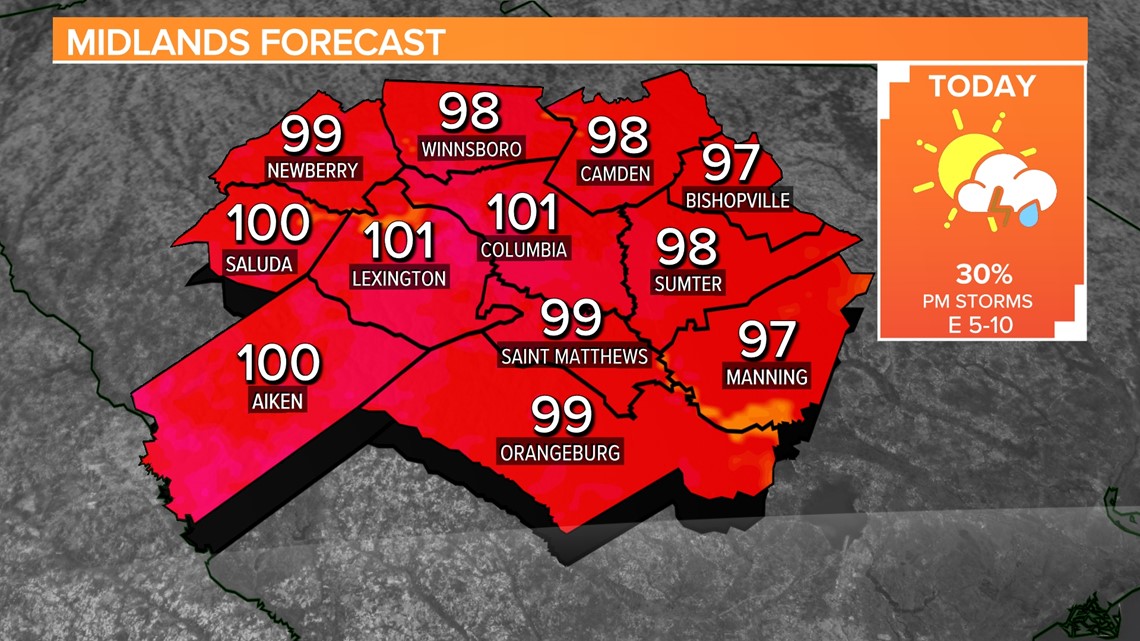
Monday was the hottest day we have had in Columbia since July 2018. It made it to 103 degrees yesterday. That high temperature broke the old record of 102° set in 1958. We may set more record high temperatures this afternoon too, as the heat continues to impact the Midlands.

A heat advisory is in effect from 11 A.M. until 7 P.M. today, for most of the Midlands. Lee County is not under this advisory. Heat index values are expected to be above 110° at times this afternoon. Hot temperatures and high humidity may cause heat illnesses to occur.
Drink plenty of fluids, stay in an air-conditioned room, stay out of the sun, and check up on relatives and neighbors. Young children and pets should never be left unattended in vehicles under any circumstances.
Take extra precautions if you work or spend time outside. When possible, reschedule strenuous activities to early morning or evening. Know the signs and symptoms of heat exhaustion and heat stroke.
To reduce risk during outdoor work, the Occupational Safety and Health Administration recommends scheduling frequent rest breaks in shaded or air-conditioned environments. Anyone overcome by heat should be moved to a cool and shaded location.
Heat stroke is an emergency. Call 911 immediately, if you suspect someone is suffering from heat stroke.
A shower or storm will be possible this afternoon or this evening. The Storm Prediction Center does have most of the Midlands under a slight risk of severe weather today.

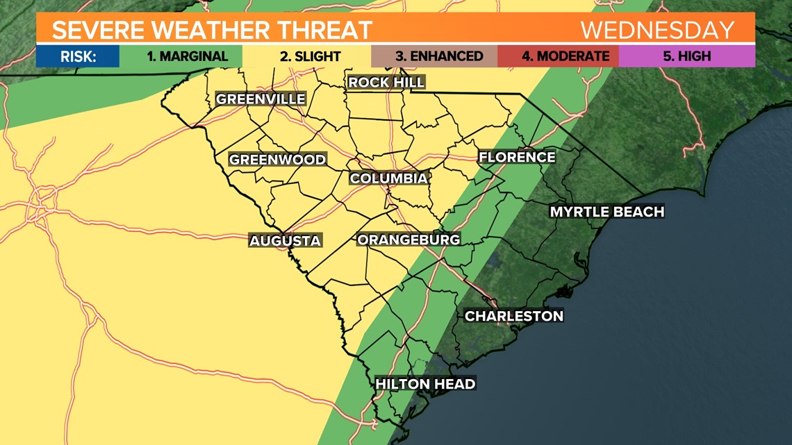
A slight risk for severe weather means that scattered severe storms are possible but typically are short-lived and not widespread. Intense severe thunderstorms are possible under this category but are isolated. If a severe thunderstorm were to develop today, the greatest threat would be damaging wind gusts.
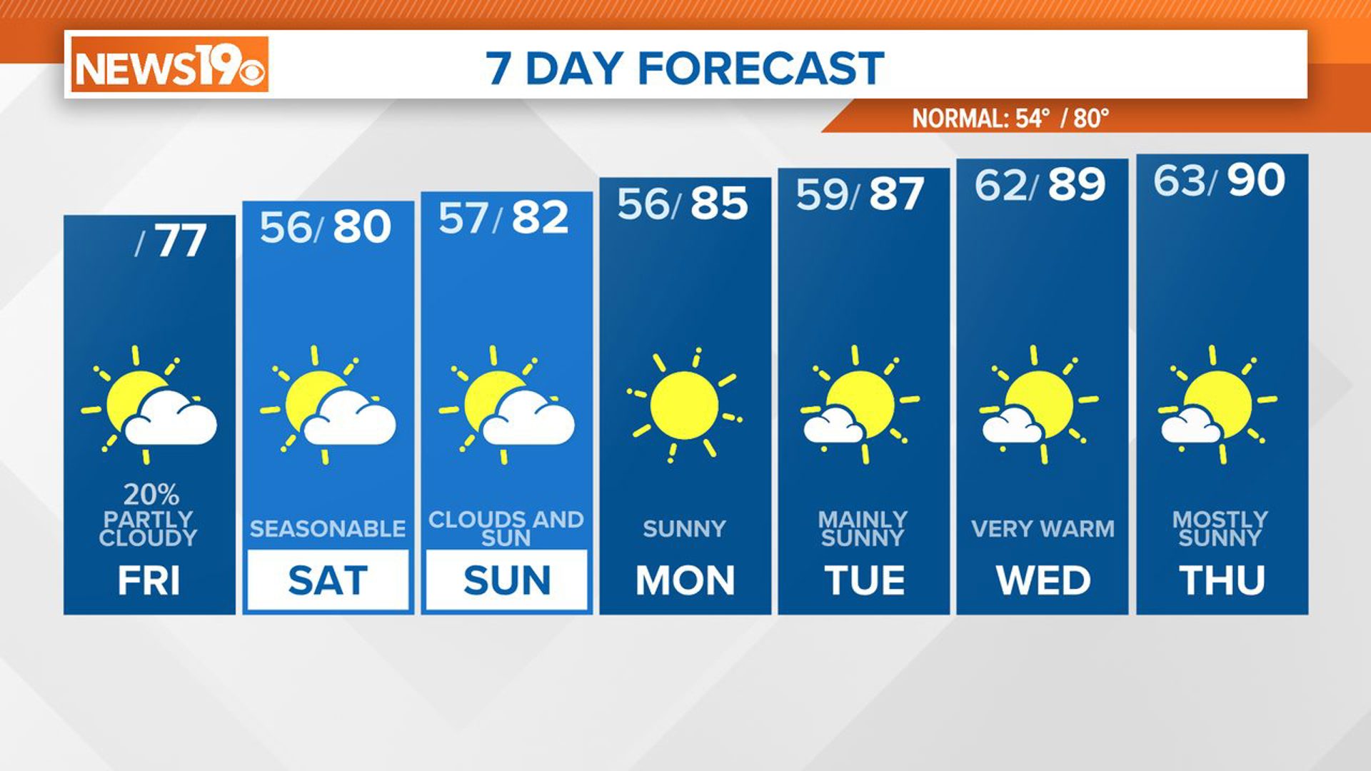
The extremely hot weather will continue through Friday. Highs are forecast to climb into upper 90s to lower triple digits.

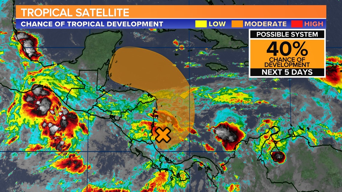
Tracking the Tropics:
Disorganized showers and thunderstorms over the southwestern Caribbean Sea are associated with an area of low pressure.
Gradual development of this system is possible while it drifts northwestward near the coasts of Nicaragua and Honduras, and it could become a tropical depression late this week if the disturbance remains over water.