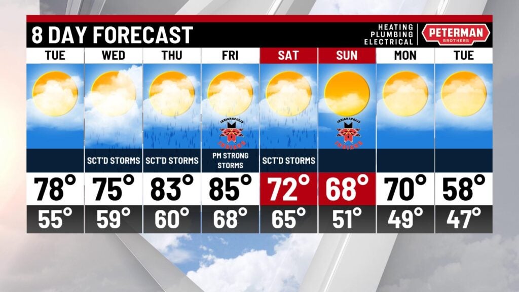
Dry Tuesday, active stretch to follow
INDIANAPOLIS (WISH) — After a hot and active weekend, we opened up the new workweek on a beautiful note with refreshing air and bright skies. An equally impressive Tuesday is on the way before a series of rain and storm chances arrives.
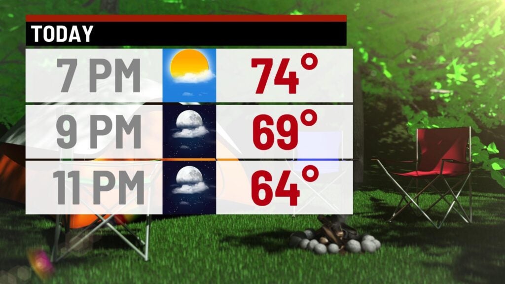
Monday night: Cool and comfortable conditions are ahead for tonight. Mostly clear skies will lead way to lows falling into the mid 50s.

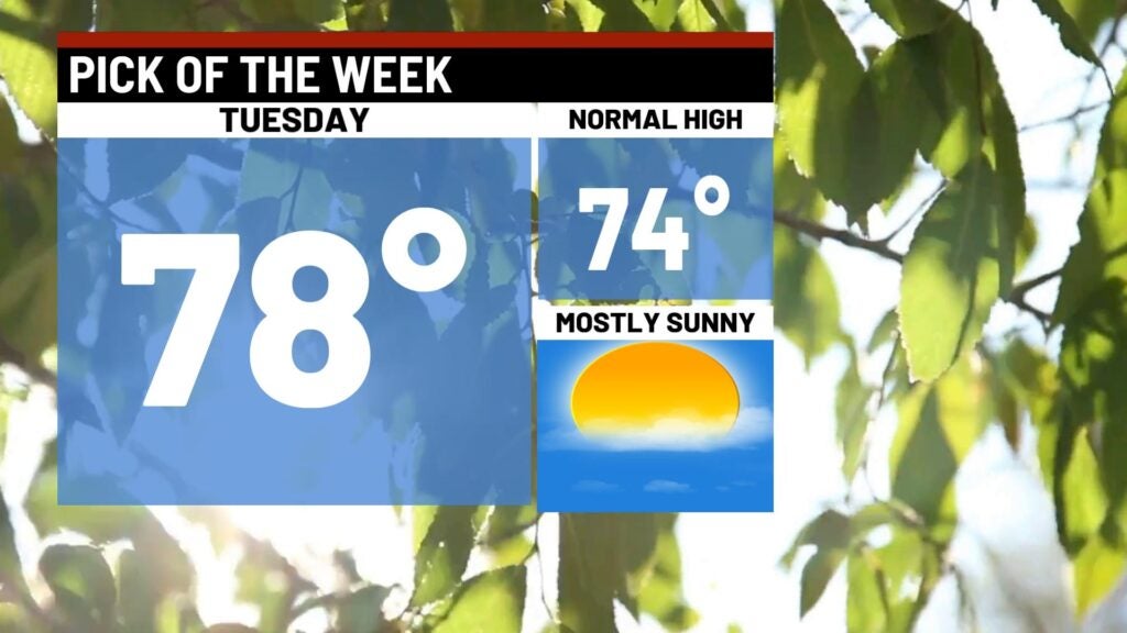
Tuesday: Tuesday will by far be the best weather day of the week. Enjoy a terrific afternoon that will feature lots of sunshine and low humidity values. Highs are set to top out in the mid to upper 70s. Some locations south of Indy look to hit the 80s.
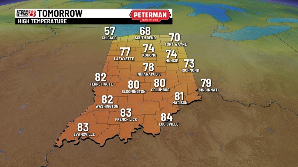
Wednesday: We wish we could keep this fantastic weather trend going, but unfortunately changes are on the way as a system will bring on and off showers and storms. Wednesday overall looks to be active throughout much of the day.


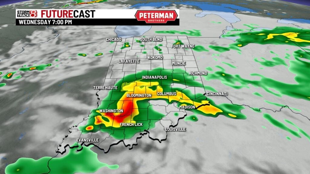

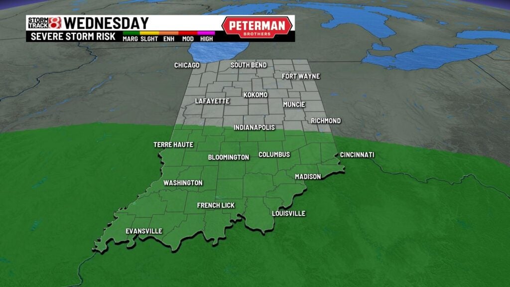
There could even be isolated stronger to potentially severe storms as a Marginal Risk (level 1/5) is in place for the southern half of the state. Indy is NOT included in the risk at this time. Damaging winds and hail will be the primary threats.
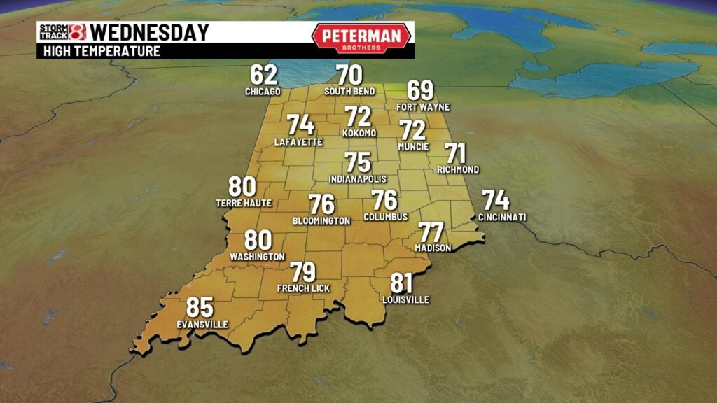
It will be a touch cooler due to the activity with highs rising into the low to mid 70s.
8-Day Forecast: Storm chances will continue for the remainder of the workweek with temperatures warming back into the mid 80s. We will be monitoring the potential for stronger storms late Friday before a quick and large cooldown swings in for the weekend. Temperatures look to be slightly below average going into next week.