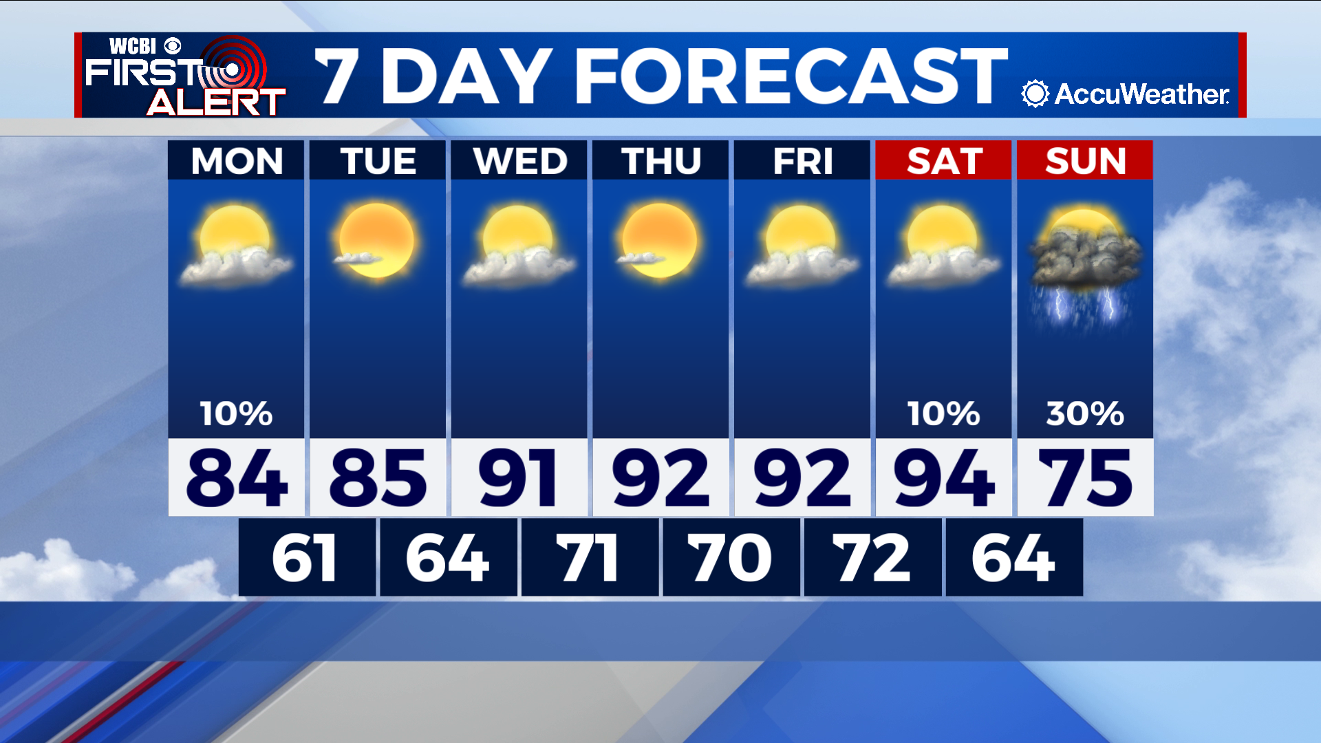
Hot week brings taste of summer
COLUMBUS – SUMMARY: Highs jump into the mid 90s later this week as the heat piles on. Some relief with a cold front overnight Saturday will drop highs back down into the mid 70s while bringing along a healthy dose of rain.
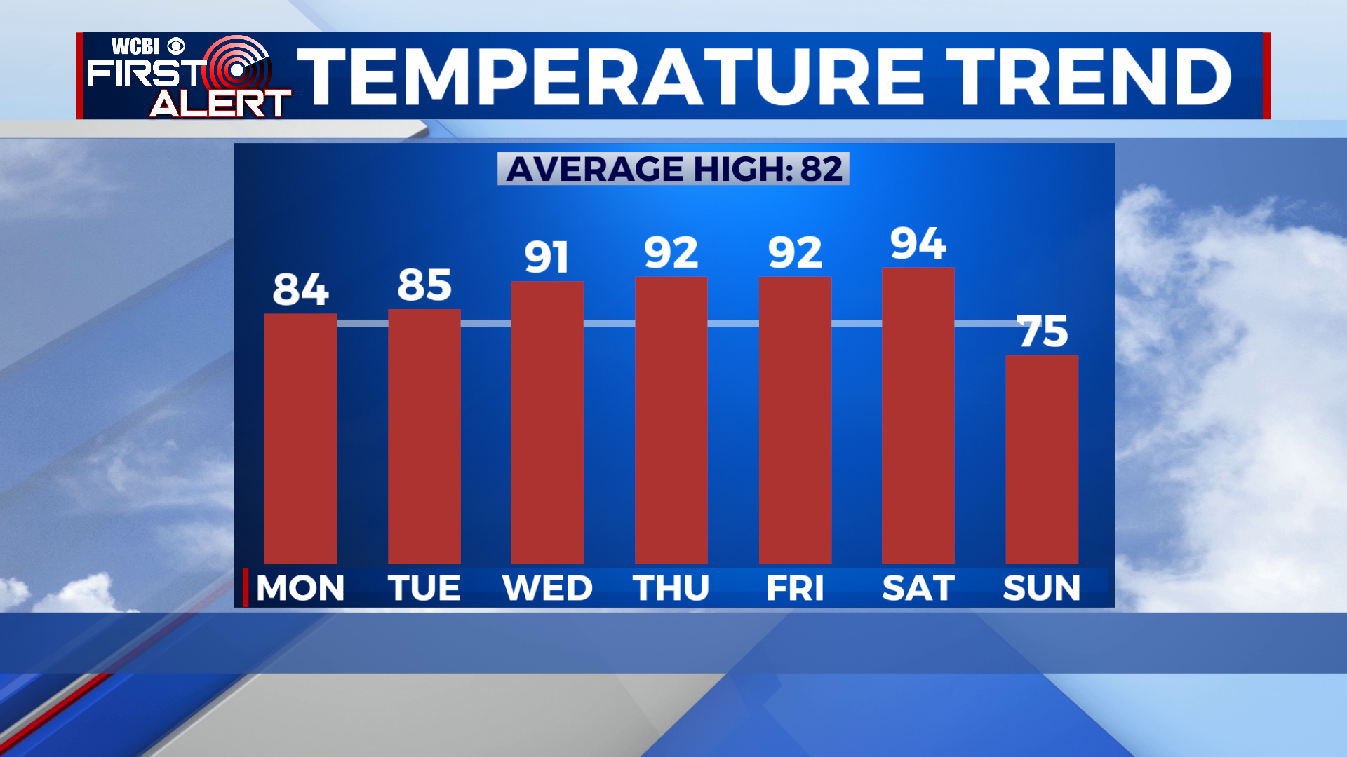
MONDAY: A somewhat warm day awaits us with highs in the mid 80s to cap out the afternoon. Partly cloudy skies throughout the day may occasionally be accompanied by the stray shower or pop-up thunderstorm. Lows bottom out in much more comfortable low 60s temperatures.
TUESDAY: Little change is expected from Monday to Tuesday as afternoon temperatures remain in the mid 80s. Partly cloudy skies bring more sunshine to aid in future warming while lows improve slightly into the mid 60s.
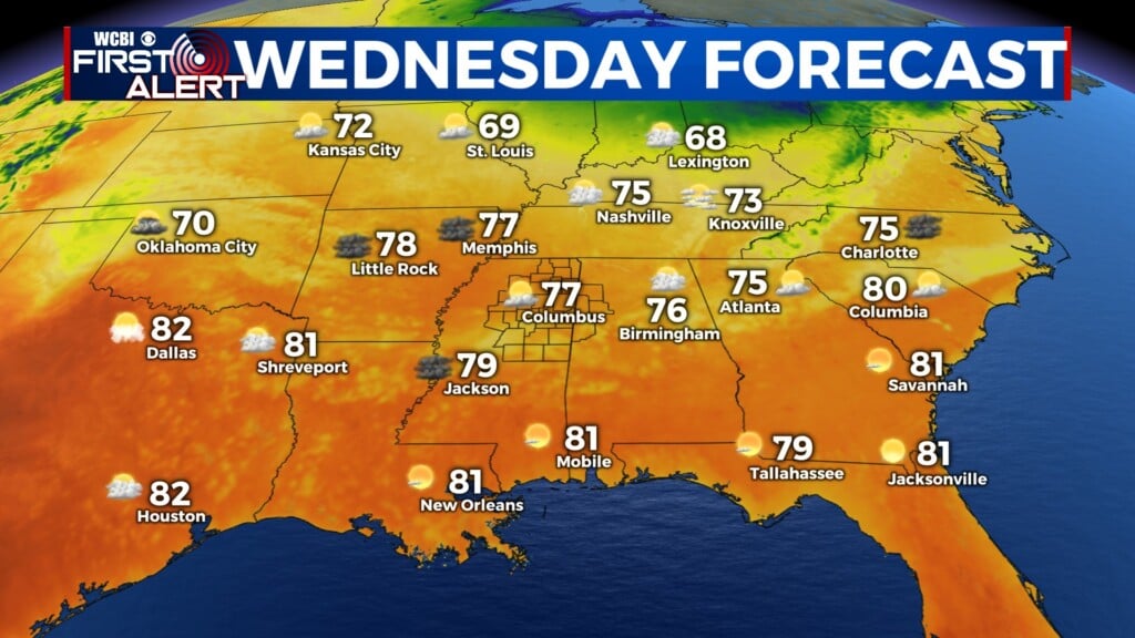
REST OF THE WEEK: Rapid heating from Tuesday to Wednesday will put us in the 90s Wednesday. Highs will remain in the 90 degree range, maxing out in the mid 90s on Saturday. An overnight cold front Saturday will bring some heat relief, and highs will make the 20 degree drop down into the mid 70s. Lows will warm into the 70s by overnight Wednesday before dropping back down into the 60s overnight Saturday.