
CLEVELAND — UPDATE: 8:30 p.m.- A Flash Flood warning has been issued for Medina County until 11:15 p.m.
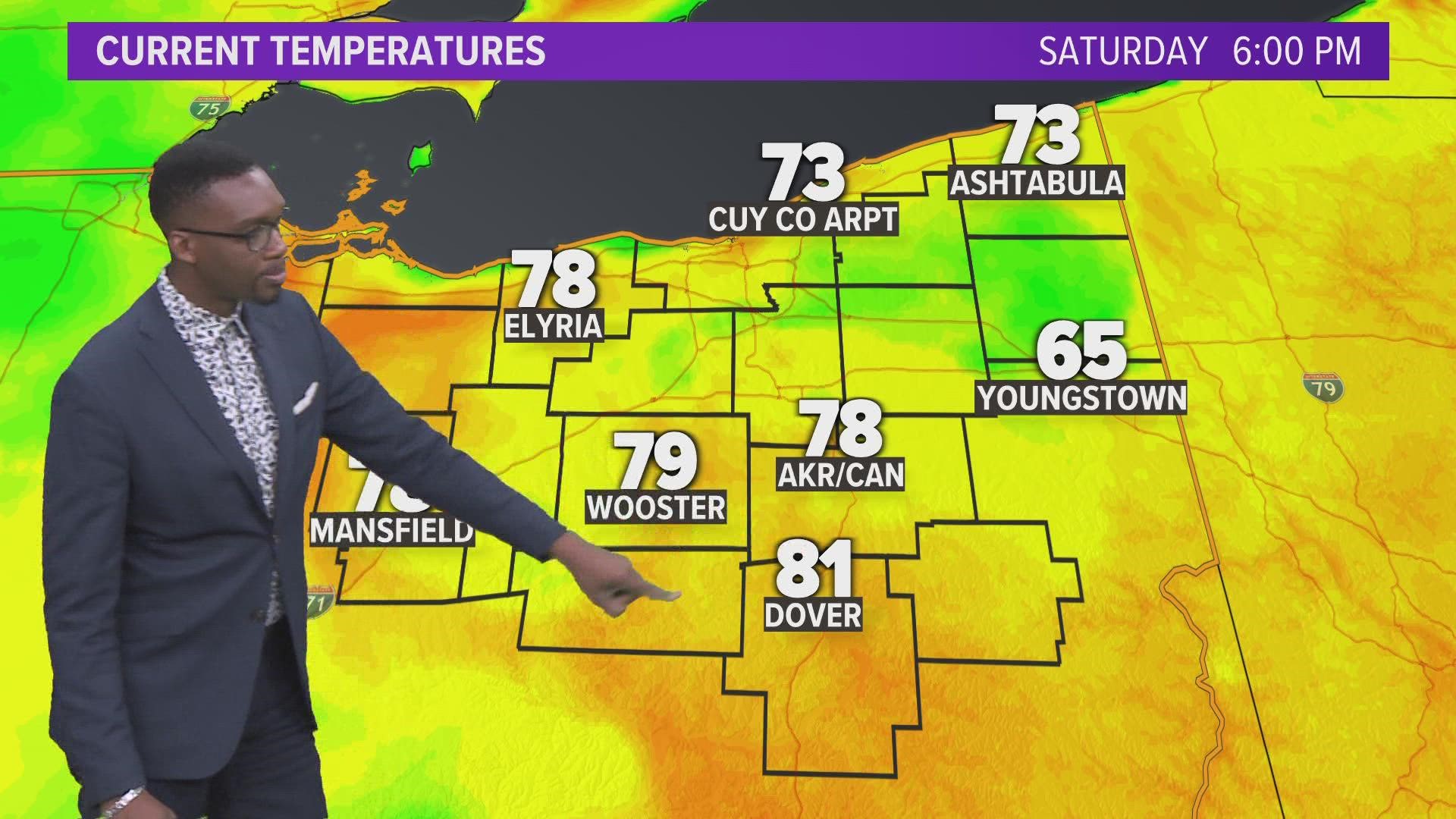
While the weather may still be warm, we're finally starting to see some rain across Northeast Ohio.
The National Weather Service has issued a severe thunderstorm warning for central Stark County and the southeastern tip of Summit County that will expire at 7:45 p.m. Officials say they first spotted the storm near Canton just after 6:45.
Moments later, a second warning was issued for northeastern Ashland, southwestern Medina, and northern Wayne counties until 8 p.m. This is the second such warning involving Medina County today, with an earlier alert involving it and Summit County expiring at 6 p.m.
Wind gusts of up to 60 miles an hour and quarter-sized hail should be expected, along with possible damage to trees and power lines. Canton, Massillon, and Medina are among the communities that could be hit hardest., with Akron also taking the brunt of the weather earlier.
The NWS says up to three inches of rain could fall in total, and flood advisories has been issued for the following areas:
- Medina County (until 8 p.m.)
- Trumbull County (until 9 p.m.)
- Portage, Stark, and Summit counties (until 9:45 p.m.)
This is a developing story. Please stay with the 3News weather team for updates as they become available.