TRAVELS WITH TOBY WEEK FIVE: Halfway home (but we won’t be there by morning)
Published 10:24 am Friday, April 8, 2022
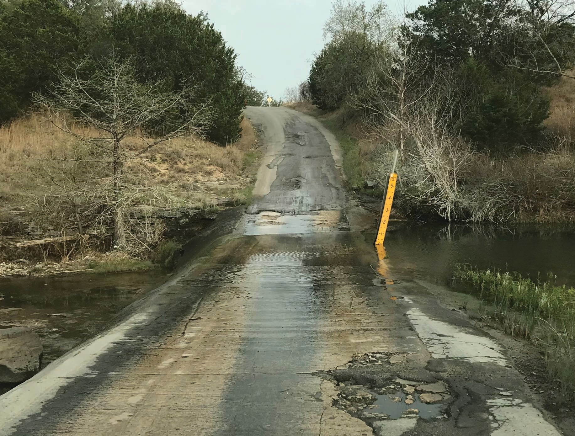
- On secondary roads, Texas DOT believes in fording creeks rather than bridging them. This is between Johnson City and Austin near our overnight stop on April 4. (Contributed)
|
Getting your Trinity Audio player ready...
|
Thursday, March 31, Day 21
Sanderson to Comstock, Texas
Overnight camping in Sanderson was restful, and as we pedaled out of the tiny town we immediately began a climb out of the first of several river canyons we would encounter over the next few days. And while the climb was not steep, it was a long and, for the most part, lonely trip to Seminole Canyon State Park, located just west of Comstock.
Toby Thorpe
Along the way we passed through a few once-thriving towns that, for one reason or another, have all but died.
The first one of these, Pumpville, we did not pass through, but we did see a number of signs and a Texas historical marker accounting its one-time existence. What really caught my eye, however, was a sign for Pumpville Baptist Church, which tagged itself as “The Gospel West of the Pecos,” a play on the famed Judge Roy Bean’s claim to be “The Law West of the Pecos.”
Our next encounter with West Texas ghost towns came in Langtry, the home of the old judge (where a museum of his life operates). We knew that in the state park campground, we would not be anywhere near a restaurant, so we had researched the map for grocery stores where we could grab a few things to cook on site at the campground, and found the “Wagon Wheel Grocery” at Langtry listed. We didn’t have much choice, because it was the only grocery store shown between Sanderson and Seminole Canyon.
Upon arrival, we found that the grocery selection was, to put it lightly, limited. The inventory consisted of a choice of Spam, canned green beans, canned beef stew, canned tuna or canned pintos. The owner, however, also offered to sell us some homemade tamales, which he said would warm up well in the RV microwave.
By that time, 60 miles into the day’s pedal, we would have eaten styrofoam with ketchup, so we proceeded to purchase four cans of tuna, one can of beef stew and eight tamales.
Fortunately, we also had an extra bottle of Pepto-Bismol, which we passed around after eating the tamales.
The view from our campsite was tremendous. We had a 360-degree panorama that allowed us to see much of the area we had come from, as well as where we were headed. We could also see well across the sands of the Rio Grande into Mexico, about four miles away.
As we slept that night, we knew weather forecast for the next day … and it was going to be a challenging one.
Friday, April 1, Day 22
Comstock to Brackettville, Texas
As we pedaled out of Seminole Canyon on a chilly April Fool’s morning, we were buffeted once again by a steady headwind with frequent gusts, seemingly a constant of the Texas climate.
Our end destination was to be Brackettville, a small town about 70 miles away, due east of Del Rio, where we would, for the first time since starting the trip, begin to move away from the US-Mexico border. However, a couple of obstacles would cause us to deviate slightly from our original plan.
We had become accustomed to the wind and were prepared to battle it. But headed into Del Rio, our route crossed a large lake on a narrow bridge with no bicycle lanes, and took us into town on heavily-traveled four-lane roads. Having already been “buzzed” by several discourteous motorists while pedaling in the bicycle lane, we were somewhat gun-shy about fighting traffic, and especially so while fighting the wind at the same time.
So, we decided to load up the bikes on the RV and ferry across the lake into Del Rio, where we grabbed a Chick-Fil-A lunch and hit the road again.
Moving away from the Rio Grande and toward Central Texas was a pleasant experience. It was as if we were entering a different and more inviting landscape. While the wind continued to create resistance, we were blessed with the presence of shade trees, some green grass and a more hospitable habitat than the arid, dry lands along the border.
Brackettville is home to Fort Clark, an Army base that was decommissioned after World War II, and the community has repurposed the base into living quarters, recreational facilities, and operates it in the same manner as a homeowners’ association. One of the amenities there is an RV park, at which we camped for the night.
But likely the highlight of our stay in Brackettville was our evening meal at Ziggy’s BBQ, which served fantastic food for very reasonable prices, and treated us like guests in every sense of the word. If you’re ever in Brackettville, I’d highly recommend you go there.
Saturday, April 2, Day 23
Brackettville to Leakey, Texas
As we pedaled out of Brackettville on a pleasant Saturday morning, our route took us into some terrain we had not dealt with very often since starting the trip – rolling hills.
Leaving San Diego, we went directly into climbing mode for the first two days, after which we descended seven miles of mountain road into the southwest desert, and had pretty much remained in that type climate with flat, sandy soil and little plant life since the start. But now, we began seeing some greenery and trees that actually produced significant shade.
Between Brackettville and Leakey, we also had a few climbs that were both challenging and rewarding.
Between a rest stop at the town of Campwood and our final destination of Leakey, we climbed over 1,200 vertical feet, which makes the legs and lungs cry for mercy. But at the top of the climb, we were rewarded with views of the Nueces and Frio River valleys below that would have been impossible to experience without the climb.
(OK, I know we could have climbed it in a car, but how much fun would that have been?)
At Leakey, we camped at an RV park where we met two fantastic folks, Chris Atwell and Stephanie Childs.
They are originally from Florida, but have transplanted to Texas, and knew the area around Leakey well. They helped us map a route out of Leakey toward Kerrville that would be scenic, but take us through less traffic than the ACA route.
The only thing that kept us from getting to sleep early that night was Keith, whose loyalty to the UNC Tarheels required him to listen to the game on his phone. And he pulled them through.
Sunday, April 3, Day 24
Leakey to Kerrville, Texas
The morning of April 3 saw us hop on the bikes at the town square in Leakey and head out on Stephanie’s recommended variant of the ACA route. As we passed ranch after ranch heading into the hills, we speculated among ourselves how much the ornate gates might have cost.
No doubt … some of the ranch gates alone had to cost more than my house and property.
In the seventh mile we hit a fair climb, but nothing very exhausting. Mile nine brought another one, similar to the first.
We had looked at an elevation chart of the route the night before, and saw three humps on the chart, indicative of climbs. The first two were done, and the third looked similar to the first two. “Heck,” we thought collectively, “today’s gonna be easy.”
But at mile 11 we rounded a hill and saw a wall directly in front of us … a wall of asphalt with a yellow center line and two white side lines, going straight up, 90 degrees.
OK, I’ll admit that’s an exaggeration. The slope was actually only 83 degrees.
The “click, click, click” of gears shifting down was the next sound, after which mountain riders Mike and Earl accelerated up the slope while I slogged behind, desperately trying to find a lower gear on my rear sprocket.
Within a minute or two, they were around the first curve.
It was then that I noticed the awesome view to my right of the valley back toward Leakey. Below us was a horse training facility with a track and barn. Further down were enormous houses set among the trees. The road early on a Sunday morning was nearly deserted, so I took the opportunity to stop and shoot a few photos.
Plus, it would give me an excuse as to why I fell so far behind the mountain boys.
In the NC mountains (and the Appalachians in general), when you get to a mountain top, it means you are about to start back down. But not so in the Southwestern USA, where the climbs take you to high plateaus with rolling hills very similar to the Piedmont region of North Carolina.
After reaching the top, we met Keith at our appointed stop, re-stocked on water, and headed on toward our end destination of Kerrville, and the rolling undulation in the topography. And that was music to my legs.
Pedaling in mountain terrain is painful. It’s climb, climb, climb until you reach a “gap” or a “pass,” which usually allow you to coast for about 10 seconds. Then it’s back to climbing.
Pedaling in flatlands is not painful, but it can be monotonous. The good news is, there are no hills to climb.
The bad news is, there are no hills to coast down. So it’s pedal, pedal, pedal … and hope you have a tailwind.
But on rolling hills, a globular-built cyclist like myself can get a running start down a short hill and gain enough momentum to coast up the following hill and so forth.
It’s all in the timing … hit the pedals hard on a downhill too soon and you are out of breath before you can get up the next hill. Hit them too late, and you are straining before you get halfway to the top. However, when you time it right, it’s a great feeling and you can move on up the road pretty quickly. That’s what I was able to do on the “rollers” between Leakey and our next rest stop, the town of Hunt. It was an exhilarating segment, with low traffic and great scenery paralleling the Guadalupe River and lined with vacation homes and resorts.
By the end of the ride, we had passed through the towns of Hunt and Ingram, and camped in Kerrville, right beside the river, which unlike the Rio Grande and its West Texas tributaries, actually contained water.
Monday, April 4, Day 25
Kerrville to Johnson City, Texas
The road out of Kerrville continued to be one of rolling hills, many of which crossed creek beds on paved fords.
Yes, I said “fords,” as in, “you have to drive through the water to get across.”
The Texas DOT apparently does not like to spend money on bridges along secondary roads, so they temporarily dam the streams, build a concrete and asphalt ramp through the creek bed, shore it up on both sides, and erect a sign reading “Road May Flood” on both sides,
I’m glad it’s been a dry winter in Texas, otherwise we’d have had to trade in our RV for a pontoon boat.
The day became more interesting when, along our second segment, we reached our 15-mile rendezvous point with no Keith in sight.
Earl, the eternal optimist, said, “He’s probably only a mile up the road; he had to find a place to pull over.”
After 16, 17 and 18 miles with no Keith, the optimism had dried up, along with our water bottles.
Surprisingly, we had cell service, so we contacted Keith and discovered that his GPS and ours were on different wavelengths. So we looked at Google Maps, saw a town called “Sandy” that appeared to be a good place to meet, and agreed to head there.
Upon our arrival at Sandy, we saw three signs and two signposts. The first was a directional sign, pointing us to the “Sandy Cemetery,” on our right.
The next two signs were for the city limits of Sandy. Both signs were on the same post, facing in opposite directions. Our hopes of hitting a gas station, convenience store or a wayward shopping mall were dashed.
Within minutes, however, Keith rolled up in the RV. Next to the Sandy city limit signs was a gravel entrance road to a pasture, which was chained and locked. Seeing that the pasture was deserted, we directed Keith to pull off at that road.
Approximately 17 seconds after Keith parked the RV, a large, gruff man in a 10-gallon hat pulled up in an oversized pickup and informed us, “Hey, that’s a private drive.”
Wow. I’d never have guessed that. But, not wanting to create a conflict between the home folks and the spandex-clad visitors, we moved on.
After passing through Johnson City, the hometown of Lyndon Baines Johnson, we headed west toward Pedernales Falls State Park, where we intended to camp for the night.
Little did we know that Texas state parks do not accept on-site/day-of camping reservations. So at 5 p.m., we were still looking for a place to camp. In an RV, that can be done on the roadside, but it’s a lot nicer if you have Wi-Fi, especially when the NCAA Basketball Championship is on that night.
A quick search of area RV parks turned up the Fitz RV Resort – Opening Soon, and a phone call secured us a place for the night.
And although the basketball game did not turn out as hoped, no one lost any sleep.
Tuesday, April 5, Day 26
Johnson City to Bastrop, Texas
Leaving the Fitz RV Resort we were routed on some rather narrow and curvy two-lane roads through the countryside toward the state capital Austin. The roads had seemed rather sparsely populated as we rode into the area.
But somewhere, people were lurking … and they all decided on Tuesday morning to drive our route to Austin.
Despite the heavy traffic, we were able to persevere to our first stop point.
Our plans to meet Keith near the intersection of Fitzhugh Road and US 290 were temporarily derailed when he found there was nowhere around the intersection to park and wait. But we did make contact and eventually found a vacant lot at a nearby crossroad to meet and re-stock, after which we dispatched Keith to the next meet-up point to and headed into Austin to meet Brian Creasy, a friend of Earl’s, who now lives in Austin and could lead us on a safe route through town.
After some initial difficulty locating the meet-up point (a Best Buy store) we eventually slogged in about 30 minutes late, located both Brian and Keith, and headed on our way, while Keith took the RV to Bastrop, our end point and rest stop for the week.
Brian is young (at least to us … he’s in his 40s), and rides every day. And in Austin, that’s what a lot of folks do. The city has developed a tremendous network of safe greenways and bikeways for its many bicycle commuters and college students, and it’s nearly impossible to find a surface street there that doesn’t have a designated bicycle lane. In downtown, the city has adopted “back-in angle parking,” which, when we discussed it in Albemarle some years ago, nearly caused apoplexy among some traditionalists. It appears to be a very pedestrian-friendly and bicycle-friendly city despite its large population.
With Mike having worn out the cleats on his cycling shoes, a new set was in order, so Brian took us to a Trek store downtown, which is by far the biggest bike shop I have ever seen. It was more like a bike mall. I actually volunteered to work there, but withdrew the offer when they told me they would not issue me a company bicycle.
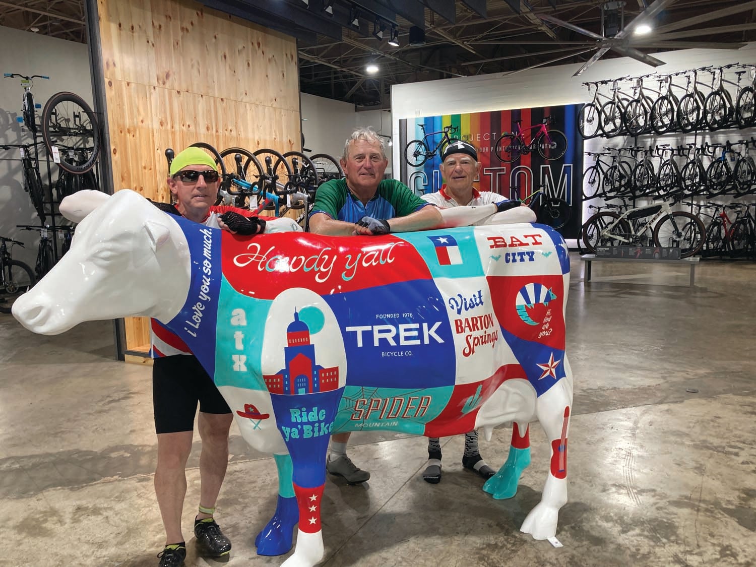
Earl McMahon, left, Toby Thorpe and Mike Stanley take a break in the Trek Store in Austin. (Contributed)
Once Mike was freshly-shod, Brian took us out of town, past the Austin Airport and on to the outskirts of Bastrop, a booming town about 20 miles outside Austin. That’s where we will spend Tuesday night, a rest day on Wednesday, and from where we will pull out on Thursday morning, heading ever further east.
Wednesday, April 6, Day 27
Rest Day in Bastrop, Texas
Not much to report on a rest day … but we head out again early Thursday morning. Stay tuned.
Toby Thorpe is a retired parks and recreation director and a freelance writer for The Stanly News & Press. He will file reports from the road for The SNAP. To donate to his fundraising effort (the Annie Armstrong Easter Offering – North American Missions Board), visit https://www.namb.net/give or www.northalbemarle.com/ways-to-give. Follow along as well using #pedaling4annie.