
Embedded in the Amargosa Desert lies a segment of the 185-mile long Amargosa River that is split between Nevada and California.
The river starts north of Beatty then flows south through the town to Ash Meadows and crosses over to strike the small villages of Shoshone and Tecopa, California, before wrapping its way into Death Valley.
The flat and mostly desert landscape might seem like a barren place for new land development, but underneath the surface holds a vast complex of underground water channels that have created pockets of aquifers. At ground level, it’s difficult to see the network of underground water, but from above it becomes more apparent how the water flows and how it could be key to survival in the area for years to come.
Preserving the resource is crucial, according to conservationists.
On a recent Saturday, Bruce Gordon, founder and president of EcoFlight, piloted a small six-seater propeller plane that headed north over the Amargosa Desert into Beatty and the Bullfrog Hills, where the Amargosa River gets its headwaters.
“It’s a real beautiful sight of all the western landscapes and through my career, I’ve flown a plane across the Atlantic and done work in Africa,” said Gordon. “I call it conservation flying.”
By giving people an aerial perspective, Gorden aids in advocating for the protection of wildlands and habitats. There are a few factors that could have catastrophic impacts on the Amargosa River and the land it supports.
Mason Voehl, executive director of the Amargosa Conservancy, a nonprofit that is committed to working toward a sustainable future for the Amargosa Basin through science, stewardship, research and advocacy, sees prospective mining in the area as worrisome, given its close proximity to the headwaters. Gold mining occurs at higher elevations in the Bullfrog Hills and away from the spring system that feeds into the river. However, Voehl worries that drilling and other mining activities still have the potential to disrupt groundwater flows.
“All gold mining operations by nature of the machinery and infrastructure they require pose some risk,” Voehl said. “The biggest risk is unintentionally altering the flow of natural springs which are crucial to the integrity of the Amargosa River.”
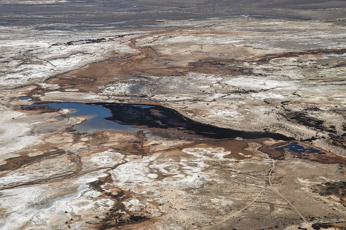
After touring the headwaters of the Amargosa River, Gordon flies the plane south to pass over Ash Meadows National Wildlife Refuge, a wetland that contains a portion of the Amargosa River and some rare species of wildlife.
Over Ash Meadows there is a clearer view of how the water is traveling. Snow caps from nearby mountain ranges around the basin will slowly trickle down several miles recharging the aquifers. As a result, the soil forms squiggly lines in the terrain where water is traveling from the town down to the meadows.
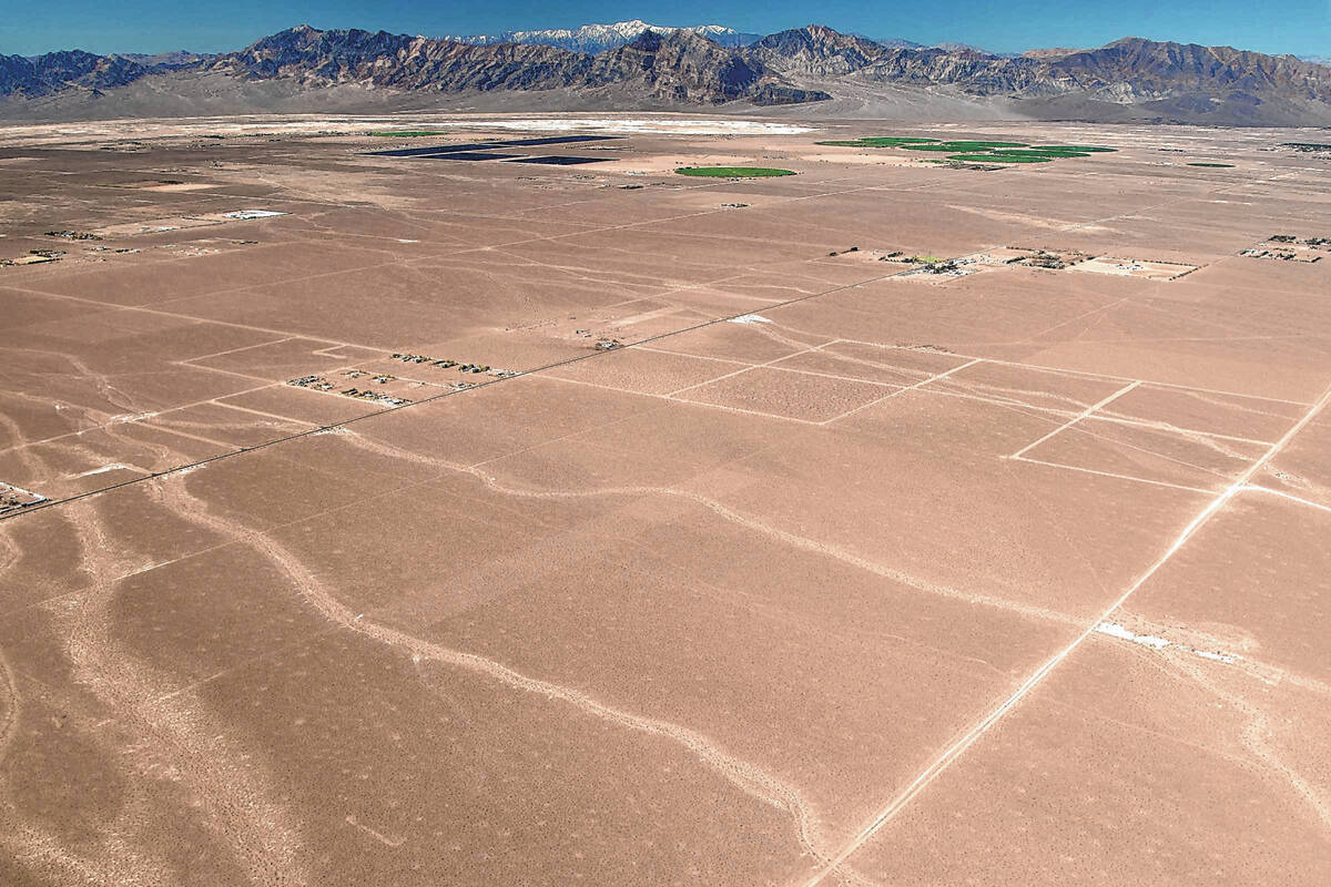
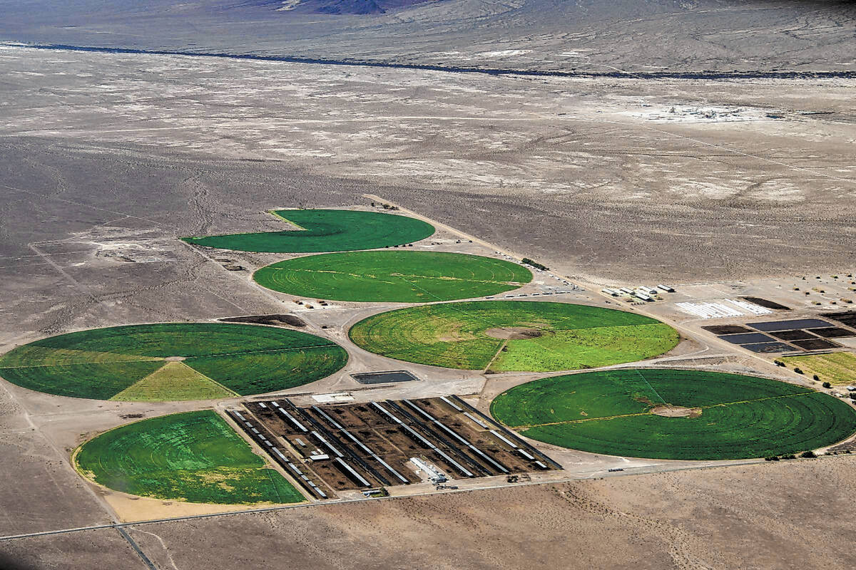
Close to the Ash Meadows is a private solar plant. A dairy and agriculture farm also inhabit a portion of the land. The two operations are currently not severely degrading the Amargosa River, but that could change if they increase their water usage in the future, Voehl said.
Protections are in place to ensure these developments don’t encroach on water needed for the survival of wildlife in the refuge, yet Voehl says concerns remain regarding the close proximity of these water-intensive facilities to one of the most unique groundwater ecosystems in the world.
One of the main water sources of the Amargosa River comes from the other side of the basin from the snow-capped Spring Mountains.
Snow and rain that fall on the higher peaks eventually trickle their way into the Amargosa River, but this process takes thousands of years. In some places, the water’s path through the miles of bedrock are limited — it could take as long as 8,000 years for the water to flow into the river. It underscores the importance of conservation now, because water supplies aren’t quickly replenished.
Hydrologists continue to study the system’s flow in hopes of understanding how ancient the water expressses on the surface.
Voehl points out that if the water supply from the Amargosa is depleted, the rare life that exists around it could die. River water levels are already low and threatened species such as the Amargosa toad, Devils Hole Pupfish and other wildflowers could become extinct.
It’s an “extremely unique network of habitat and wildlife and human communities that have called these lands homes for thousands of years,” Voehl said.
Contact Jimmy Romo at jromo@reviewjournal.com. Follow @jimi_writes on Twitter.