Estimated read time: 4-5 minutes
This archived news story is available only for your personal, non-commercial use. Information in the story may be outdated or superseded by additional information. Reading or replaying the story in its archived form does not constitute a republication of the story.
SALT LAKE CITY — A storm arriving in Utah on Tuesday and lingering into Wednesday may not produce as much as originally hoped, but still should provide the most snow that Utah snowpack regions have seen in over a month.
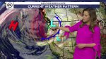
An initial cold front is forecast to arrive in Utah from the northwest Tuesday morning around 7 a.m., bringing a mix of rain and snow to Utah's valleys and some snow to Utah's mountains as it slowly sweeps across the state throughout the day, said KSL meteorologist Kristen Van Dyke.
"As it comes in, the showers really start to break up and the front starts to split apart," she said. "We are going to be looking at a chance for rain, snow mix. In fact, looks a little warmer (Tuesday) ... and I don't think we'll see much sticking to the ground. Very, very light stuff and very spotty (Tuesday) in northern Utah."
Wednesday is expected to be cooler and more snow is likely. As such, Van Dyke believes Wednesday's commute may be impacted as a result — much more than Tuesday's commute.
This is the result of wind from the north blowing into Utah behind the front, resulting in cooler temperatures and a better chance for accumulating snow on and off throughout the day, Van Dyke explained.
Utah's valleys may receive a dusting of snow while the mountains are expected to receive a few inches throughout the duration of the storm. The National Weather Service projects some of Utah's mountain areas may receive a dusting of snow up to about 2 inches on Tuesday, and then 2 to 4 inches on Wednesday.
The agency tweeted models that show the wide range in snow probability from Tuesday to Wednesday. It shows Salt Lake City has a 73% chance at receiving at least 0.1 inches of snow and only a 6% chance at 2 inches or more. Alta, on the other hand, has an 80% chance of receiving some snow and a 20% probability of receiving 4 inches or more.
❄🌬Snow, Rain, Wind & a Temperature change? All of these arrive mid-week thanks to an incoming cold front. This system is not particularly impactful for the Wasatch Front, but a few inches of snow may fall on mountain summits. Check out the below. #UTwxpic.twitter.com/rHPyGdY21e
— NWS Salt Lake City (@NWSSaltLakeCity) February 14, 2022
It's not the biggest storm but the most Utah's snowpack has seen in some time. The weather service's station at Alta, for example, last received more than 2 inches on Jan. 21; it hasn't received 6 inches or more from a single storm since it received 13.7 inches on Jan. 5-6.
Utah's collective snowpack has suffered as a result, entering the week at 87% of normal for this time of the year. It continues to fall below normal as February continues to be about as dry as January was, which ended up the third-driest January on record.
Temperature drops and wind
One certainty from the storm is that it's about to get chillier than the recent spring-like temperatures across the state. The high topped out at 60 degrees in Salt Lake City on Monday, narrowly missing out on the city's Valentine's Day record of 63 degrees set in 1921.
High temperatures across the Wasatch Front will drop into the mid-40s Tuesday and into the 30s on Wednesday. Lows will again drop into the 20s. The forecast calls for high temperatures to return into the 50s by the start of the Presidents Day weekend. In Logan, high temperatures will drop into the mid-30s on Tuesday and only top out in the low 30s Wednesday and Thursday before reaching close to 40 over the weekend.
Van Dyke said southern Utah residents may see gusts in the 35 to 40 mph range Tuesday. High temperatures in St. George will drop from the mid-60s Tuesday to mid-50s Wednesday and Thursday before rebounding back into the 60s by the end of the workweek.
What's on the horizon?
The storm system is expected to be followed by another high-pressure ridge to close out the week; however, more storms could be in the mix to close out the month. The weather service's Climate Prediction Center published a new 8- to 14-day long-range forecast Sunday that calls for an above-average probability of precipitation and below-average temperatures for all of Utah between Presidents Day and Feb. 27.
We know this is something many of followers will be happy to see...
— NWS Salt Lake City (@NWSSaltLakeCity) February 14, 2022
We may be seeing a pattern shift in the models to a potentially more active pattern for the last week or so of February. #utwx#wywxpic.twitter.com/jU7ERflJbx
"We may be seeing a pattern shift in the models to a potentially more active pattern for the last week or so of February. Typically active pattern (equals) cooler temperatures. You can see that is the trend here," the Salt Lake City office of the National Weather Service tweeted.
Full seven-day forecasts for areas across Utah can be found at the KSL Weather Center.


