


DENVER – After Tuesday’s snowstorm brought several inches of snow to the metro area and a heavy band dropped about 2 feet near Burlington in eastern Colorado, the area is in for another round on Thursday.
The National Weather Service upgraded the Denver metro area, foothills, Palmer Divide and southern Weld County to winter weather advisories, which are in effect until 3 p.m. Thursday.
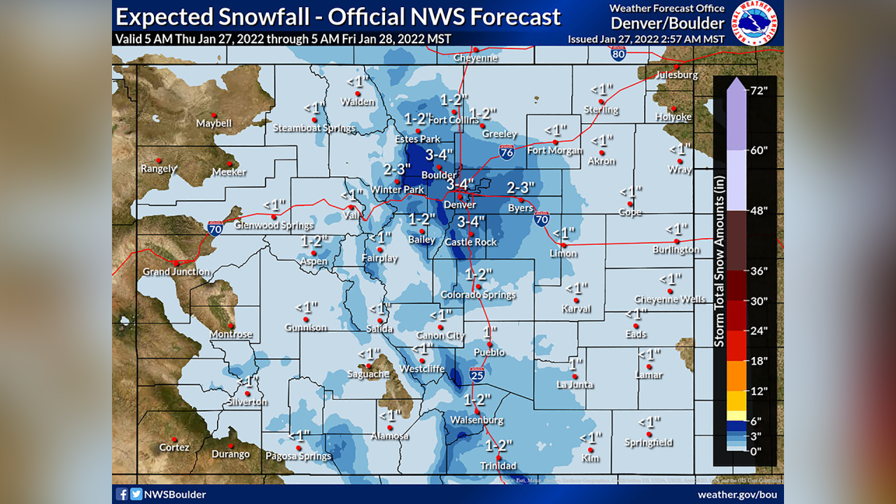
Between 2 and 4 inches of snow is expected in those areas, with higher totals in the foothills of up to 5 inches and winds gusting up to 35 miles per hour.
MORE: Live updates | Closings and Delays | Full forecast | Radars | Traffic | Weather Page | 24/7 Weather Stream | 24/7 Radar Stream
Snow started near the Wyoming border around 6 a.m. and move south. According to the NWS, the heaviest snowfall rates of about a half-inch per hour should fall between 8 a.m. and 11 a.m. on the northern plains, from 10 a.m. to 1 p.m. in the metro area and from around noon into the early afternoon along the Palmer Divide.

The National Weather Service said once there is more confidence in the locations of the heaviest snow, a winter weather advisory could be issued. Otherwise, the NWS said there were “plenty of similarities” to Tuesday’s storm.
MORE: Live updates: Second snowstorm of the week for northern Colorado hits Thursday morning
However, the water content is expected to be lower with this storm, and forecast snowfall is about half of what fell on Tuesday, according to the NWS.
After the snow, the plains and mountain valleys could reach low temperatures below zero, while the metro area will likely see low temperatures in the teens overnight Thursday into Friday.
That storm will move toward the Northeast, where it is expected to bring heavy snow to the New England area.
In Colorado, temperatures will warm, and we’ll see a mild and dry few days through Monday, according to the NWS, before another storm system with likely snow hits Tuesday or Wednesday.
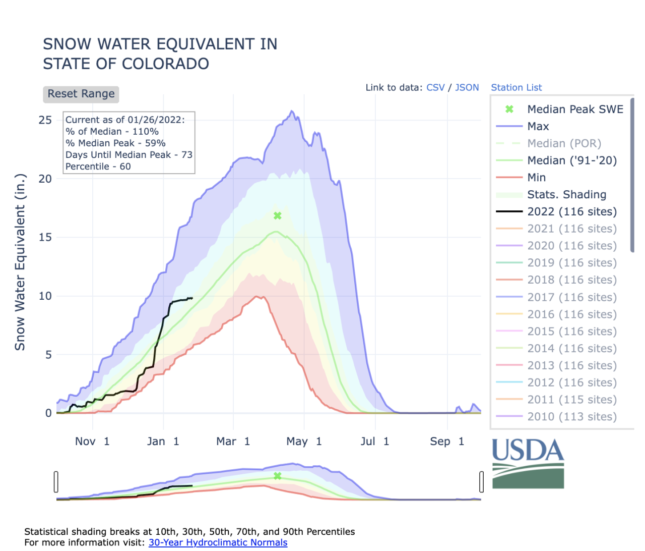
Colorado’s snowpack growth has somewhat leveled off since the first week of January after a steep increase during the last week of December and first week of the year. But it sat at 110% of median statewide as of Wednesday.
Six of the state’s eight river basins still have above-median snowpack levels. The Upper Rio Grande (85%) and Arkansas (83%) basins are the two that are below median levels.

But the South Platte (113%), Laramie and North Platte (120%), Upper Colorado Headwaters (118%), and Gunnison (124%) basins were all above 110% of median. The Yampa and White (109%) and San Miguel, Dolores, Animas and San Juan (109%) basins were all still above median levels.
You can always watch 24/7 weather, radar and news updates on the free Denver7+ app on your TV.
