Satellite images show 4,000km-long Saharan dust cloud across Atlantic Ocean
Forecasters say storm could stretch as far as Iceland

Sign up to the Independent Climate email for the latest advice on saving the planet
Get our free Climate email
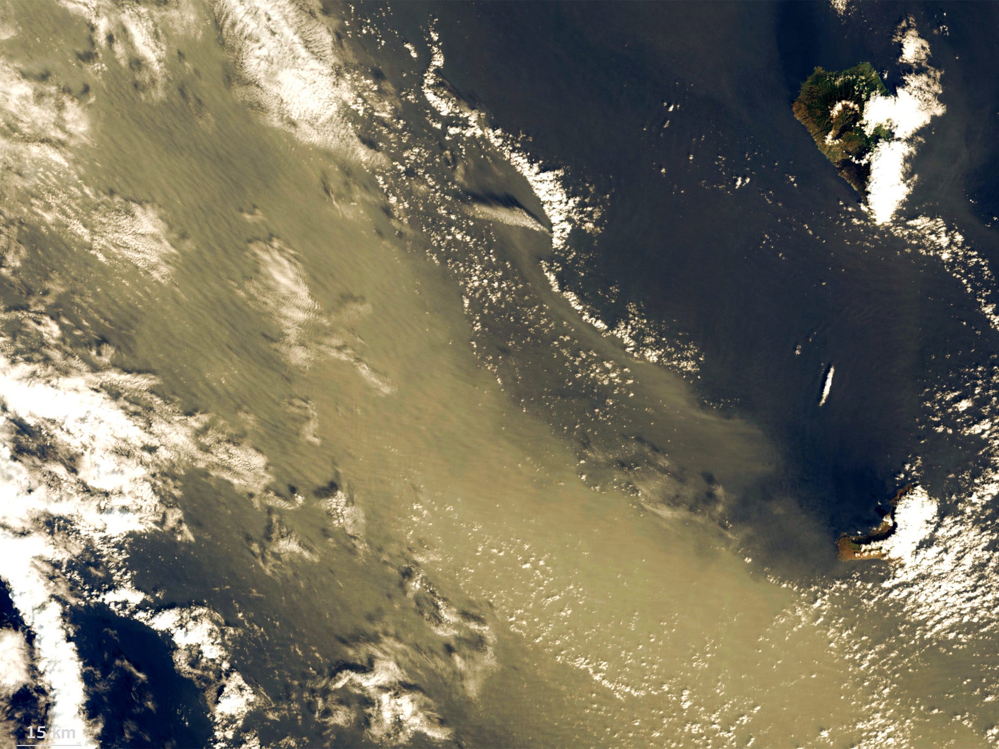
Images from space have captured the massive scale of a Saharan dust storm billowing out over the Atlantic Ocean.
The dust plume extends 4,000km (2,500 miles) from the coast of Mauritiania in Western Africa up to Ireland.
Pictures of the storm have been captured by Copernicus, the European Union's earth observation satellite.
The Copernicus Atmosphere Monitoring Service (Cams) forecast that the dust would recirculate towards northwest Europe and the North Sea in the coming days.
The dust could reach as far as Iceland nearly 5,000 miles away, forecasters said.
Last year, a Saharan dust storm which travelled over the Mediterranean sea had an impact on air quality in southern European cities including Barcelona and Marseille.
The US government agency National Oceanic and Atmospheric Administration (NOAA) tracks the movement of Saharan dust over the Atlantic throughout the year.
It said the phenomenon is caused by the Saharan Air Layer, a mass of dry air that forms over the desert throughout the year.
The dust is more well known for travelling west over the Atlantic but sometimes travels north towards Europe.
The dust can be harmful to humans as the fine particles can affect the respiratory system but it has been known to benefit plant life.
The NOAA said the dust storms bring minerals such as phosphorus that support soil health as far away as the Amazon rainforest. It said they can also suppress tropical storm development during hurricane season.
In summer 2020, a dust cloud was so huge it was dubbed “Godzilla” after winds swept nearly 24 tons from the Sahara to North and South America.
But scientists expect that the storms will be smaller in the coming decades due to climate change.
After “Godzilla”, Nasa scientists used satellite data and computer modelling to study the phenomenon. They predicted that the dust clouds would reach their smallest size in 20,000 years over the next century as the ocean warms.
Sea surface temperatures have a direct impact on wind speeds. If the northern Atlantic warms, then trade winds are weaker and cannot carry as much dust.
Weaker winds will also mean that bands of tropical rain can more easily move into desert regions, keeping the sand damp and less likely to be blown away.
Smaller dust clouds are part of a feedback loop that is adding to global heating. Particles in the air can reflect the sun so when the clouds are smaller or more sparse, more sunlight and heat reach the ocean, causing it to get even warmer.
Subscribe to Independent Premium to bookmark this article
Want to bookmark your favourite articles and stories to read or reference later? Start your Independent Premium subscription today.
Join our commenting forum
Join thought-provoking conversations, follow other Independent readers and see their replies