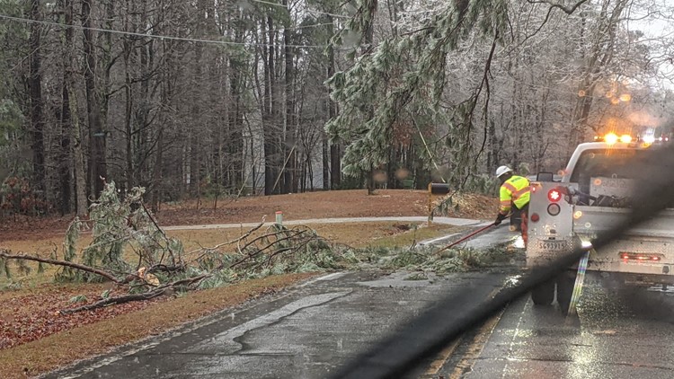
COLUMBIA, S.C. — Icy conditions have moved into the Midlands of South Carolina Sunday, as the system will create hazardous driving conditions and some power outages.
Download the free WLTX app for the latest weather on your mobile device to stoy up to date, even if you lose power.
There have been reports of ice in trees and power lines in Kershaw County, Lee County, Sumter County, Richland County, Newberry County, and Lexington County.
Power outages have begun to rise, with the most in Kershaw County and extreme northern Richland County.
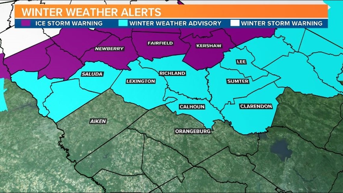
The ice storm warning is in effect will be in effect for all of Sunday the following counties: Fairfield, Newberry, and Kershaw counties.
Most of the central and southern Midlands are under a winter weather advisory. This advisory includes Saluda, Lexington, Richland, Sumter, Lee, Calhoun, and Clarendon counties.
The winter weather advisory was cancelled for Aiken and Orangeburg counties during the mid-morning hours of Sunday.

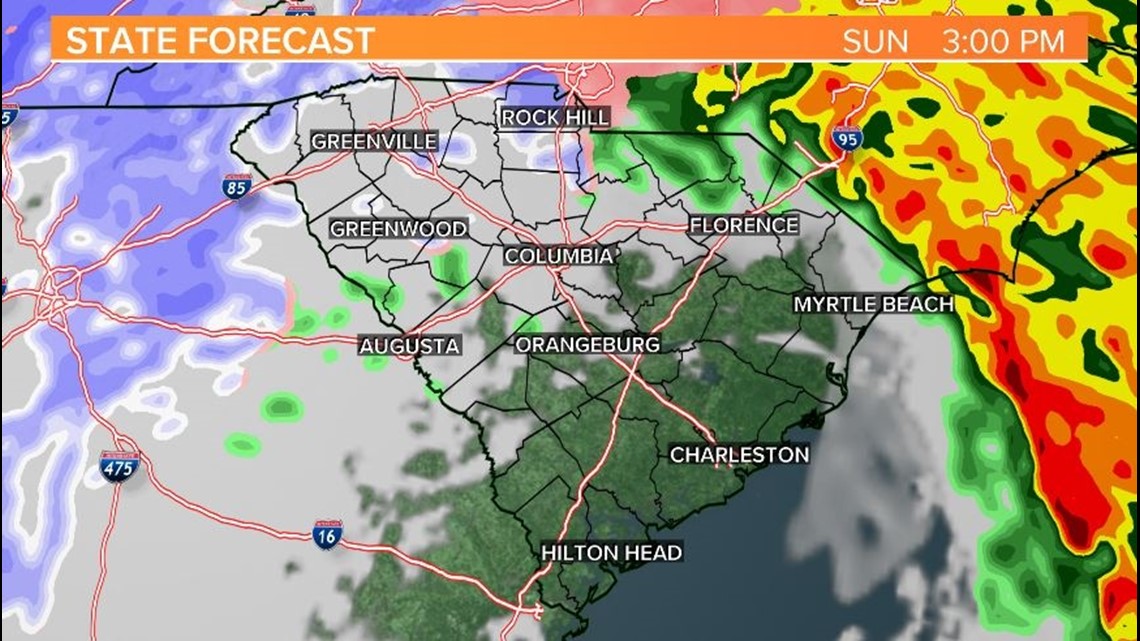
.We are expecting wintry weather across the Midlands through most of today. As we go into the next 12 hours we will be watching the radar and temperatures closely as the event unfolds. Right now, the forecast for the most part remains unchanged, so with that being said, let's break down what to expect.
Rain began to move in from the west Saturday night as an area of low pressure moves across the Southeast. The real concern starts around 4-5 AM where we start to get around freezing. This will allow for the precipitation to begin to freeze on elevated surfaces (Freezing Rain). Sleet will not be out of the question especially in our northern counties.
This wintry precipitation will continue through the morning hours and the longer that locations stay below freezing, the more the freezing rain will have time to accumulate on surfaces.

RELATED: Local Forecast
Right now, the biggest impacts look to be along and north of I-20 where these colder conditions last longer through the day. Our in-house model, is currently putting out some pretty hefty totals of ice accumulation in counties like Newberry, Fairfield, and Northern Kershaw of .5"+. At these amounts, we could start seeing widespread outages in these counties with more sporadic outages across the I-20 corridor.
RELATED: 'It's going to be serious': SC governor urges caution, says state is prepared for winter storm
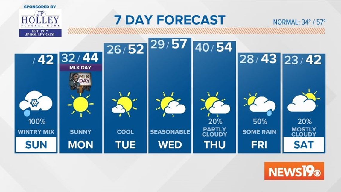
As we head towards midday, it looks like any frozen precipitation should begin to wrap up as temperatures get above freezing. We cannot rule out a few snowflakes though as we get around 5-8 PM although, no accumulations are expected at this time.
Looking past Sunday, black ice will be an issue as any wet surfaces will likely freeze overnight. This will be an issue through about 8-9 AM on Monday before temperatures warm up after sunrise. Ahead on the 7-day forecast we will need to keep an eye on the end of the week. Very cold air will be ushered in by an arctic front which will likely bring us the coldest weather we have seen so far this season.