


The area saw its share of extreme weather this year.
There were numerous notable storms and record rainfall and temperatures, including several heat waves.
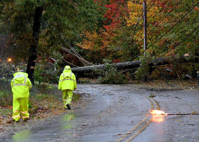
In the middle of November there were two rain and windstorms within two days that knock out electricity to parts of the area.
Thunder, lightning and hail were seen in some locations, with the second storm dumping nearly 2 inches of rain and packing winds of over 50 mph.
Those storms followed a nor’easter that wreaked havoc at the end of October. More than 25,000 area homes and businesses lost electricity, and several homes and vehicles were damaged.
October was quite wet, totaling 6.36 inches of rain, nearly making the Top 10 highest rainfall for Octobers.
The month also turned out to be the sixth warmest in the record books kept by the Attleboro Water Department, with the thermometer reading in the 70s half the days.
Massachusetts had its second warmest October, and the Northeast Regional Climate Center at Cornell University reports the region had its warmest October, and those records go back to 1895.
A crazy summer brought record rainfall, three intense storms and a rare four heat waves.
July received 10.21 inches of rain — the most recorded by the city water department for July. The month usually sees only about 3 1/2 inches.
July was also the 13th rainiest for any month in the record books, and rain was recorded on 19 days in July — the most on record, water department records show.
The wet weather certainly posed a challenge for area organizers of outdoor activities, with many canceled, postponed or forced indoors.
The remnants of Hurricane Ida dropped almost 3 1/2 inches of rain in Attleboro in less than a day at the beginning of September — about a month’s worth of rainfall. There was some flooding.
What was expected to be the first hurricane in three decades to make landfall in New England was scaled back to a tropical storm by the time Henri hit the area in late August. But it still brought strong winds and heavy rainfall that led to more than 2,000 homes and businesses losing power in the area.
Nearly 4,000 Attleboro electrical customers were in the dark as Tropical Storm Elsa swept through Southeastern New England in early July.
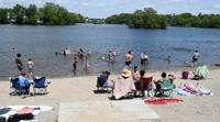
As for temperatures this summer, there were four heat waves, which are at least three consecutive days of 90 degrees or more.
Many of the 90-degree days felt like the low 100s because of stifling humidity, which prompted heat advisories from the National Weather Service in Norton.
During the last of two heat waves in August, a day of 96 felt like 110. June had two heat waves — the first time that many were ever recorded for that month.
Some area communities opened cooling centers during particularly hot days, and stores were reported to be sold out of air conditioners and fans.
For meteorological summer, which runs from June to August, the U.S. mainland’s average temperature of 74.01 was warmest on record, according to the National Oceanic and Atmospheric Administration. Boston experienced its warmest summer.
Spring was rather routine for weather in these parts, though winter made a comeback the middle of April, with snow showers and even some measurable snow.
Last winter turned out to be a season of contrasts, with the first half warmer than usual with little snowfall, and the latter half colder and snowier than normal.
One storm the beginning of March delivered wind gusts over 60 mph, with trees and limbs hitting several houses. A low temperature of 15 degrees felt like 2 with the wind, the water department said.
And in early February, a weekend storm dumped up to a foot of snow in the area, including about 9 inches in Attleboro and 12 inches in Norfolk.
The snow season totaled 31 1/4 inches, falling short of the 37 1/4-inch average.