The dreaded winter season officially arrived on Tuesday, though it seems as if winter has been here off and on for weeks.
While meteorologists consider the winter season to start the first of December, the official date is Dec. 21, the winter solstice. That’s when there’s the least amount of daytime for the year in the Northern Hemisphere.
Recent days have been winter-like, with temperatures bottoming out in the 20s, but the end of last week surely wasn’t, and Thursday saw record-breaking temperatures in the 60s.
December may not have seen any memorable storms yet, but autumn overall was a stormy season.
The middle of November, two storms in two days knocked out electricity to parts of the Attleboro area after trees, limbs and utility wires blew down.
The second storm, a fast-mover packing strong winds and heavy rain, also brought thunder and lightning and hail in some spots. Rainfall totaled nearly 2 inches in Attleboro, and there was a high wind gust of 51 mph reported in Wrentham.
Overall, though, November weather was fairly normal after near-record rainfall and warmth in October.
November turned out to be rather dry, with seasonable temperatures, Attleboro Water Department records show.
Rainfall totaled 2.89 inches, well short of the normal 4 1/2 inches for the month.
In comparison, rainfall for October tallied 6.36 inches, nearly making the Top 10 highest rainfall for Octobers, and one in a string of wet months.
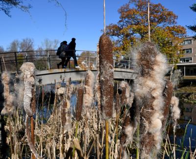
While November brought more seasonable fall weather that finally colored leaves, the first part of autumn seemed like an extension of summer many days.
October turned out to be one of the warmest in the record books, with temperatures well above normal many days and nearly half the days reaching into the 70s.
The average daily high temperature of 67 degrees compared to a normal 62, and just five of the past 82 Octobers had higher average temps, water department records show.
The end of October will also be remembered for a strong nor’easter that plowed through the region.
The coastal storm saw wind gusts of at least 55 mph in the area, with several homes and vehicles damaged.
At one point, more than 25,000 area homes and businesses lost power, but most had electricity restored just in time for Halloween weekend.
September was also rainy, with rainfall nearly half the days, and temperatures above normal.
Just under 6 inches of rain was recorded by the Attleboro Water Department, much higher than the usual rainfall for the month of nearly 4 inches.
Meteorological autumn, which is September through November, was the fourth warmest on record for the Northeast, driven in part by a record warm October. Massachusetts and Rhode Island saw their third warmest autumn. It was also the third warmest autumn for the contiguous U.S., according to the NOAA National Centers for Environmental Information and the Northeast Regional Climate Center, which has records dating since 1895.
Four of the five warmest falls over the Northeast have occurred in the last 11 years — 2011, 2015, 2021, and 2016. The season is warming at a rate of 0.2 F per decade since 1895, the centers say.
Autumn was wetter than normal across most of the region. Massachusetts received 16.5 inches of rain — the most of any state in the Northeast. That is 3.5 inches above normal, making for the 12th wettest autumn in the books.