This may be a situation where nobody wins, except may southern Maryland and lower Delmarva baed on the first call.
In my prior report I downgraded my expectations for snow, but that did not mean we get nothing. Although a few models went that far.
There is still a weak weather system moving through with the chance to watch light snow or flurries fall. FITF
At this point I am simply talking about watching flakes in the air.This is also a time where my original forecast may play out best in our southern areas and Delmarva where more snow may fall but on warmer ground. So they stay mostly wet.
I had elaborated on the mid range models being rather poor guidance.I have discussed that with you for months, and worked to identify their errors to anticipate and adjust.
Shorter range modeling has been better, which seems logical. Especially with high resolution models like the HRRR and NAM 3 Km that grab real observations hourly and update accordingly.
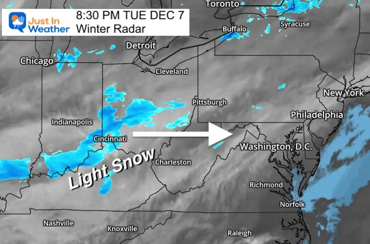
Tuesday Evening Radar
Here a band of light snow on radar along the Ohio River Valley. This does look a little more impressive than expected, and will be pushing east overnight.
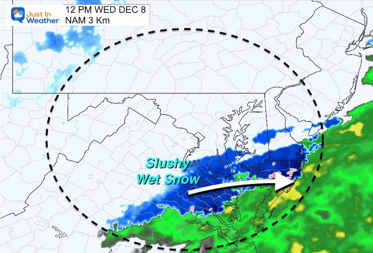
HRRR Model —> slider 6 AM to Noon
Here we still see light snow arriving near Frederick just before daybreak.Then spreading to metro Baltimore through mid morning.
I don’t see enough to cause an issue on roads, but falling snow and a coating is possible.
Also note: This model has been slow by 1 to 2 hours. So that buffer should be considered.
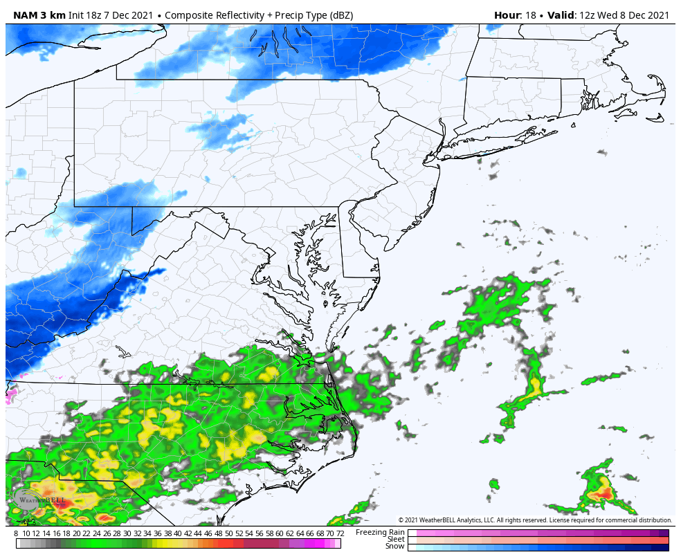
Comparing the last slide above with the HRRR and this, we can see there is still contrasting plots for noon.
The timing and track is off, but there still remains a better chance for snow to fall in southern Maryland and Delmarva.
Here we see snow falling at noon in southern Maryland across to Cambridge and Salisbury.
But temps will be in the mid 30s. So a coating on the grass, but roads will remain wet.
Why Less Snow?
The reason for lower expectations of snow has been due to the two ingredients in the atmosphere needing to meet over our region, just missing, and splitting north and south.
NAM 3Km
This model shows the split well.
The Low Pressure and main moisture appears to our south, while the northern piece shows a band of snow in Pennsylvania.
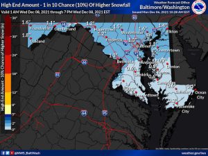
See the NWS Snow Forecasts for MD/PA/NJ/DE/NoVA and WV
Click the image for the resource page
Note: There are ‘official’, high and low snow maps to view.
Also, the Pennsylvania mapping only is for 24 hours and at last check did not include the event yet.