Good evening, folks. I wanted to drop by for a quick update on the streaks of light snow developing across the region tonight and early Wednesday. Overall, I have no changes on this weak system that can put down some minor accumulations.
The late day models are in the same camps as earlier with the GFS being the lone model showing widespread light snow. The new run is forecasting up to 1″…
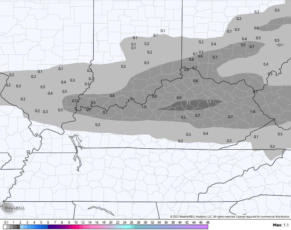
The late day EURO did trend more toward the GFS…

The NAM says 🙄…

You can clearly see how the NAM has a streak in the far north and far southeast.
Don’t expect much tonight, folks. I’ll take some coatings out of this setup and be happy about it. 😁
Here are your radars to follow the flakes…

Enjoy the evening and take care.
