Weather
Winter is on its way? Up to 19″ of snow in the forecast through Friday night
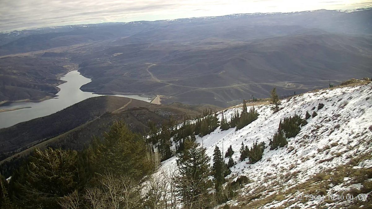
Sultan Express Webcam Photo: Deer Valley
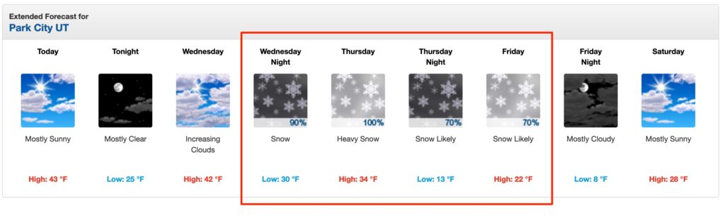
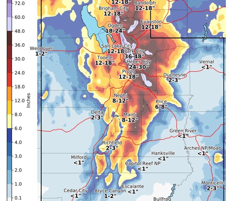
PARK CITY, Utah — The question heard far and wide across mountain towns throughout the west, “where is the snow?” may finally get answered. NOAA is reporting a potential of 9-19″ of snow in Park City starting Wednesday night through Friday night with the heaviest snowfall predicted for Thursday with 5-9″.
The Utah Avalanche Center is calling for potentially higher amounts at upper elevations stating “The next storm looks to be on track so stay tuned on this one… Hoping for 14-28″ of new snow.”
As this will hopefully be the first significant snowfall of the season be sure to check your local avalanche conditions.
Keep an eye on the storm with the TownLift Snow & Weather Report page rolling up the snowfall totals and webcams from top regional ski resorts.
@powderbuoy called for a storm on 12/9 over a week ago and it appears this will materialize.
View this post on Instagram
Fingers crossed this storm delivers! Keep on dancing.
TownLift

4536 N Painted Sky Drive
St. George, UT 847703137 East George White Road
Moab, UT 845322600 N 1200 West, Suite 6
Lehi, UT 840437566 E Ponderosa Dr
Huntsville, UT 843177948 Red Tail Court
Park City, UT 840601068 W Shoreline Dr
Layton, UT 84041Talk of the Town


Park City Jobs
Office Administrator, Park City Soccer Club
1 day ago Part time $21.00 - $23.00 hourly

Community Liaison & Administrative Assistant to the General Manager, K&K Property Management
14 days ago Full time $20.00 - $23.00 hourly

Full-time paint retailer at Park City Paint, Park City Paint
16 days ago Full time $20.00 - $24.00 hourly

Park City Gardens is hiring for the summer!, Garden Cafe at Park City Gardens
22 days ago Seasonal $17.00 - $22.00 hourly
Interior Designer & Sales Specialist, San Francisco Design
24 days ago Full time $60,000 - $75,000 yearly
You May Also Like

You must be logged in to post a comment.