


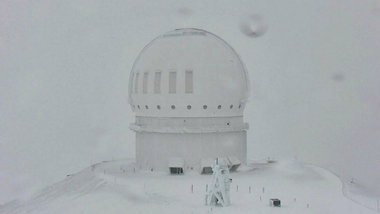
The peaks of Hawaii’s Big Island now have a Winter Weather Advisory through Monday evening.
Since the Big Island’s peaks rise more than 13,000 feet above the sea, they’re still prone to winter weather.
The summits are in Winter Weather Advisories through 6 p.m. HST. Up to four inches of additional snowfall is still possible on top of what's already fallen. Winds could still reach up to 60 mph. Those will combine to create major blowing and drifting snow and low-visibility conditions.
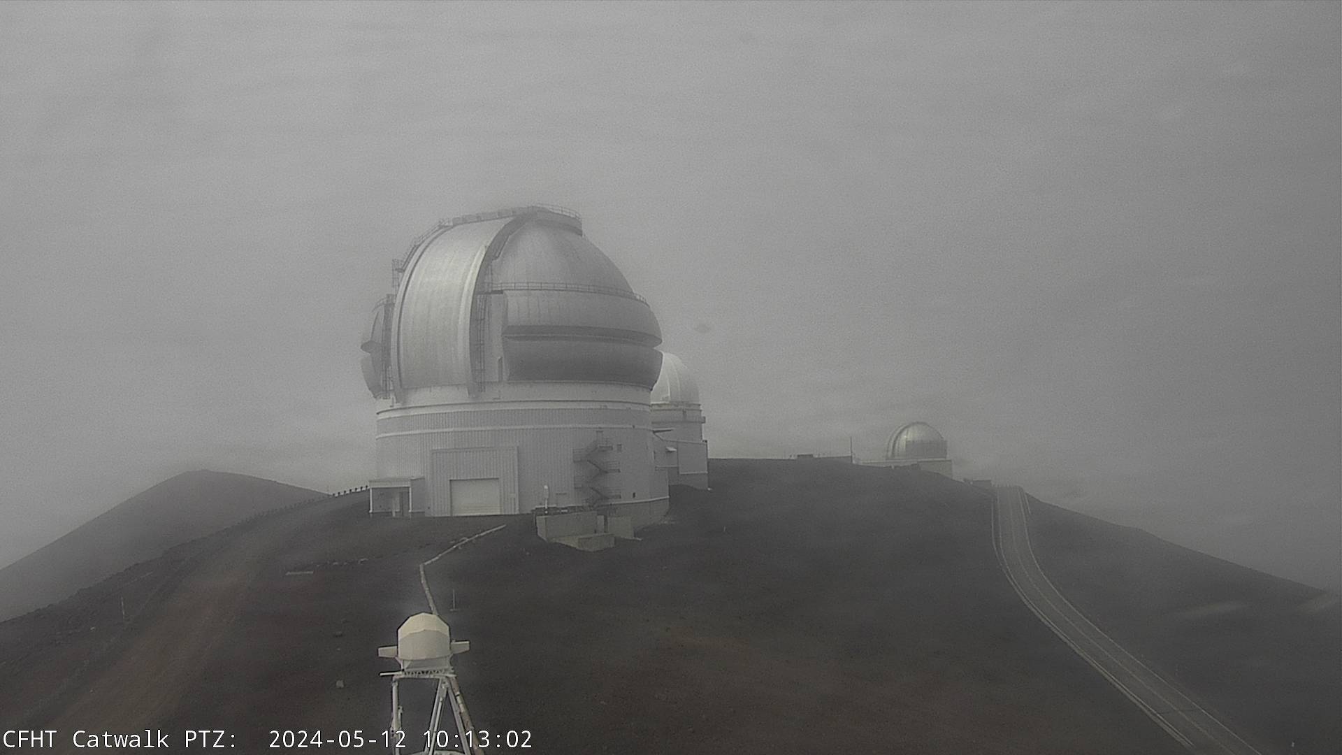
Here's the latest view from one of the webcams at the Canada-France-Hawaii Telescope. See recent timelapses here.
Lower elevations will face the risk of heavy rain and flooding, along with landslides.
For the past few days, we had Blizzard Warnings first, which aren’t exceptionally rare in Hawaii. Since 2011, the National Weather Service (NWS) in Honolulu has issued five Blizzard Warnings, according to data from the Iowa Environmental Mesonet. That’s the same number that both the Green Bay and Milwaukee, Wis. NWS offices have issued over the same period.
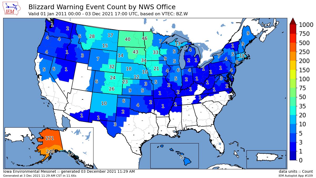
Blizzards are most common where the wind is strongest when there’s either snow on the ground or snow falling. That includes Alaska, the Rockies and Northern Plains.