


Cloud cover to increase further ahead of rain tomorrow
MACON, Georgia. (41NBC/WMGT) – Warm conditions will stick around Wednesday with plenty of clouds filling in during the evening.
Today
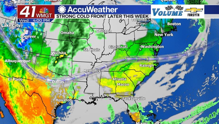
Plenty of clouds moved in overnight Tuesday around Middle GA, and some of them helped with a spectacular sunrise that got the morning going. These allowed morning lows to warm up just a bit thanks to the extra insulation. These clouds will clear for most of the region by lunchtime today as temperatures will climb back into the upper 70s this afternoon for our highs. Wind blowing gently from the south is adding plenty of moisture to the Georgia atmosphere. It may feel a bit muggy later this evening as clouds begin to fill in once again, only this time there will be some mid and low level clouds as well. Rain chances will also begin to increase overnight, though Middle GA shouldn’t see any precipitation until after midnight. Low temperatures overnight and into tomorrow morning will continue to increase, this time falling only into the 50s. Showers will become more widespread and numerous ahead of the sunrise.
Veteran’s Day
There is a strong possibility that most locations in Middle GA will be waking up to some light to moderate rainfall Thursday morning. A raincoat out the door would be a good idea, and fortunately it doesn’t need to be a heavy one given the warmer low temperatures. The thick clouds that fill in overnight Wednesday will insulate the region quite well, only allowing low temperatures to fall into the 50s. By comparison, some locations were waking up to temperatures close to 20 degrees below that on Tuesday! Clouds and shower activity will persist through much of the afternoon across Middle GA with sunshine being very limited. Wind will also persist out of the south, continuing to feed the system with moisture ahead of the cold front.

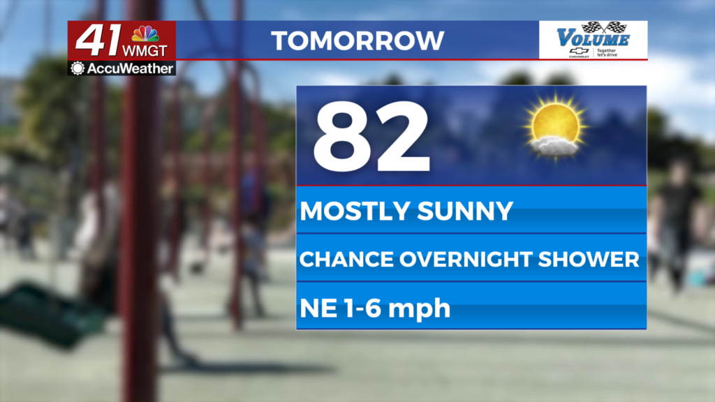
By the middle of the day the temperatures will peak in the mid 70s, only slightly cooler than the day before. The continuous shower activity as well as the blanket of cloud have cancelled out any risk for severe weather tomorrow. The rain will turn to thunderstorms after sunset as the cold front finally pushes through. It will take a bit before the conditions outside respond, however. Overnight lows for tomorrow are in the mid 40s, so not much different than this morning.
The End of the Week
The sunshine will be back for Friday, however, and wind from the northwest will clear out the excess moisture. Highs for Friday afternoon will be in the upper 60s and lower 70s, but come Saturday those will be in the upper 50s and lower 60s. Just think, the high temperatures this weekend are only a few degrees warmer than the low temperatures for tonight. The below average temperatures look to carry into much of next week as well, with rain chances also remaining below normal.

Follow Meteorologist Aaron Lowery on Facebook (Aaron Lowery 41NBC) and Twitter (@ALowWX) for weather updates throughout the day. Also, you can watch his forecasts Monday through Friday on 41NBC News at Daybreak (6-7 a.m.) and 41Today (11 a.m).


Leave a Reply