A nor'easter is forecast to bring heavy rainfall and strong winds to parts of the northeastern United States early this week, with the National Weather Service issuing a flash flood watch.
The flash flood watch affects roughly 23 million people and goes into effect from late Monday into early Tuesday. It covers an area from southern Connecticut all the way to the Jersey Shore, including New York City and the surrounding areas.
Forecasters say a low-pressure weather system in the Midwest is moving towards the Northeast and will intensify by late Monday, likely resulting in heavy rain and potentially flash flooding.
Some locations could see more than 4 inches of rain, computer models indicate.
But what is a nor'easter?
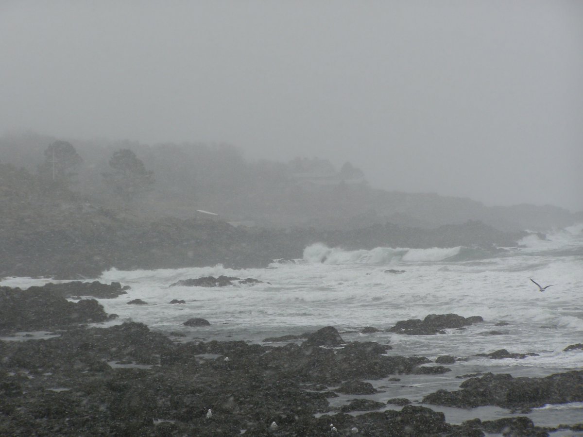
A nor'easter is essentially a storm that forms along the East Coast of North America, according to the National Weather Service.
Nor'easters can occur at any time of year, but they are most frequent and violent between September and April, the NWS added.
These storms tend to develop in the latitudes between Georgia and New Jersey within 100 miles east or west of the U.S. East Coast. They usually progress northeastward and typically reach maximum intensity near New England and the Maritime Provinces of Canada.
Nor'easters often result in heavy rain or snow, in addition to strong winds, rough seas and sometimes flooding.
Past nor'easters have been responsible for billions of dollars of damage, in addition to causing significant economic and travel disruption.
Among the best-known nor'easters in history are the blizzard of 1888, the Ash Wednesday storm of March 1962, the New England blizzard of February 1978, the March 1993 "superstorm" and the Boston snowstorms of January and February 2015.
This week, forecasters have said rainfall could affect the northeastern United States from Monday through Wednesday, with the heaviest downpours expected tonight into Tuesday.
The NWS has also issued high wind watches for much of southeast New England, with gusts in some parts potentially reaching up to 55 miles per hour.
In an alert posted on Monday, the weather service said: "Rain and scattered thunderstorms are forecast to spread into the Mid-Atlantic and Northeast out ahead of a low-pressure system currently gliding across the Midwest."
It added: "Rainfall will focus the most over southern/coastal New England over the next two days. A Slight Risk for Excessive Rainfall Leading to Flash Flooding is in effect
for this area, particularly on Tuesday when this rain event will have
entered its second day."
Uncommon Knowledge
Newsweek is committed to challenging conventional wisdom and finding connections in the search for common ground.
Newsweek is committed to challenging conventional wisdom and finding connections in the search for common ground.
About the writer
Aristos is a Newsweek science reporter with the London, U.K., bureau. He reports on science and health topics, including; animal, ... Read more
To read how Newsweek uses AI as a newsroom tool, Click here.